
Download
3D Flyover
Add to list
More
6.4 km
~1 hrs 47 min
310 m
Loop
“A brooding Skye loop where sea-loch shimmer, lonely moor, and Black Cuillin drama close in.”
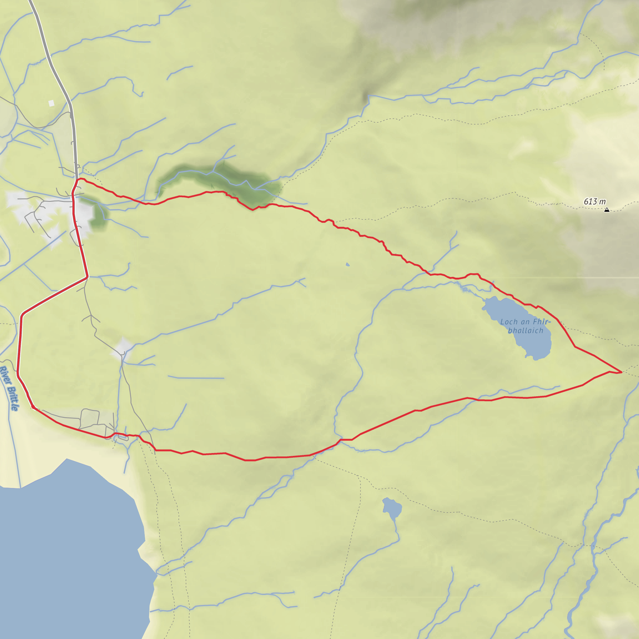
This medium-difficulty loop of about 6 km / 3.7 miles with roughly 300 m / 985 ft of ascent explores the wild edge of Glen Brittle beneath the Black Cuillin, combining sea-loch views, a small upland loch, rough moorland, and a dramatic sense of mountain enclosure. The route is generally associated with the Glenbrittle area on the Isle of Skye, with the most practical start point near Glenbrittle Campsite, Glenbrittle, Carbost, Isle of Skye IV47 8TA, close to the head of Loch Brittle and the beach at Glen Brittle. That is the nearest clear address and landmark for planning purposes. (highland.gov.uk)
From the start, expect a quick transition from the coastal fringe into open hill ground. Loch Brittle is a sea loch on Skye’s southwest coast, and the surrounding glen is one of the classic access points into the Cuillin. Even on a relatively short circuit, the landscape feels much bigger than the mileage suggests. The mountains rise abruptly, weather can move in fast, and underfoot conditions often make the walk feel more serious than the distance alone would imply. (en.wikipedia.org)
What the route is like
The opening section is usually the easiest to read on the ground, with tracks and paths around the Glenbrittle area before the route begins climbing away from the loch. As you gain height, the terrain becomes more open and exposed, with boggy or muddy stretches possible after rain. Around 300 m / 985 ft of ascent packed into 6 km / 3.7 miles means the walk has a steady, noticeable climb rather than a long gentle gradient, so waterproof footwear and a spare layer are sensible even in fair weather. (alltrails.com)
Loch na Fhir Bhallaich, also rendered as Loch an Fhir-bhallaich, is one of the key landmarks on the circuit: a small freshwater loch set against the dark, jagged backdrop of the Cuillin. This part of the walk is where the route feels most remote. The loch gives the circuit its character, and in poor visibility it can also be a point where the landscape becomes harder to interpret because the surrounding moor and slopes can look deceptively similar. If cloud drops, careful navigation is important, and if you use a navigation app, HiiKER is the one to rely on for checking the line of the loop. (uklakes.ceh.ac.uk)
Depending on the exact line taken, some versions of the circuit also pass near the gorge of Allt Coire Banachdich and the Eas Mòr waterfall, adding a more dramatic water feature to the outing. If your planned track includes that section, expect steeper ground near the burn and extra care on wet rock. (alltrails.com)
Landmarks, scenery, and wildlife
The dominant visual feature throughout is the Black Cuillin, the most rugged mountain range on Skye and among the most dramatic in Britain. Glen Brittle is one of the principal approaches into these mountains, and even lower-level walks here carry a distinctly alpine feel by Scottish standards. Views can open across Loch Brittle toward the coast, while inland the skyline is defined by dark gabbro ridges and steep corries. (undiscoveredscotland.co.uk)
Nature on this route is shaped by Atlantic weather, peat, rock, and open moor. Hikers should expect heather, rough grasses, mossy ground, and wet flushes, with burns running strongly after rain. Birdlife may include meadow pipits, skylarks, ravens, and raptors overhead, while red deer are possible in quieter areas of the glen and surrounding hills. Near the coast and sea loch, seabirds may also be seen depending on season and conditions. These sightings are never guaranteed, but the mix of marine edge, moorland, and mountain habitat makes the area especially rich. The same wet ground that supports this habitat also means midges can be intense in still, damp summer weather. (scotland.org.uk)
Historical significance of the area
Glen Brittle sits within a part of Skye deeply shaped by Gaelic culture, crofting history, and older patterns of settlement and movement through the landscape. The wider Minginish peninsula and Skye more broadly preserve evidence of long human occupation, from prehistoric and Iron Age sites elsewhere on the island to later township and crofting
What to expect?
Surfaces
Unknown
Wood
Comments and Reviews
User comments, reviews and discussions about the Culnamean Loop via Loch Brittle and Loch na Fhir Bhallaich, Scotland.
average rating out of 5
0 rating(s)

