
Download
3D Flyover
Add to list
More
5.5 km
~2 hrs 14 min
683 m
Out and Back
“A deceptively short, boggy and steep mountain outing crowned by wild Assynt panoramas.”
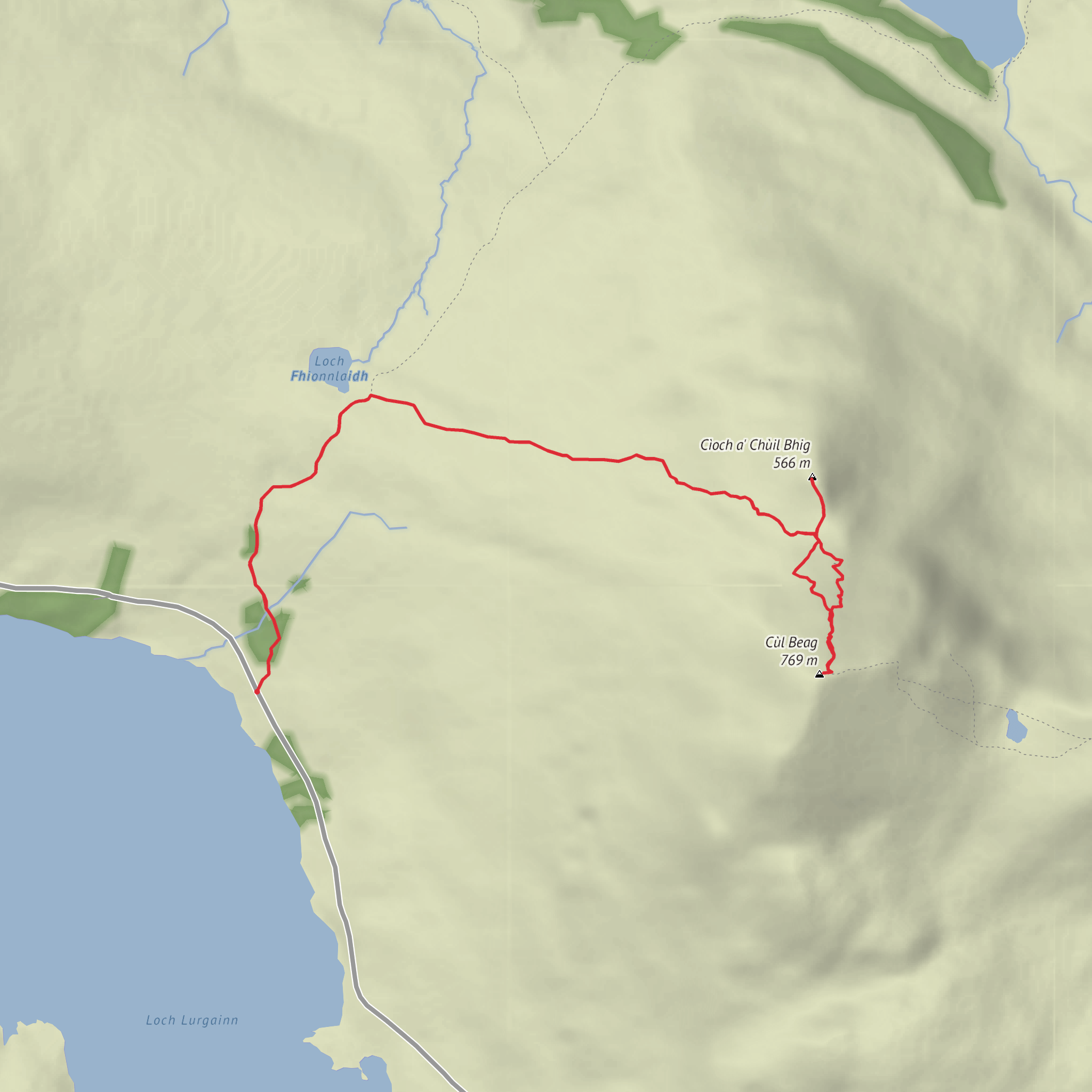
This is a short route on paper but a very serious mountain day in practice: roughly 5 km to 10.5 km depending on the exact line taken and whether you include the out-and-back to Cloch a’ Chuil Bhig, with about 700 to 729 metres of ascent, or around 2,300 to 2,390 feet. The combination of steep ground, rough heather, boggy approach terrain, faint trods, and exposed summit slopes justifies the Extra Difficult rating even though the mileage is modest. The usual start is on the A835 south of Knockan Crag, at a small parking area opposite the southern end of the old road loop near Knockan Crag National Nature Reserve, with the nearest useful landmark being Knockan Crag, about 21 km north of Ullapool. The commonly used start grid reference is NC184078. (walkhighlands.co.uk)
Getting there is fairly straightforward by Highland standards. By car, approach on the A835 from Ullapool toward Elphin and Knockan Crag; NatureScot gives the nearest postcode for the reserve area as IV27 4HH, though it is centered on Elphin and not the exact trailhead, so it is best treated as a navigation aid rather than the final destination. There is parking at Knockan Crag itself, and the mountain route start lies a little south along the A835 at the old road loop parking area. By public transport, an infrequent bus service passes the start, and buses from Ullapool can stop at the reserve entrance on request; the Ullapool–Lochinver corridor is the key service to check before travel. For navigation on the hill, plan the route carefully in HiiKER before setting out, because the approach path becomes faint and the upper mountain is not waymarked. (walkhighlands.co.uk)
The outing begins gently enough on an old road section and ATV track, but that easy start is deceptive. The first few hundred metres follow firm ground before the route swings out across moorland toward Lochan Fada. This lower section is where many hikers underestimate the day: the terrain can be wet underfoot, the line is not always obvious, and progress is often slower than the map suggests. Walkhighlands describes the approach as a stalkers’ path followed by open heather slopes, and also notes a high bog factor, which is a good clue to what to expect after rain or during prolonged wet spells. (walkhighlands.co.uk)
Route character and ascent
As the path trends west and then north-west, the route becomes more committing. A faint trod leaves the clearer track and crosses moorland, with a fence crossing along the way, before aiming toward Creag Dhubh and the foot of Meall Dearg. From here the climb steepens sharply. The ascent up Meall Dearg is on heather and rough hillside with only intermittent traces of path, so this is where strong hillcraft matters most. In poor visibility, the broad, undulating upper ground can make accurate line-finding harder than the map implies. (walkhighlands.co.uk)
Beyond Meall Dearg, the mountain opens into a more broken sandstone landscape. The bealach holding Lochan Uaine gives a brief visual pause before the final pull to Cùl Beag. That last climb is steep again, and the ground can feel loose, lumpy, and tiring underfoot. Walkhighlands notes solifluction terraces on the upper slopes, landforms created by repeated freeze-thaw action, and they are one of the more interesting geological details on the mountain itself. If your route includes Cloch a’ Chuil Bhig, expect an additional detour over rougher, less direct ground near the bealach and subsidiary tops; this can add time out of proportion to the extra distance. (walkhighlands.co.uk)
The summit area is a superb natural viewpoint. Cùl Beag stands among some of Assynt and Coigach’s most distinctive isolated peaks, and views commonly extend to Cul Mòr and Stac Pollaidh, with a wider panorama over lochs, rocky ridges, and the broken north-west Highland landscape. The mountain’s name is generally translated as “small back,” a reminder of the strong Gaelic naming tradition across the region, where landforms were often described by shape, size, or position. (walkhighlands.co.uk)
Terrain, hazards, and what to prepare for
This is not a technical scramble on the standard line, but it is a demanding hill route. The main hazards are steep gradients, wet peat, hidden holes in heather, pathlessness in places, and the difficulty of retreat once you are committed to the upper slopes.
Comments and Reviews
User comments, reviews and discussions about the Cloch a' Chuil Bhig and Cul Beag, Scotland.
average rating out of 5
0 rating(s)


