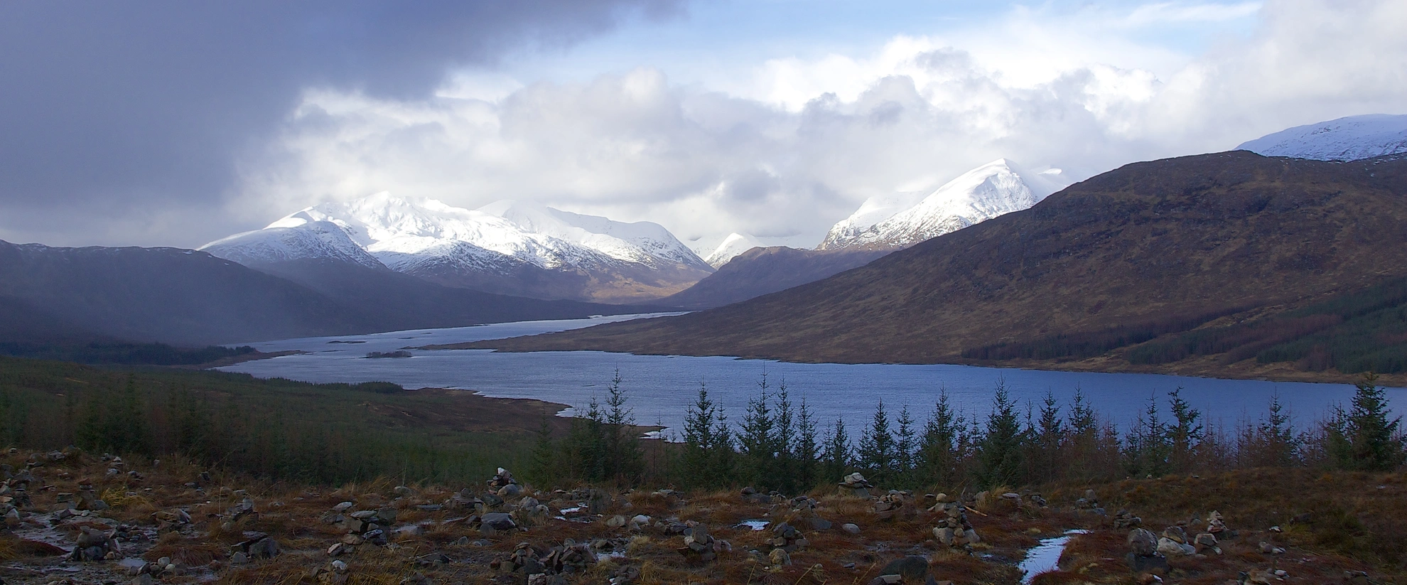
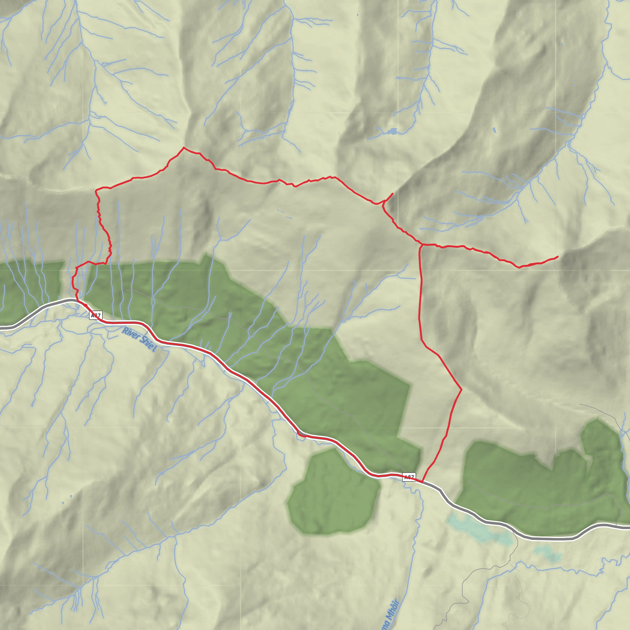
Bealach an Lapain, Saileag, Sgurr a' Bhealaich Dheirg and Aonach Meadhoin Loop
Download
3D Flyover
Add to list
More
13.2 km
~4 hrs 33 min
1154 m
Loop
“A fierce Glen Shiel ridge day, rising from soggy toil to airy, unforgettable Munro horizons.”
This is a big, serious Glen Shiel mountain day over three Munros on the ridge known as the Brothers of Kintail: Sàileag, Sgùrr a’ Bhealaich Dheirg, and Aonach Meadhoin. Expect roughly 13 km / 8.1 miles overall with about 1,200 metres / 3,940 feet of ascent, though route variations and the point where you rejoin the road can nudge the total a little. The difficulty comes less from technical scrambling and more from the combination of a brutally steep opening climb, sustained ridge walking at altitude, exposure to Highland weather, and a long, committing descent. The route begins from the Glen Shiel car park off the A87, just east of a break in the forestry and beside an information board for the Battle of Glen Shiel; the mapped start used for this ridge is at grid reference NH009135, which places it near the roadside parking area on the A87 in Glen Shiel, near Shiel Bridge, Highland, Scotland. The classic line is not a perfect loop in the strictest sense, as the standard descent reaches the A87 farther east, opposite the Cluanie Inn, so transport planning matters. (walkhighlands.co.uk)
The day starts immediately with effort. From the car park, the path heads west briefly and then turns uphill beside the forestry fence on boggy ground before steepening dramatically. In barely 1 km / 0.6 miles, around 550 metres / 1,800 feet are gained to reach Bealach an Lapain, so this first section often feels like the crux for legs and lungs. The path is generally clear, but in wet weather the lower ground can be greasy and the climb can feel relentless. Once the bealach is reached, the sense of space opens up and the route turns into a much more expansive ridge traverse. (walkhighlands.co.uk)
On the ridge
From Bealach an Lapain, the ridge path climbs more cleanly to Sàileag, the first summit, at about 956 metres / 3,136 feet. Although it can seem like a quieter top compared with what follows, it gives a fine first look across Kintail and along the rest of the day’s skyline. Beyond Sàileag, the ridge undulates over minor tops and cols before the longer rise toward Sgùrr a’ Bhealaich Dheirg, the highest and most striking summit of the three. A cairn sits on the ridge at around 1,014 metres / 3,327 feet, but the true summit lies a little farther along a short rocky spur to the northeast, where a well-built cairn marks the top at about 1,038 metres / 3,406 feet. This short out-and-back section is one of the most memorable parts of the route, with a narrower, rockier feel than the broader ridge sections. (walkhighlands.co.uk)
After returning to the main ridge, the route drops to a col around 827 metres / 2,713 feet and then climbs again over a 938-metre / 3,077-foot top before the final rise to Aonach Meadhoin, at about 1,001 metres / 3,284 feet. From there, the descent continues over the rocky ridge toward Sgùrr an Fhuarail, where bypass lines may exist on the right in places, before the ridge finally eases and drops toward the road. The standard finish reaches the A87 opposite the Cluanie Inn, about 7.5 km / 4.7 miles from the start point in a straight traverse sense, which is why many walkers treat this as a linear outing unless they have arranged a lift, bike shuttle, or road walk back. (walkhighlands.co.uk)
Terrain, hazards, and what to prepare for
This is a difficult outing because the terrain changes character several times. The lower slopes can be boggy and slippery, the initial ascent is punishingly steep, and the ridge itself is exposed to wind from almost any direction. In clear weather
Comments and Reviews
User comments, reviews and discussions about the Bealach an Lapain, Saileag, Sgurr a' Bhealaich Dheirg and Aonach Meadhoin Loop, Scotland.
average rating out of 5
0 rating(s)
