Download
3D Flyover
Add to list
More
22.9 km
~7 hrs 14 min
1597 m
Loop
“A wild Rum Cuillin circuit weaving jagged volcanic ridges, airy summits, and a deep sense of remoteness.”
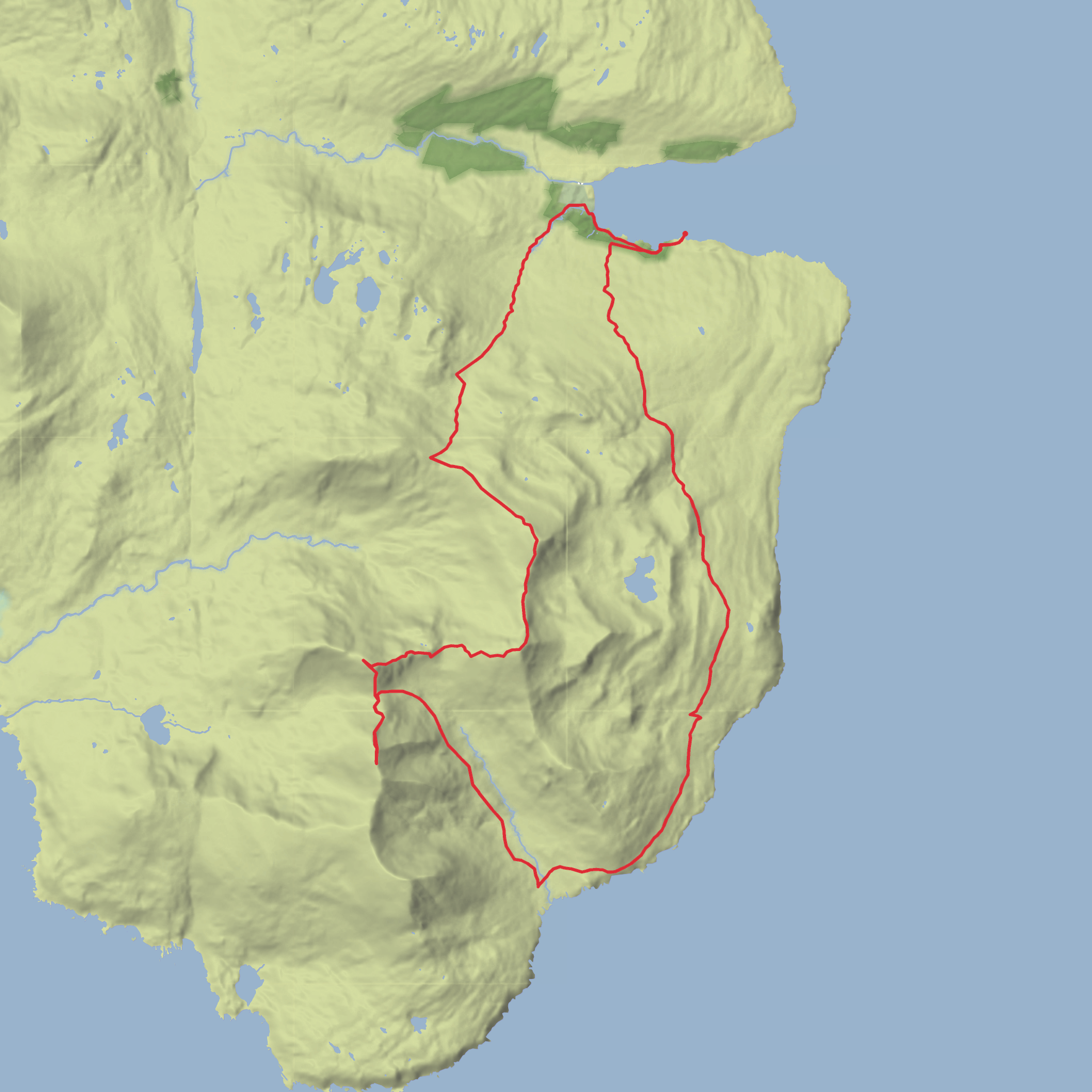
This is a long, committing mountain circuit on the Isle of Rum that links three of the island’s most striking peaks above Loch Scresort: Askival, Trallval and Ainshval. At roughly 23 km / 14.3 miles with around 1,600 m / 5,250 ft of ascent, it is a serious day in wild terrain, with steep climbs, rough volcanic rock, intermittent or faint paths, and sections where confident navigation is essential in poor visibility. The usual start is from Kinloch near the ferry pier on Loch Scresort, Isle of Rum, the island’s main settlement and arrival point. Kinloch is centered around Kinloch Castle and the pier at Loch Scresort, which is the nearest significant landmark and practical trailhead reference. (en.wikipedia.org)
Most hikers begin by following estate tracks out from Kinloch before climbing into the Rum Cuillin. The early ground is comparatively straightforward, but the day quickly becomes more demanding as the route rises onto steep mountain flanks and narrow, rocky ridges. Expect a sustained first half, with the ascent toward Askival doing much of the heavy lifting. Askival is the highest point on Rum and one of the island’s defining summits, and the approach often involves loose, stony ground and hands-on balance in places, especially if the rock is wet. From there, the traverse toward Trallval and then Ainshval feels remote and exposed, with repeated height loss and regain that can make the route feel harder than the raw distance suggests. Reports and route descriptions for the Rum Cuillin consistently describe rough, rocky terrain and easy scrambling on parts of these hills, while the reserve itself is managed as a wild mountain landscape rather than a heavily waymarked walking area. (walkhighlands.co.uk)
Terrain and route character
The opening section from Kinloch is usually on track or clear path, allowing a steady warm-up before the mountain ground begins. Once higher up, the route becomes much more rugged. The ridges and upper slopes are built from Rum’s ancient volcanic landscape, and that geology gives the mountains their jagged profile, blocky outcrops and dramatic corries. Underfoot, hikers should expect a mix of grass, scree, broken rock and occasional boggier sections on lower traverses and bealachs. In dry, calm weather the circuit is a magnificent ridge day; in mist, wind or rain it becomes a much more serious undertaking. Rum is noted by NatureScot for its extinct volcanoes, high mountains and strong sense of wilderness, and that is exactly what shapes this outing. (nature.scot)
A practical way to think about the day is in stages. The first several kilometres lead from Kinloch into the hills, often via the glen paths and bealachs that give access to the main ridge. The climb to Askival is the biggest single ascent, and by the time you reach its summit you will already have covered a substantial portion of the day’s elevation gain. The traverse onward to Trallval is not especially long in pure distance, but it is slow-going because of the roughness of the ridge and the need to pick careful lines around crags and broken ground. Ainshval, often saved for later in the circuit, rises sharply again and can feel like the sting in the tail. The return usually involves descending by bealachs and contouring paths back toward the Kinloch side of the island, where tired legs will notice every uneven step. Walk reports for this combination regularly mention the steepness of Trallval and Ainshval and the rough, time-consuming nature of the traverse. (walkhighlands.co.uk)
Because this is a difficult route, timing matters. Even strong hikers should allow a full day, with extra margin for ferry schedules, weather delays and slower progress on rock. If cloud drops onto the ridge, navigation becomes one of the main hazards. For planning and on-the-ground route checking, HiiKER is the navigation tool to rely on, but it should be backed up by the skills to interpret terrain and retreat safely if conditions deteriorate.
Landmarks, scenery
Surfaces
Unpaved
Unknown
Dirt
Comments and Reviews
User comments, reviews and discussions about the Askival, Trallval and Ainshval from Loch Scresort, Scotland.
average rating out of 5
0 rating(s)
