Download
3D Flyover
Add to list
More
24.5 km
~5 hrs 11 min
175 m
Point-to-Point
“From Crail’s harbour charm to St Andrews, this sea-swept path blends wild headlands and golden sands.”
This 24 km / 15 mile coastal walk from Crail to St Andrews is one of the gentler long days on the Fife Coastal Path, with only about 200 m / 656 ft of ascent spread across the route, so the challenge is more about time on your feet, sea wind, and a few rougher shoreline sections than steep climbing. The terrain is varied but generally straightforward: village lanes, grassy cliff-top paths, compact earth tracks, short stony stretches, beach walking near Kingsbarns, and easier surfaced sections as you approach St Andrews. The overall difficulty sits well at easy for regular walkers, though in wet or windy weather it can feel more demanding along exposed headlands. The route is part of Scotland’s Great Trails network and this section is widely regarded as one of the most scenic on the Fife coast. (honeypotcrail.co.uk)
The walk begins in or near the centre of Crail, the nearest obvious start landmark being Crail Harbour and the village centre around Marketgate and Castle Street, rather than an isolated trailhead. Crail itself is a historic East Neuk fishing village and former royal burgh, with a harbour, old stone houses, and medieval street pattern that make the opening kilometres especially atmospheric. If you are arriving by car, parking is generally better in the village rather than at the harbour itself, as visitors are not allowed to park at Crail Harbour. If using public transport, Crail is served by the Stagecoach 95 corridor linking Leven, Anstruther, Crail, and St Andrews, with stops including Crail Post Office, which is a practical place to begin. (crailfestival.org)
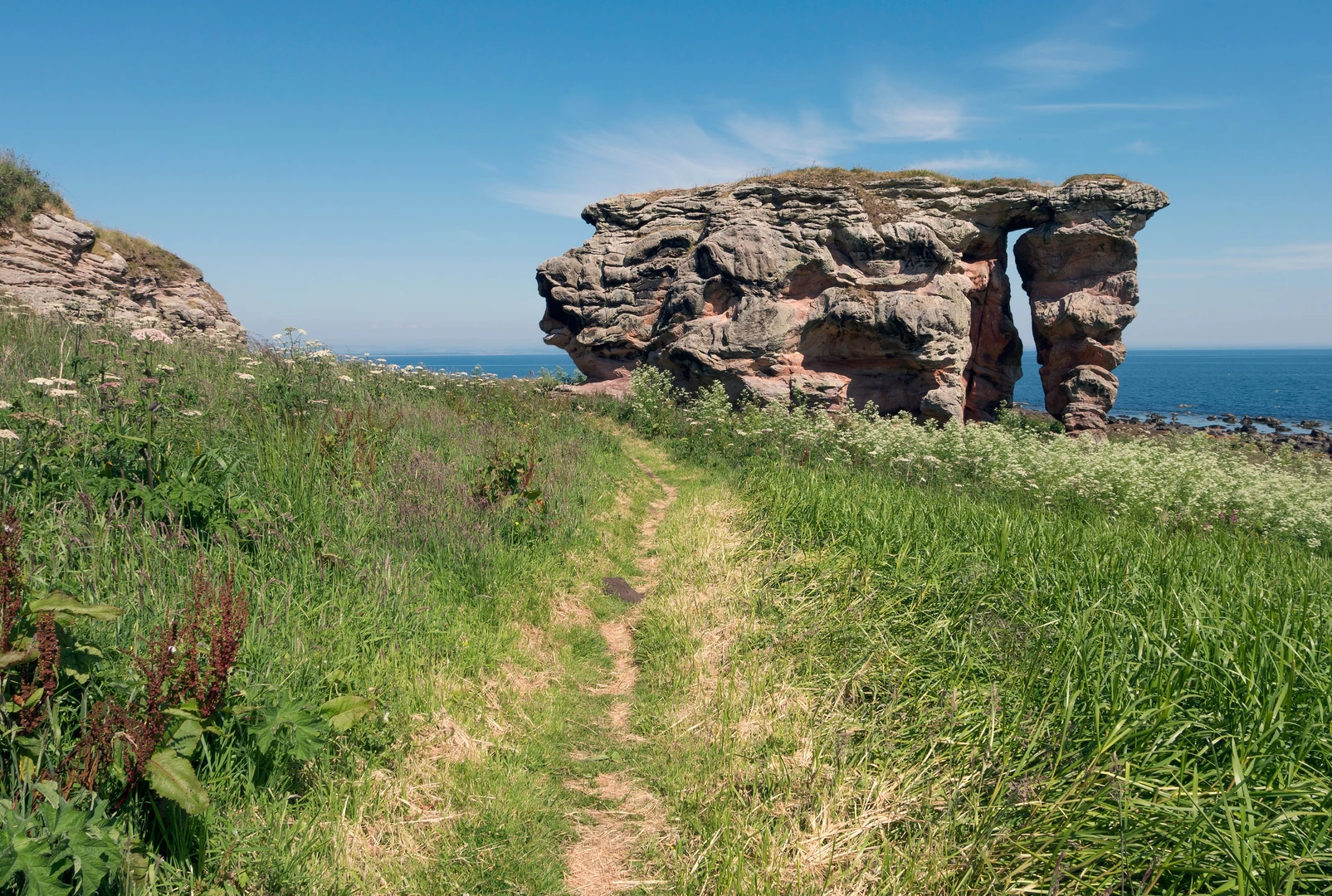
In the first stretch out of Crail, the path heads northeast past the edge of the village and toward open coastal ground, with broad views over the North Sea almost immediately. This early section is easy-going and low-lying, and it gives a good sense of the day ahead: open skies, salt air, and a coastline that alternates between rocky shelves, rough grassland, and cultivated fields inland. Around Kilminning and Danes Dike, the route passes an area associated with an ancient fortification and then continues toward Fife Ness, the easternmost point of mainland Fife. This is also where the landscape starts to feel wilder and more exposed. (fifewalking.com)
Coast, headlands, and wildlife
Fife Ness is one of the most distinctive landmarks on the walk. The headland is known for its disused coastguard station, open sea views, and strong birdlife interest. The wider Fife Ness coast is protected for its geological importance, and the area around Fife Ness Muir, sometimes known locally as “The Patch,” is well known among birdwatchers as a migration hotspot and ringing site. Depending on season, hikers should watch for seabirds offshore, passing migrants in scrub, and the usual mix of gulls, waders, and coastal species along the shore. In spring and autumn especially, this part of the route can be far more lively than it first appears. (nature.scot)
From Fife Ness the route bends north and then northwest, passing Babbet Ness and continuing along a rugged but not especially strenuous coastline. Expect some uneven ground here, with occasional roots, stones, and narrow path sections near the cliff edge, so this is a place to keep an eye on footing, especially in strong wind. The reward is a constantly changing shoreline: low rock platforms, small inlets, rough grass, and long views back toward Crail and ahead toward Kingsbarns and St Andrews. This middle section feels remote compared with the villages at either end, so it is wise to carry enough water, a windproof layer, and snacks for several hours between services. HiiKER is the best tool to keep track of progress and confirm junctions where farm tracks or golf-side paths can briefly make the line of travel less obvious.
As you continue toward Kingsbarns, the walking becomes more relaxed again. The route can pass around the edge of the golf course or along the beach in places, depending on conditions and the exact line taken, before reaching the area of Kingsbarns Beach and car park. This is one of the loveliest sandy interludes on the day, with a broad designated bathing beach popular with walkers, swimmers, and surfers. Sand can slow the pace a little, but the gradients remain easy. (fifewalking.com)
Kinkell Ness to St Andrews
North of Kingsbarns, the route continues past **

Surfaces
Unknown
Dirt
Sand
Asphalt
Gravel
Paved
Grass
Concrete
Comments and Reviews
User comments, reviews and discussions about the Crail to St Andrew via Fife Ness, Babbet Ness, Kinkell Ness and St Andrews, Scotland.
average rating out of 5
0 rating(s)