Download
3D Flyover
Add to list
More
13.6 km
~2 hrs 46 min
32 m
Out and Back
“A breezy estuary ramble where bridges, beaches, and Barnbougle Castle unfold in storybook succession.”
This easy coastal outing covers about 14 km / 8.7 miles with virtually no climbing—roughly 0 m / 0 ft of ascent—so the challenge is less about fitness and more about distance, underfoot conditions, tide awareness, and exposure to wind off the Firth of Forth. The route links a string of shoreline landmarks west of Edinburgh, following the Dalmeny estate coast between the South Queensferry side and Cramond, with long open views to the Forth bridges, the estuary, and the opposite shore. Public path access along this stretch is well established, and it is commonly described as a shore walk between Queensferry and Cramond. (walkhighlands.co.uk)
The most practical trailhead reference is near Dalmeny Station, South Queensferry, or on the eastern end near Cramond Brig / Cramond Village. If you are arriving by rail, Dalmeny Station is the clearest public-transport access point on the western side. If you prefer to finish near buses, Cramond Brig is the more convenient eastern end. Walkhighlands notes that both ends are accessible by public transport, with rail or bus options at South Queensferry/Dalmeny and bus access at Cramond Brig. (walkhighlands.co.uk)
By car, most walkers treat this as either a linear walk with a return by bus/taxi, or an out-and-back from one end. South Queensferry and Cramond both offer easier parking than trying to drive into the estate interior. Barnbougle Castle itself sits within the private Dalmeny Estate, and official venue information states access to the castle is via the Chapel Gate entrance for booked events, so hikers should not assume castle parking or direct vehicle access is available for general walking use. (roseberyvenues.co.uk)
The terrain is mostly low-level and gentle, but “easy” should not be mistaken for uniformly smooth. Expect a mix of estate tracks, shore path, shingle, sand, rock shelves, and uneven foreshore. After rain, some sections can feel greasy or soft, and on breezy days the exposed coastline can feel much cooler than inland. Good walking shoes are usually enough in dry weather, but waterproof footwear is sensible if there has been recent rain or if you plan to explore the beach edges closely. Because parts of the route run beside the foreshore, it is worth checking the line carefully in HiiKER before setting out and allowing extra time for slower progress over rougher coastal sections. (walkhighlands.co.uk)
What the route feels like
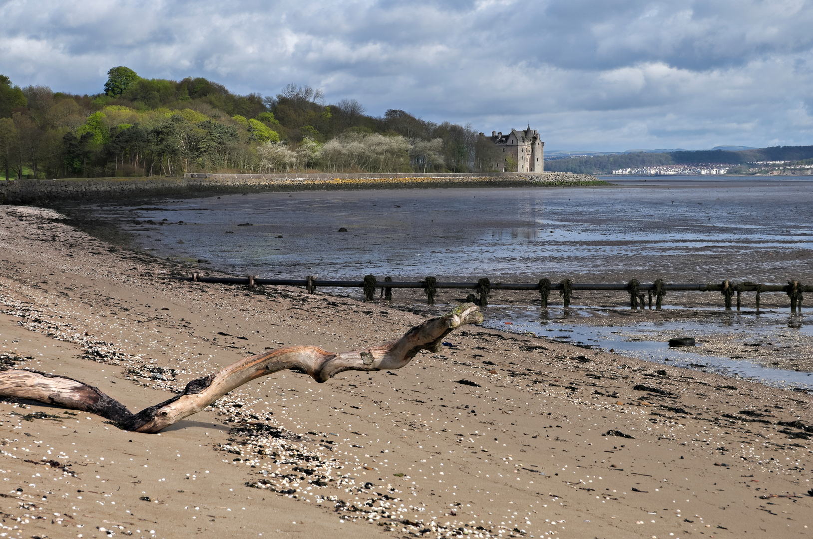
From the Queensferry/Dalmeny side, the walk begins with broad estuary scenery and a strong sense of open space. Whitehouse Bay introduces the character of the route well: low shore, pebbly and sandy margins, and wide views across the Forth. This is not a mountain walk with dramatic ascent; it is a shoreline ramble where the interest comes in layers—sea light, geology, estate landscape, birdlife, and historic sites appearing one after another. The lack of elevation gain makes it suitable for steady walkers, families with older children, and anyone wanting a longer but non-strenuous day out.
Around the first few kilometres, the shoreline opens toward Barnbougle Castle, one of the route’s standout landmarks. The castle occupies a striking position right on the shore between Cramond and Queensferry, and although what you see today includes major 19th-century rebuilding, it preserves the footprint and fabric of an older tower house associated with the Mowbray family and later the Rosebery estate. Its placement on a projecting rock terrace gives it a dramatic, almost storybook profile from the path. (en.wikipedia.org)
Historically, this coast is rich far beyond the castle itself. Barnbougle and Dalmeny are

Surfaces
Asphalt
Unpaved
Unknown
Dirt
Comments and Reviews
User comments, reviews and discussions about the Whitehouse Bay, Barnbough Castle, Snab Point and Eagle Rock, Scotland.
average rating out of 5
0 rating(s)