
Download
3D Flyover
Add to list
More
5.7 km
~1 hrs 39 min
309 m
Loop
“From Swanston’s whitewashed cottages, a brisk climb unfolds into wild Pentland skies and sweeping city views.”
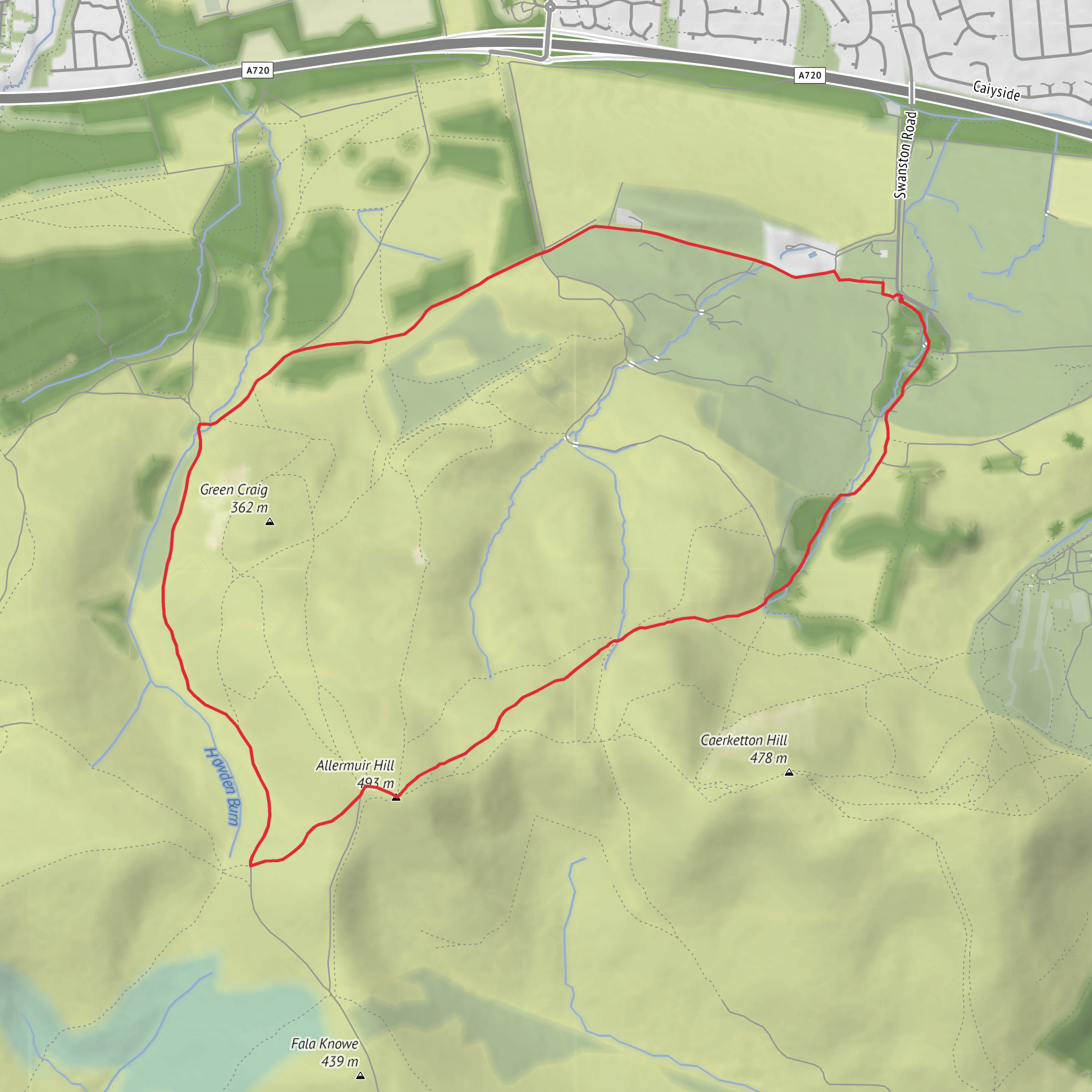
This is a compact but properly hilly Pentland outing, climbing roughly 6 km / 3.7 miles with about 300 m / 985 ft of ascent, and it feels bigger than the numbers suggest because the route rises quickly from the edge of Edinburgh onto open hillside. The usual start is at Swanston car park near Swanston Brasserie & Golf Club, 111 Swanston Road, Edinburgh EH10 7DS, on the southern edge of the city at the foot of the Pentland Hills. That gives you the nearest clear landmark and practical access point for planning. (elgt.org.uk)
From the start, the route heads past the old hamlet of Swanston and begins climbing on broad hill paths and estate tracks toward Allermuir Hill. The first section is straightforward underfoot compared with many deeper Pentland routes, but it is still a sustained uphill pull. Expect a mix of firm tracks, grassy sections, and occasionally muddy patches after rain, especially where water sits on the hillside or where stock have churned the ground. In windy or wet weather, this medium walk can feel notably tougher because the upper slopes are exposed and there is little shelter once you leave the village behind. (walkhighlands.co.uk)
What the climb feels like
The ascent builds steadily rather than all at once. Over the first 1.5 to 2 km / 0.9 to 1.2 miles, you gain most of the height, with the city dropping away behind you and the Pentland ridge opening up ahead. Allermuir Hill stands at about 493 m / 1,617 ft, and although this loop does not involve technical terrain, the gradient is enough to demand decent fitness and steady pacing. The summit area is marked by a cairn and is one of the best viewpoints on the northern Pentlands, with wide views over Edinburgh, the Lothians, and on clear days toward the Firth of Forth. (walkhighlands.co.uk)
Because the route is relatively short, many walkers underestimate it. Strong winds are common on the upper hill, and low cloud can reduce visibility quickly. Good footwear is advisable even in summer, and if visibility is poor, route-finding is much easier with HiiKER loaded in advance, especially where multiple hill paths and connecting tracks branch across the slopes. The paths here are generally obvious in fair conditions, but mist can flatten the landscape and make junctions less intuitive than they first appear. (walkhighlands.co.uk)
Landmarks, scenery, and wildlife
One of the most distinctive features of this walk is the contrast between the historic settlement at Swanston and the open volcanic hills above it. Swanston is known for its whitewashed cottages and long rural character despite being right on Edinburgh’s edge. As you climb, the setting changes quickly from village fringe to moorland hillside, with gorse, rough grass, and broad views becoming the dominant character of the route. (alltrails.com)
Allermuir is one of the most prominent Pentland summits overlooking the city, and the loop gives a particularly good sense of that transition from urban fringe to upland landscape. The northern slopes are especially rewarding for views back over Edinburgh, while the higher ground opens inland toward the central Pentlands. This is also an area where walkers may spot buzzards and skylarks, and the hills above Swanston are well known for Highland cattle grazing on the flanks of Caerketton and Allermuir in warmer months. Give cattle plenty of space, keep dogs under close control, and avoid getting between animals and calves. (swanston.co.uk)
The Pentlands are also geologically significant. Allermuir and nearby Caerketton are formed from rocks associated with the Pentland Hills Volcanic Formation, which helps explain the rounded but commanding hill shapes seen on this side of the range. Even without specialist knowledge, the terrain has a distinct upland character: broad shoulders, open skyline, and a mixture of grassy and heath-like ground rather than craggy mountain scenery. (en.wikipedia.org)
Historical background
This area carries more history than the short mileage might suggest. Swanston itself is part of a historic estate landscape and conservation area with medieval roots, and the wider Pentlands have long been used for farming, drove routes, hunting, and later water-supply works. The regional park notes that water-supply developments in the Pentlands began as early as the 17th century, including the building of a cistern at Swanston. Medieval landholding and movement through these hills shaped many of the routes and patterns still visible today.
Surfaces
Unknown
Gravel
Dirt
Ground
Asphalt
Comments and Reviews
User comments, reviews and discussions about the Swanston Loop via Allermuir Hill, Scotland.
average rating out of 5
0 rating(s)

