
Redford Bridge, South Black Hill, Carnethy Hill, Turnhouse Hill, Glencorse Reservoir and Threipmuir Reservoir Loop
Download
3D Flyover
Add to list
More
20.4 km
~5 hrs 25 min
806 m
Loop
“A windswept Pentlands circuit of shimmering reservoirs, rugged ridges, and far-reaching views rewards a full-day effort.”
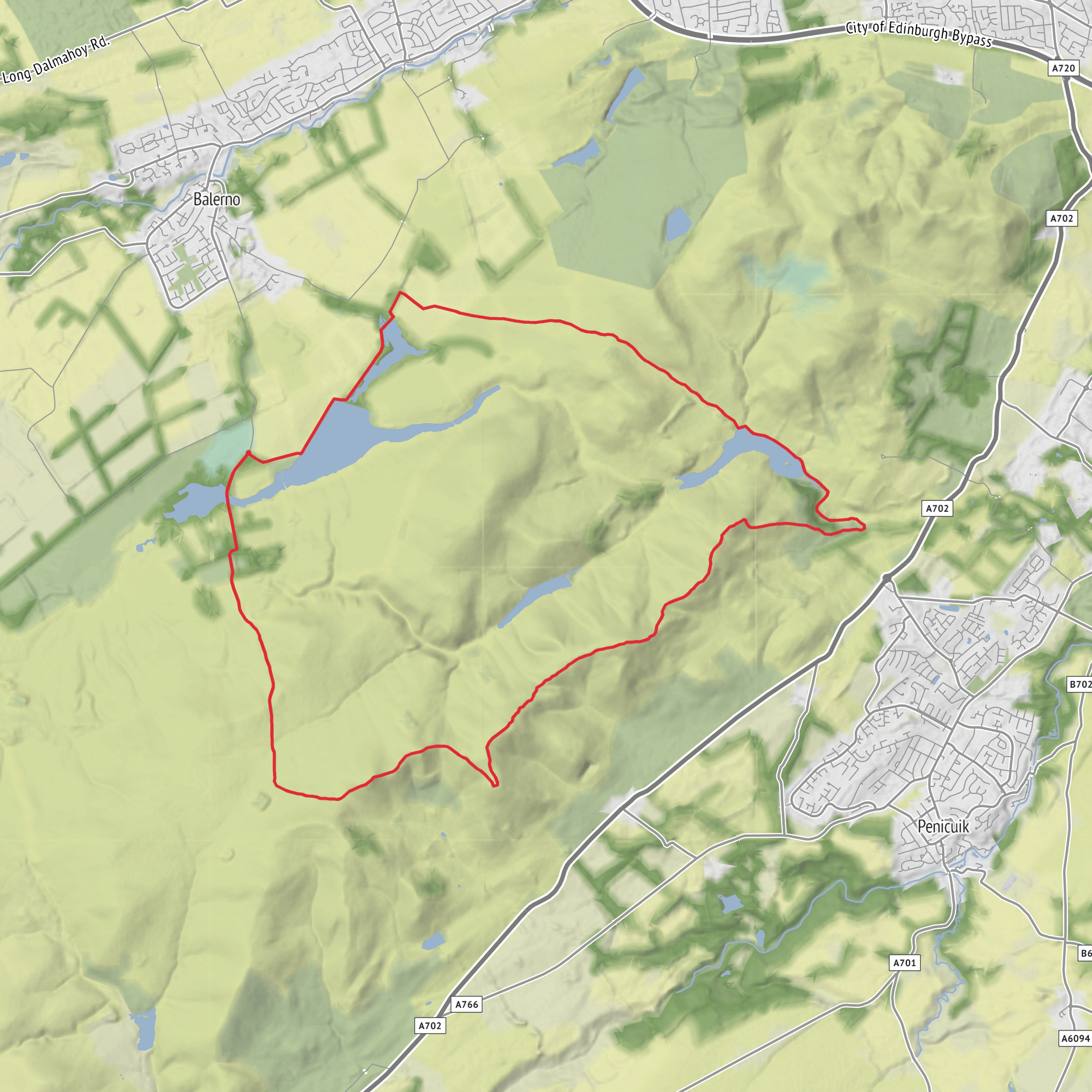
This 20 km (12.4 mile) circuit in the Pentland Hills packs a lot into a medium-grade day: broad reservoir shorelines, long grassy ridges, steep hill pulls, and some of the best open views south and west of Edinburgh. With around 800 metres (about 2,625 feet) of ascent, it is best treated as a full outing rather than a casual stroll. The route links Redford Bridge with South Black Hill, Carnethy Hill, Turnhouse Hill, Glencorse Reservoir and Threipmuir Reservoir, moving through a landscape of old hill tracks, waterworks, moorland and volcanic summits in the Pentland Hills Regional Park. (pentlandhills.org)
The start is best understood as being near Redford Bridge by Threipmuir Reservoir and the Bavelaw area in the Pentland Hills, southwest of Balerno, Edinburgh. For drivers, the nearest practical parking is usually Threipmuir Reservoir car park, EH14 7JT, or Harlaw House Visitor Centre car park, EH14 7AS, depending on the exact line of approach. If you are arriving by public transport, the most useful option is typically the Lothian 44 to Balerno Terminus, then continuing on foot toward Harlaw and Threipmuir; there is also bus access on the southeast side of the park via Flotterstone Visitor Information Point, EH26 0PP, served by the 101/102. There is no train service directly into the regional park. (pentlandhills.org)
Expect a varied walking surface from the outset. Lower sections around Redford Bridge and the reservoirs are usually on estate tracks, reservoir-side paths, short road links and well-used hill paths. Once the route turns uphill toward South Black Hill and the higher ridge, the walking becomes rougher and more exposed, with steeper grassy and stony sections. In wet or windy weather, the Pentlands can feel much more serious than the “medium” label suggests, especially on the open tops where visibility can drop quickly and paths can become slick or eroded. The regional park specifically notes that paths are vulnerable to erosion and that visitors may encounter livestock, working land and water-management structures. (pentlandhills.org)
Climbing to South Black Hill
From the Redford Bridge side, the early part of the loop is comparatively gentle, giving you time to settle in before the bigger climbs begin. The route passes the edge of Threipmuir Reservoir, one of the defining landmarks of this side of the Pentlands, with views across the water toward Black Hill and the surrounding slopes. This lower ground often feels pastoral compared with the higher ridge: rough grass, patches of marshy ground, stone walls, and occasional shelter from the wind near plantations and estate boundaries. (pentlandhills.org)
The pull onto South Black Hill is where the day starts to feel more strenuous. Although not the highest point on the circuit, it introduces the pattern for the rest of the walk: sustained climbing followed by airy traverses and repeated ups and downs. Allow roughly 5 to 7 km (3 to 4.5 miles) from the start to reach this part of the route, depending on the exact line taken around the reservoir and approach tracks. The ascent here can be steep underfoot, and after rain the ground may be greasy. Looking back, you begin to get wider views over Threipmuir, Harlaw and the lower western Pentlands. (pentlandhills.org)
Geologically, this section is interesting because parts of the Pentlands, including South Black Hill and Carnethy Hill, are associated with the Pentland Hills Volcanic Formation, while other nearby hills are formed from older sedimentary rocks. That contrast helps explain the distinct shapes and textures of the skyline across the range. (en.wikipedia.org)
Carnethy Hill and Turnhouse Hill
From South Black Hill, the route continues into more classic ridge walking. Carnethy Hill is one of the standout summits of the Pentlands, with a broad, open feel and excellent sightlines in clear weather. This middle section is where the route earns its reputation: the terrain is exposed, the wind can be strong even on otherwise fair days, and there is little shelter once you are committed to the tops. The climb and traverse between hills can feel longer than the map suggests, so pacing matters. Using HiiKER beforehand is worthwhile for checking the sequence of junctions, escape options and elevation profile.
By the time you reach Carnethy Hill, you are likely around the halfway mark in effort rather than distance. The views are expansive: west toward the reservoir
AI Planner
Days planned around your pace, with somewhere to stay each night.
Surfaces
Unknown
Dirt
Gravel
Asphalt
Unpaved
Wood
Comments and Reviews
User comments, reviews and discussions about the Redford Bridge, South Black Hill, Carnethy Hill, Turnhouse Hill, Glencorse Reservoir and Threipmuir Reservoir Loop, Scotland.
average rating out of 5
0 rating(s)



