
Download
3D Flyover
Add to list
More
9.2 km
~2 hrs 5 min
153 m
Loop
“Reservoir calm gives way to marshy moorland, with spacious Pentland views and a hint of wildness.”
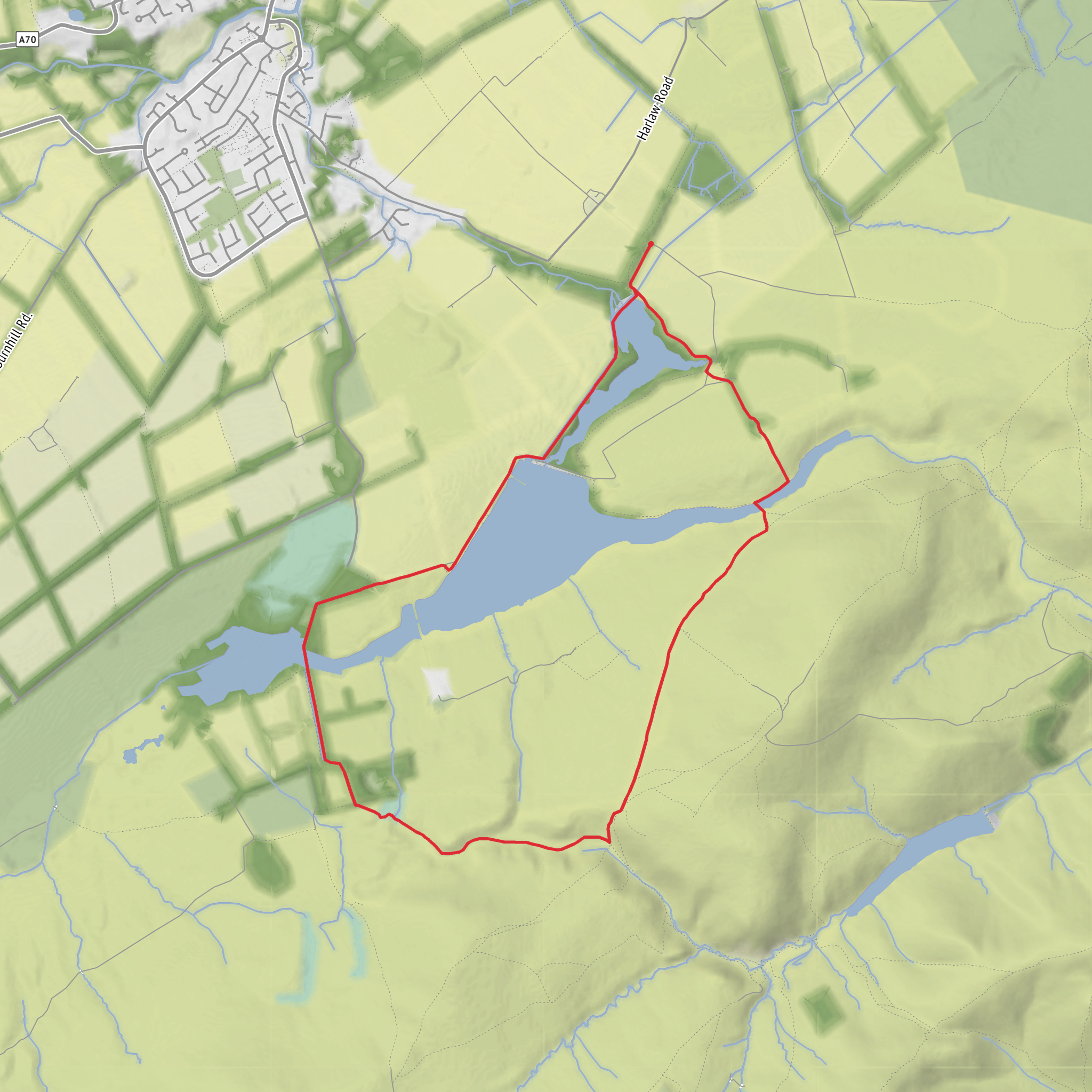
This easy loop in the western Pentland Hills gives a varied outing of about 9 km / 5.6 miles with roughly 200 metres / 656 feet of ascent, combining broad reservoir tracks, open moorland edges, marshy ground near Bavelaw, and long views across one of the most accessible parts of the regional park. The route is usually associated with the Harlaw side of the Pentlands, with the most practical start near Harlaw Reservoir Car Park, Balerno EH14, beside Harlaw House Visitor Centre on the western edge of Pentland Hills Regional Park. Harlaw House is specifically identified by the park as a main entrance point next to Harlaw Reservoir. (pentlandhills.org)
The walk is generally suitable for most hikers looking for a half-day outing rather than a summit day. Although the overall rating is easy, that should be read as “easy by hill-walk standards,” not completely flat. Expect a few gentle to moderate rises, especially as the route leaves the reservoir edge and crosses the higher ground around Bavelaw Marsh. In dry weather the paths are straightforward, but after rain the marsh and connecting field or moorland sections can become soft, muddy, and slower going. Reports and route descriptions consistently note that the outer part of the loop is rougher underfoot than the easier reservoir-side sections. (alltrails.com)
What the route feels like
From the Harlaw side, the opening section is usually the gentlest part of the day, with easy walking beside water and a clear sense of the Pentlands rising ahead. Harlaw Reservoir itself sits at the foot of the hills near Balerno and Currie, and the setting is more pastoral than dramatic at first, with woodland edges, open water, and broad tracks easing hikers into the landscape. (pentlandhills.org)
As the loop continues toward Threipmuir Reservoir, the scenery opens out. Threipmuir lies just upstream of Harlaw, and water from its spillway flows onward toward Harlaw, linking the two reservoirs visually and historically as part of the same managed landscape. This middle stretch is often the most scenic for many walkers: open water on one side, rounded Pentland slopes on the other, and a good sense of space without committing to the steeper hill routes deeper into the range. (en.wikipedia.org)
Around the marshland and higher ground near Bavelaw Marsh, the character changes again. Here the route feels wilder and less manicured, with wetter ground, rougher grass, and a more exposed moorland atmosphere. This is where hikers should expect the least tidy footing of the day. Waterproof footwear is often the safer choice, especially outside prolonged dry spells, and gaiters can be useful in colder or wetter months. The climb in this section is not especially long, but it is enough to raise the effort level above a simple waterside stroll. (alltrails.com)
Landmarks, wildlife, and what to look out for
One of the most notable landmarks near the loop is Bavelaw Castle, a 16th-century tower house on the south side of Threipmuir Reservoir. Even if the route does not go directly to its door, it adds a strong historical note to the landscape and helps explain why this walk feels layered rather than purely natural. The castle is regularly mentioned in route descriptions for walks around Threipmuir. (gps-routes.co.uk)
The reservoirs are a major draw in their own right. Harlaw and Threipmuir create a sequence of reflective water, embankments, inlets, and shoreline habitat that can make this route feel much richer than its modest distance suggests. Birdlife is one of the main rewards here: expect the possibility of seeing common waterbirds and other wetland species around the reservoir margins and marshy ground, with seasonal variation affecting what is most active. The surrounding Pentland landscape also supports moorland birds and grazing livestock, so dogs should be kept under close control where required. The regional park also warns of heavy visitor pressure and parking issues, which is a good reminder to stay considerate on shared paths and around access points. (pentlandhills.org)
Geologically, this part of the Pentlands is more interesting than it first appears. The area around Bavelaw and Threipmuir includes evidence of glacial meltwater channels and old lake-bed or alluvial features, while rocks near Bavelaw Castle have been identified as some of the oldest Silurian rocks exposed in the Pentland Hills. For hikers who enjoy reading the landscape, the broad
Surfaces
Unknown
Dirt
Asphalt
Gravel
Grass
Comments and Reviews
User comments, reviews and discussions about the Harlaw Reservoir, Bavelaw Marsh and Threipmuir Reservoir Loop, Scotland.
average rating out of 5
0 rating(s)

