
Download
3D Flyover
Add to list
More
4.3 km
~1 hrs 15 min
245 m
Loop
“A short but stirring climb, where volcanic slopes and sweeping city views make every step feel bigger.”
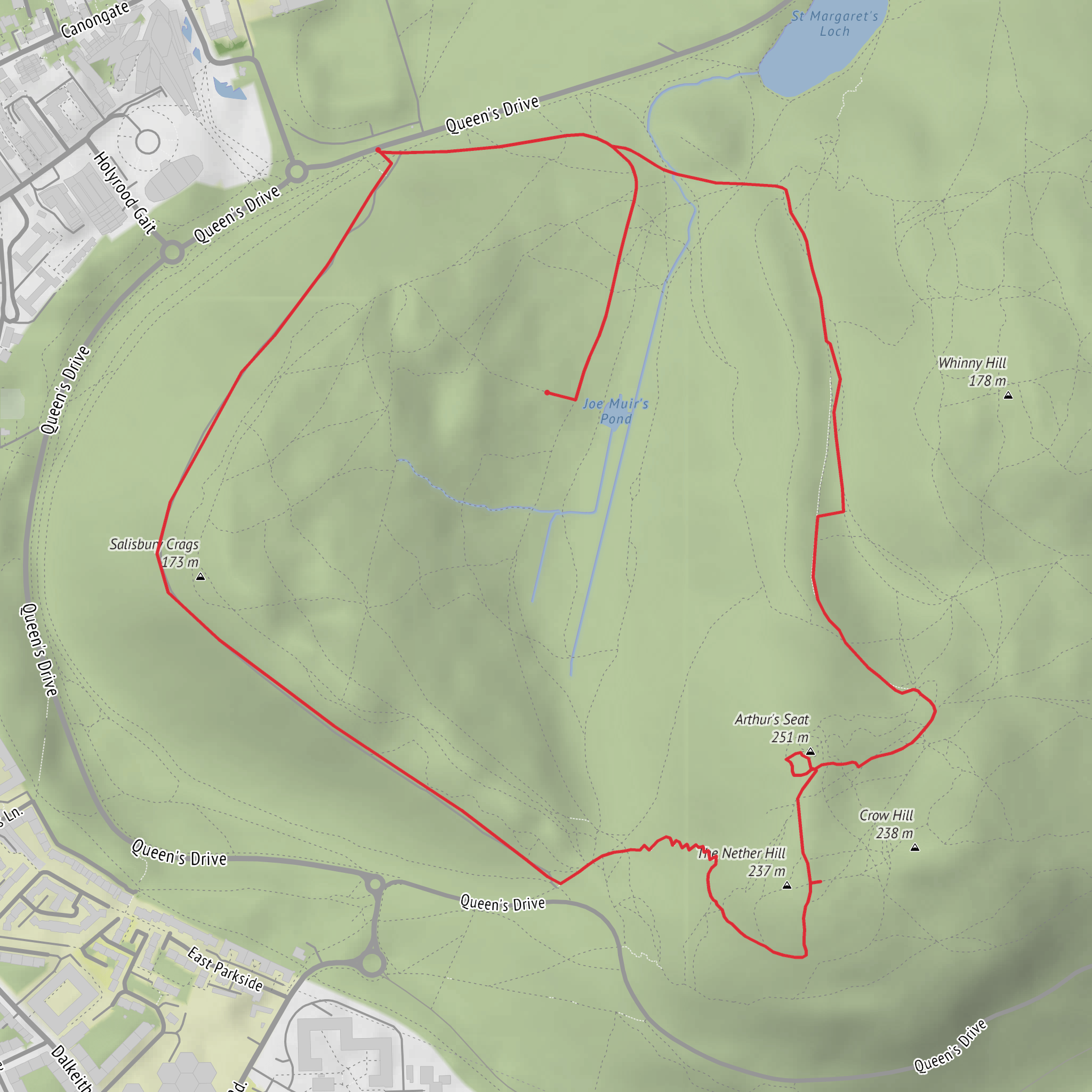
This compact loop packs a surprising amount into roughly 4 km / 2.5 miles, climbing about 300 m / 985 ft from the edge of central Edinburgh into the open slopes of Holyrood Park and up toward Arthur’s Seat. Although the distance is short, the gradient and exposed ground make it feel more substantial than the mileage suggests, so the medium rating is fair. Expect a route that begins near the Dumbiedykes side of the park, with the nearest clear landmark being Dumbiedykes Lodge / the Holyrood Park entrance off Holyrood Gait and Holyrood Road, Edinburgh, just southeast of the Old Town. (portal.historicenvironment.scot)
The opening section usually feels urban for only a moment before the landscape changes quickly. From the park edge, paths rise onto the lower flanks of Arthur’s Seat, where the city falls away behind you and the terrain becomes a mix of compacted paths, rocky sections, and steeper worn lines. On a dry day the route is straightforward for regular walkers, but after rain the stone can be slick and the dirt sections can become muddy, especially on steeper shortcuts and desire paths. Wind is often the main factor here: even when Edinburgh streets feel calm, the upper slopes can be gusty and noticeably cooler. (historicenvironment.scot)
What the climb feels like
The ascent gains height quickly. Over only about 4 km / 2.5 miles, nearly 300 m / 985 ft of climbing means there is very little flat walking. Most hikers should plan for a sustained uphill push early on, with some rougher footing near the higher ground. The summit of Arthur’s Seat itself stands at about 251 m / 823 ft, and the reward is one of the best panoramic viewpoints in Edinburgh, with sightlines over the Royal Mile, Calton Hill, the Firth of Forth, and the wider Lothians in clear weather. Arthur’s Seat is the eroded core of an ancient volcano, and that volcanic origin is a big part of why the park feels so dramatic compared with the surrounding city. (outdoorscot.co.uk)
Because this is a loop, the descent often returns by a different line through Holyrood Park rather than retracing every step. That gives a good sense of the park’s varied topography: grassy shoulders, craggy outcrops, and broad open views that shift constantly as you circle back toward the Dumbiedykes side. Descending can be harder on the knees than the climb, particularly where loose gravel sits over rock, so footwear with decent grip is worth having even on a short outing. (historicenvironment.scot)
Landmarks, landscape, and wildlife
Arthur’s Seat is the dominant landmark, but the wider setting matters just as much. Holyrood Park is Edinburgh’s largest greenspace and contains a striking mix of cliffs, ridges, lochs, grassland, and volcanic landforms in a relatively small area. Depending on the exact line of the loop, hikers may also notice the Salisbury Crags skyline nearby, the park roads curving below, and constant views back toward the historic core of Edinburgh. (historicenvironment.scot)
Nature here is more interesting than many first-time visitors expect from a city walk. Historic Environment Scotland notes conservation work in the park for rare or threatened plants including spring sandwort, sticky catchfly, and rock whitebeam. Birdlife varies by season, but open ground and loch edges can attract common urban and parkland species, while the grassier slopes support insects and small mammals. As always in a protected landscape, it is best to stay on established paths where possible to reduce erosion and avoid trampling sensitive vegetation. (edinburghoutdoors.org.uk)
Historical significance
This walk crosses a landscape with both geological and human history. Arthur’s Seat is an ancient volcanic feature, but the park is also tied closely to the story of Edinburgh itself. Holyrood Park sits immediately beside some of the city’s most important historic institutions and landmarks, including the Palace of Holyroodhouse and the foot of the Royal Mile. The Dumbiedykes name is also historic, referring to the old boundary walls associated with the edge of the parkland. That blend of royal landscape, old city fringe, and dramatic natural ground is what makes this route feel far bigger than its modest distance suggests. (en.wikipedia.org)
Planning, access, and what to watch for
For navigation, use HiiKER and pay attention to the exact line of ascent and descent, because there are multiple intersecting paths on the hill and some are steeper or rougher than others. In mist, rain, or strong wind, the upper hill can feel much more serious than the map suggests. This is not a technical hike, but it does demand care around
What to expect?
Surfaces
Unknown
Ground
Asphalt
Unpaved
Grass
Gravel
Comments and Reviews
User comments, reviews and discussions about the Dumbiedykes, Arthur's Seat and Holyrood Park Loop, Scotland.
average rating out of 5
0 rating(s)



