Download
3D Flyover
Add to list
More
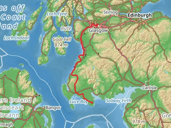
151.4 km
~6 days
2692 m
Multi-Day
“Trek the soul of Scotland on the West Highland Way, a scenic journey through history, highlands, and diverse habitats.”
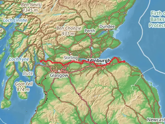
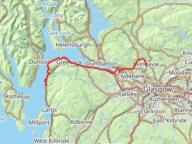
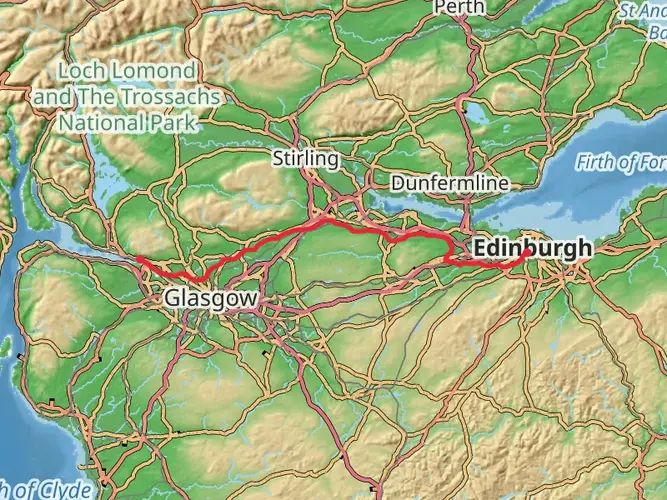
Embarking on the West Highland Way, you'll traverse a diverse landscape that showcases the heart of Scotland's rugged beauty. This long-distance footpath stretches approximately 151 kilometers (94 miles) and ascends roughly 2600 meters (8530 feet) in elevation. The journey begins near Milngavie, East Dunbartonshire, and concludes at the foot of Ben Nevis in Fort William, offering a medium difficulty trek that appeals to a wide range of hikers.
Getting to the Trailhead
To reach the starting point of the West Highland Way, you can take a train from Glasgow to Milngavie, which is a short journey of about 20 minutes. If you're driving, Milngavie is situated just north of Glasgow, and there are parking facilities available for those who plan to leave their vehicle for the duration of the hike.
Milngavie to Drymen
The trail begins with a gentle introduction to the Scottish countryside, leading you through Mugdock Country Park before entering open farmland and rolling hills. The first section to Drymen is about 19 kilometers (12 miles) and is relatively flat, making it a good warm-up for what lies ahead.
Conic Hill and Loch Lomond
After Drymen, the path rises to Conic Hill, where you'll be rewarded with panoramic views of Loch Lomond. Descending towards Balmaha, a small village on the eastern shore of the loch, you'll find the terrain becomes more challenging. The trail follows the loch's banks for about 35 kilometers (22 miles), with some sections requiring careful navigation over rocky and uneven ground. HiiKER can be an invaluable tool for staying on track during this part of the hike.
Rannoch Moor and Glencoe
Beyond Loch Lomond, the landscape opens up as you cross the expanse of Rannoch Moor. This 16-kilometer (10-mile) stretch is one of the most remote and atmospheric parts of the trail, characterized by its peat bogs and moorland. The sense of isolation here is profound, and the weather can change rapidly, so be prepared.
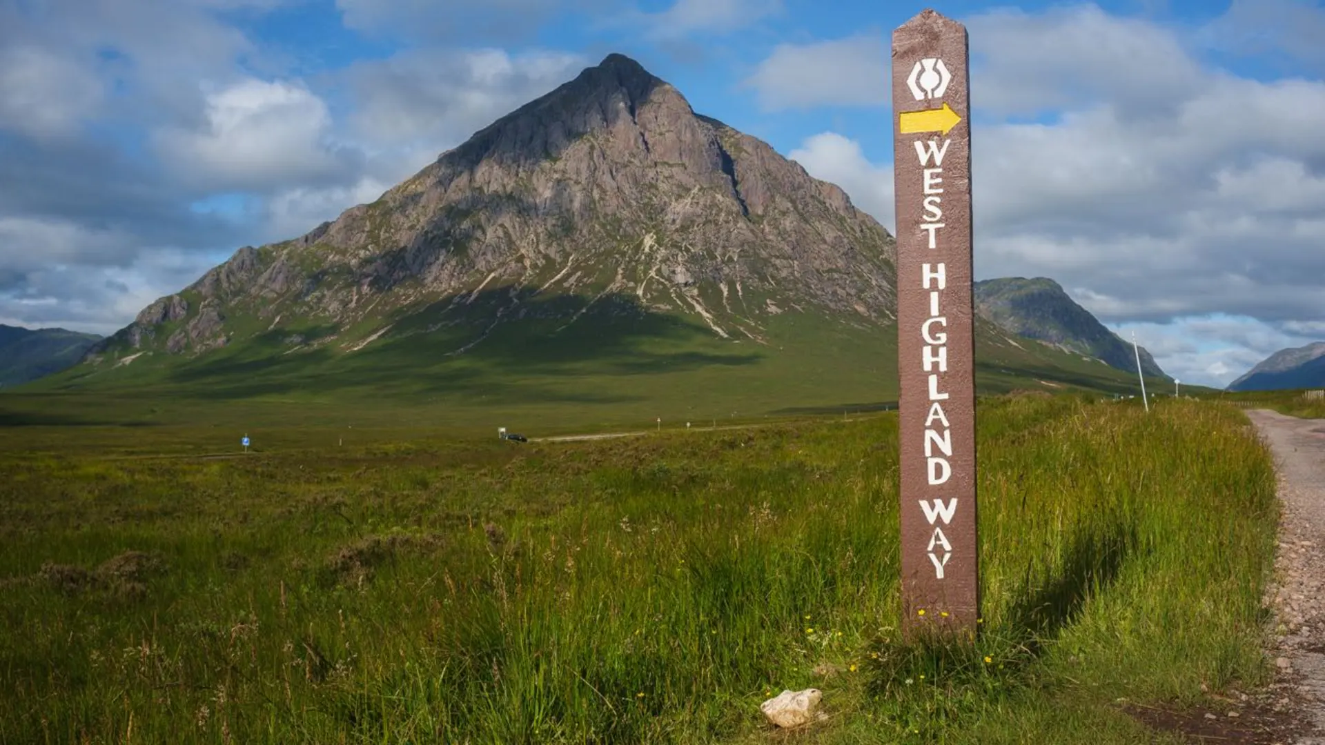
Entering Glencoe, you'll be walking through a valley steeped in history, with its dramatic peaks formed by ancient volcanic activity and glaciers. The area is also known for the Massacre of Glencoe in 1692, where members of the MacDonald clan were killed by government forces.
Climbing the Devil's Staircase and Descent to Kinlochleven
The ascent of the Devil's Staircase is a challenging climb, but it's the highest point on the West Highland Way at 550 meters (1804 feet). From the summit, the trail descends into Kinlochleven, covering a distance of about 14 kilometers (8.7 miles) from Glencoe.
Final Stretch to Fort William
The last leg of the hike takes you from Kinlochleven to Fort William, a distance of approximately 24 kilometers (15 miles). The path climbs out of Kinlochleven before traversing the Lairig Mor, an ancient drovers' road with stunning views of the surrounding mountains. As you approach Fort William, the majestic Ben Nevis, the highest peak in the British Isles, comes into view, marking the end of your journey.
Wildlife and Nature
Throughout the hike, keep an eye out for Scotland's diverse wildlife, including red deer, golden eagles, and if you're lucky, the elusive Scottish wildcat. The trail also passes through varied ecosystems, from deciduous woodlands to heather-clad moors, each supporting its own unique flora and fauna.
Preparation and Planning
When planning your hike, consider the time of year, as the Scottish weather can be unpredictable. Midges are particularly prevalent in the summer months, so insect repellent is a must. Ensure you have appropriate clothing, a reliable map, and the HiiKER app for navigation. It's also wise to book accommodation in advance, as the trail is popular and places can fill up quickly.
Remember to leave no trace, respect the natural environment, and enjoy the rich tapestry of landscapes and history that the West Highland Way has to offer.

What to expect?
Activity types
Frequently asked questions
How long does it take to hike the West Highland Way from Milngavie to Fort William?
The West Highland Way is 151.41 km long, and most walkers complete it in about 6 to 8 days. The route runs from the obelisk on Douglas Street in Milngavie to Gordon Square in Fort William, with common overnight stops including Drymen, Balmaha, Tyndrum, Bridge of Orchy, Kingshouse, and Kinlochleven.
Where do you start and finish the West Highland Way, and can you get there by train?
The West Highland Way usually starts in central Milngavie, just north of Glasgow, and finishes in Fort William at the foot of Ben Nevis. Milngavie has regular train service from Glasgow, and there are rail stations along or near the route at Ardlui, Crianlarich, Tyndrum, and Bridge of Orchy, which also makes section hiking practical.
Is there parking at the West Highland Way trailhead in Milngavie?
Yes. The official route information notes parking outside Milngavie railway station, with CCTV, and additional parking outside the police station. The start marker in Milngavie town center is only a short walk from the station, so the trailhead is straightforward to reach whether arriving by car or train.
How hard is the West Highland Way, and which parts are the toughest?
The West Highland Way is a long multi-day route with 2,692 m of climbing, so it demands solid fitness even though many sections are on clear paths and tracks. The rougher stretches are typically the Loch Lomond shoreline north of Balmaha, where the trail is slower and rockier, and the later Highland stages around Rannoch Moor, the Devil’s Staircase, and the descent toward Kinlochleven.
Can you wild camp on the West Highland Way?
Wild camping is possible on much of the West Highland Way under the Scottish Outdoor Access Code, but there are important restrictions. On parts of the route between Drymen and Crianlarich, camping byelaws apply from March 1 to September 30 in sections of Loch Lomond and The Trossachs National Park, where camping is only allowed in campsites or with a permit inside the management zones.
Is the West Highland Way dog friendly?
Yes, dogs are allowed on the West Highland Way as long as they are kept under proper control and walkers follow the Scottish Outdoor Access Code. Extra care is needed around livestock, enclosed fields, and busy lochside sections, especially on the early stages through farmland near Drymen and on the narrower terrain beside Loch Lomond.
What is the best time of year to hike the West Highland Way?
The main walking season for the West Highland Way is typically spring through early fall, when services and longer daylight make the route easier to manage. May and September are often favored because conditions can be cooler and less midge-heavy than high summer, while March to September is also the period when Loch Lomond camping byelaws affect some overnight plans.
Comments and Reviews
User comments, reviews and discussions about the West Highland Way, Scotland.
4.89
average rating out of 5
461 rating(s)