Download
3D Flyover
Add to list
More
5.1 km
~1 hrs 11 min
100 m
Loop
“A varied Glenkens ramble: wildflower riverbanks, a breezy hilltop panorama, and Dalry’s whitewashed charm.”
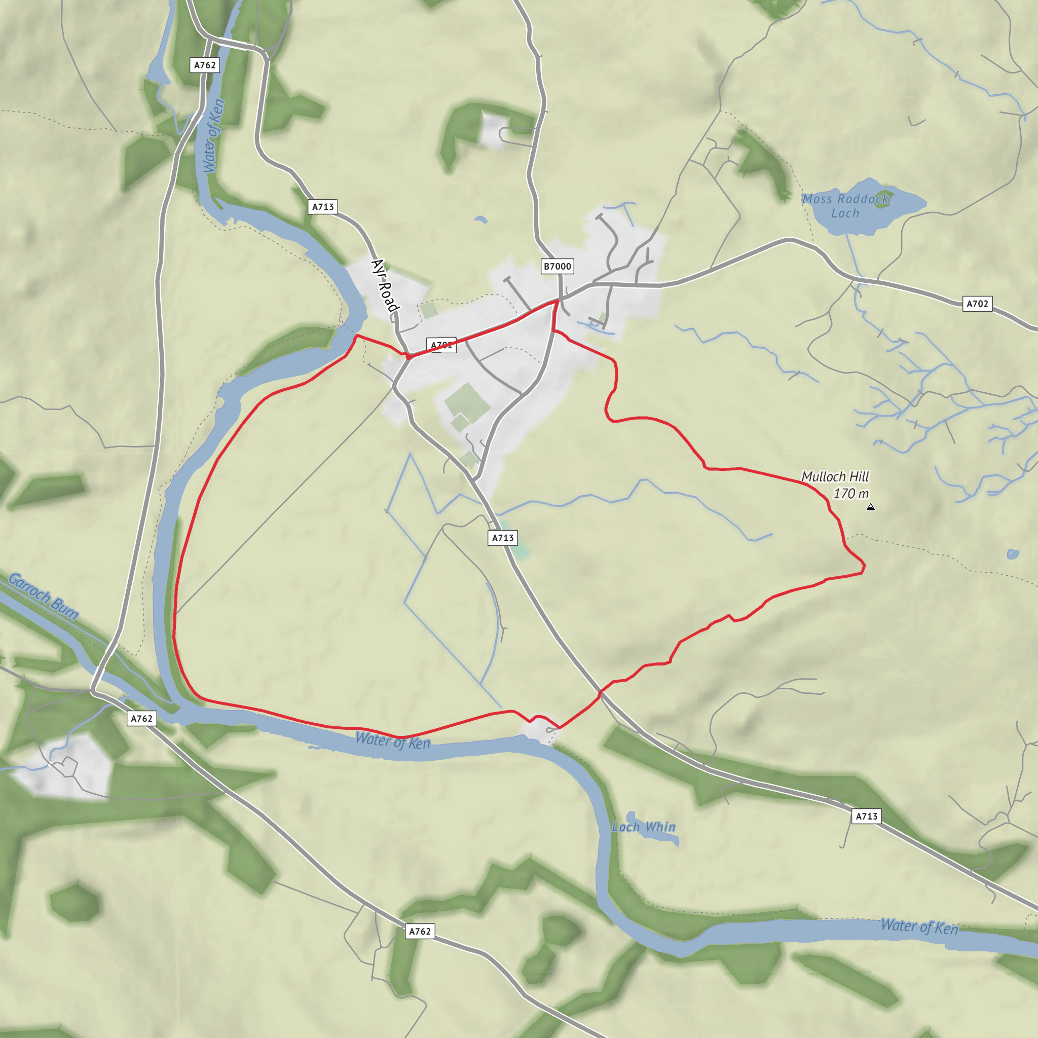
This is a short but varied circuit above and beside the Water of Ken near St John’s Town of Dalry, Dumfries and Galloway, starting from the village centre by the Southern Upland Way information shelter behind Dalry Town Hall. The route is about 5 km / 3 miles with roughly 100–115 metres / 330–377 feet of ascent, and it packs a lot into that distance: riverside walking, open pasture, a modest hill summit, broad Glenkens views, and a strong sense of local history. The overall difficulty is best thought of as medium/moderate because the mileage is short, but parts of the second half are rougher underfoot, can be soft in wet weather, and involve gates, stiles, uneven pasture and a short but noticeable climb. (info.dumgal.gov.uk)
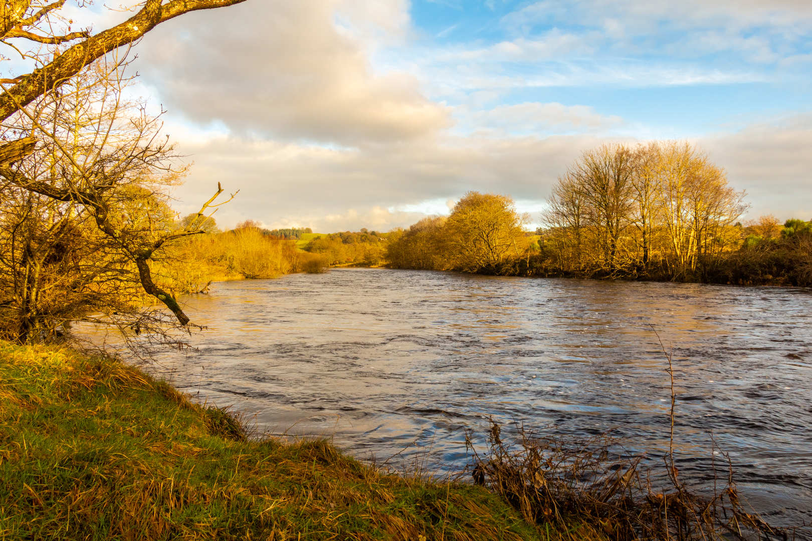
From the start in Dalry, the route heads out on signed paths near the town hall and suspension bridge, then follows the raised flood embankment beside the Water of Ken for the first section. This opening stretch is the gentlest part of the walk, with easy progress on a clearer path and a good chance to settle into the landscape before the climb begins. The river meanders through the Glenkens here, and the low-lying ground beside it gives the walk an open, spacious feel rather than a hemmed-in valley feel. In early summer, this riverside section is especially noted for wildflowers and songbirds. (walkhighlands.co.uk)
What to expect on the route
For roughly the first 2 km / 1.25 miles, you stay close to the river on the embankment before reaching a track and then the road crossing. After that, the character changes. The route crosses toward Mulloch Hill, where the path becomes less distinct across rough pasture. This is the part that deserves the most attention when planning: waterproof boots are a sensible choice, especially after rain, and hikers should expect grass, uneven ground, field boundaries and waymarked gates rather than a continuously obvious trail. Using HiiKER before setting out is a good idea for checking the line of the route across the fields. (info.dumgal.gov.uk)
The climb itself is not long, but it is enough to raise your heart rate. Mulloch Hill stands at about 170 metres / 556 feet, only around 100 metres / 328 feet above the floodplain, yet it gives a much wider outlook than its height suggests. Near the top there is a picnic table and then the trig point just beyond, with views over St John’s Town of Dalry, the Ken Valley, and toward the surrounding Galloway hills. On a clear day you can also pick out nearby settlements such as Balmaclellan and New Galloway, along with parts of the hydro infrastructure that has shaped this landscape. (info.dumgal.gov.uk)
The descent returns through fields on grassy tracks back into Dalry, finishing through village streets lined with traditional whitewashed cottages. That final section gives the walk a pleasing contrast: open hill and farmland gradually giving way to a compact historic settlement. (walkhighlands.co.uk)
Landmarks, scenery and wildlife
The standout natural feature throughout is the Water of Ken, the river that gives the Glenkens its name before eventually widening into Loch Ken and then continuing as the River Dee. The riverside section is scenic rather than dramatic, with broad bends, embankments, pasture and a sense of quiet rural space. This is a landscape of floodplain, farmland and rounded hills rather than crags or mountain drama. (exploredumfriesandgalloway.co.uk)
Mulloch Hill is the main viewpoint. Even though it is a relatively low summit, it offers a surprisingly expansive panorama across the Glenkens and toward the higher hills of Galloway Forest Park. The contrast between the fertile valley floor and the more rugged uplands beyond is one of the route’s main pleasures. (sobt.co.uk)
Wildlife interest is strongest along the river and in the wider Glenkens water system. The embankment section is known for wildflowers and songbirds in the warmer months. More broadly, the nearby Water of Ken and Loch Ken corridor is important for birdlife; Loch Ken is described as a major wintering ground for wild geese, including the locally rare Greenland white-fronted goose, and the hydro reservoirs and associated wetlands have created valuable habitat across the area. While you are less likely to see the full range of waterfowl on this short loop itself, birdwatchers should still keep an eye on
Surfaces
Dirt
Grass
Unknown
Comments and Reviews
User comments, reviews and discussions about the Water of Ken, St John's and Mulloch Hill Loop, Scotland.
average rating out of 5
0 rating(s)
