Download
3D Preview
Add to list
More
4.7 km
~1 hrs 6 min
100 m
Loop
“A vivid loop above Portpatrick mingles cliff drama, shadowy glen paths, and echoes of coastal history.”
This is a short but varied coastal-and-woodland circuit on the edge of Portpatrick, combining sea views, cliff scenery, a sheltered glen, and a strong sense of local history. At around 5 km / 3.1 miles with roughly 100 m / 328 ft of ascent, it fits well as a half-day outing, but the terrain is mixed enough to feel more substantial than the numbers suggest. The overall difficulty is best described as medium because the route includes uneven paths, some steeper sections, and potentially muddy ground in the glen, even though the distance is modest. (walkhighlands.co.uk)
The walk is near Portpatrick Harbour, Portpatrick, Stranraer, Dumfries and Galloway, DG9 8AN, with the usual access point for the glen side of the route at the Dunskey Glen walks car park off the B738, about 1 to 1.5 km / 0.6 to 0.9 miles northeast of Portpatrick. A commonly referenced start for the woodland circuit is the Dunskey Glen walks car park at grid reference NX005553. (checkmypostcode.uk)
If arriving by car, head for Portpatrick and then take the road toward Stranraer before turning onto the B738, where the signed turn for Dunskey Glen walks leads to the parking area. Parking is described as available by the Dunskey House gardens/tearoom area, though seasonal opening of the gardens themselves may vary. (walkhighlands.co.uk)
If using public transport, the practical hub is Stranraer railway station, the terminus of the Glasgow South Western Line, about 151 km / 94.5 miles southwest of Glasgow. From Stranraer, the 367 bus serves Portpatrick, with stops in the village rather than at the trailhead itself, so expect an additional walk of about 1 km / 0.6 miles to reach the Dunskey Glen start area. (en.wikipedia.org)
What the route feels like
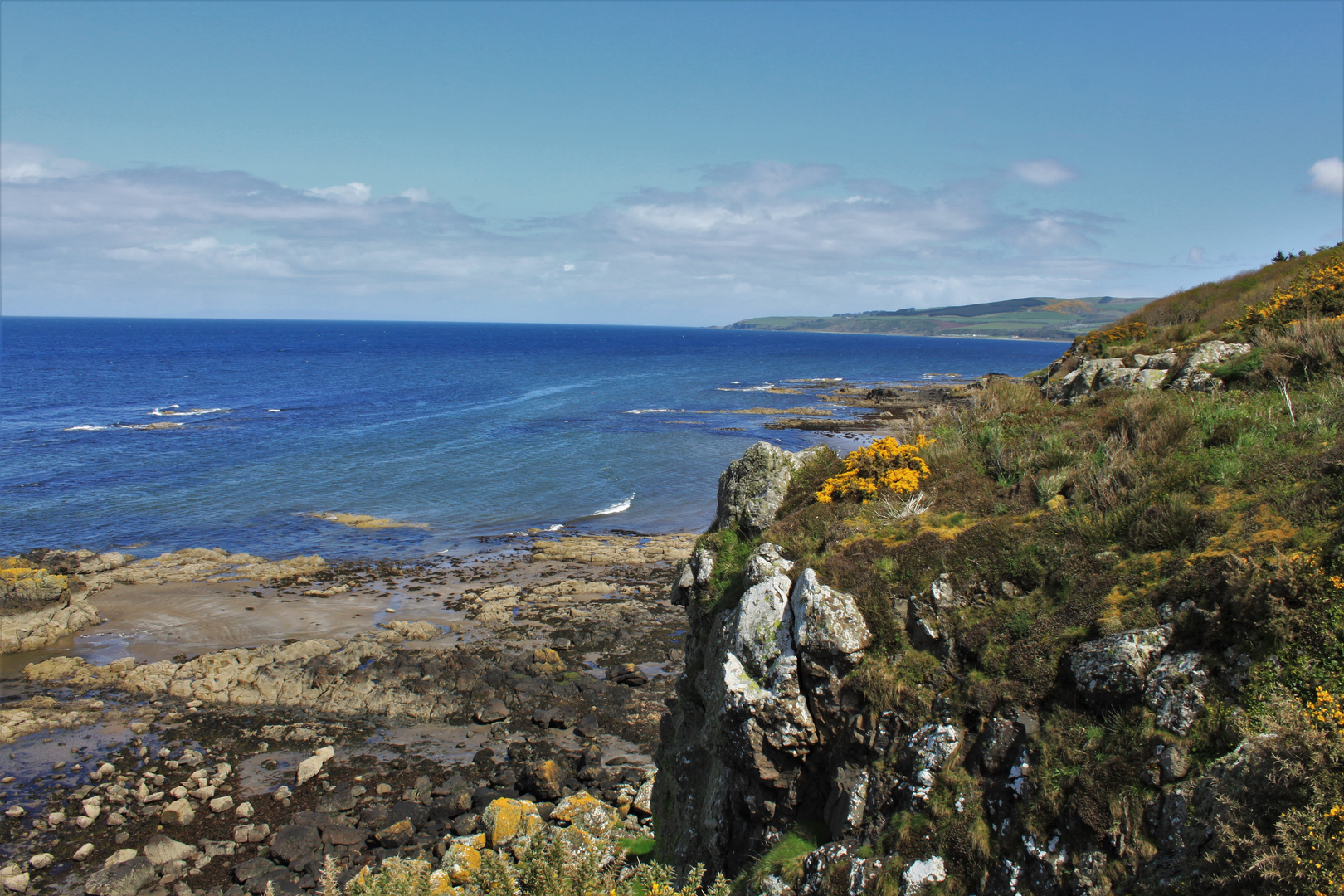
The character of the walk changes quickly. Early on, you are on estate tracks and woodland paths, then the route opens dramatically above the coast with views toward Port Mora and the rocky shoreline. From there it drops toward Port Kale, where the sea becomes the dominant feature, before turning inland again into the wooded ravine of Dunskey Glen beside the burn. That contrast between exposed coast and enclosed glen is what gives this loop its appeal. (info.dumgal.gov.uk)
The outward section is generally easier to follow on broader tracks, while the return through the glen feels more intimate and can be softer underfoot. Expect hard-surfaced sections mixed with beaten earth, with some places becoming slick after rain. Stout footwear is a sensible choice, especially if there has been wet weather. (info.dumgal.gov.uk)
Landmarks, terrain, and navigation points
One of the first notable historical features is a pair of stone pillars, remnants of the approach to the original Dunskey House, which dates back to the 17th century; the present house was built in 1903. These details give the woodland approach an estate-landscape feel rather than a purely wild one. (info.dumgal.gov.uk)
As the route nears the coast, the path runs high above the glen and gives broad views over Port Mora, a sandy bay that provides one of the most attractive outlooks on the walk. The descent to Port Kale is where the route becomes more dramatic, with cliffs of greywacke, a rock type typical of southern Scotland, and open views across the North Channel. On a clear day, Ireland is visible, roughly 34 km / 22 miles away. (info.dumgal.gov.uk)
At Port Kale, look for the unusual octagonal or double-octagonal cable house, dating from the 1850s, linked to the laying of an early submarine telephone cable between Scotland and Ireland. It is one of the most distinctive man-made landmarks on the route and a reminder that this coast was once important not just for

Comments and Reviews
User comments, reviews and discussions about the Maidenhead Bay and Dunskey Glen Loop, Scotland.
average rating out of 5
0 rating(s)