
Download
3D Flyover
Add to list
More
9.5 km
~2 hrs 17 min
232 m
Loop
“A richly varied Border circuit weaves rivers, woods, history and airy hills with thoughtful footing.”
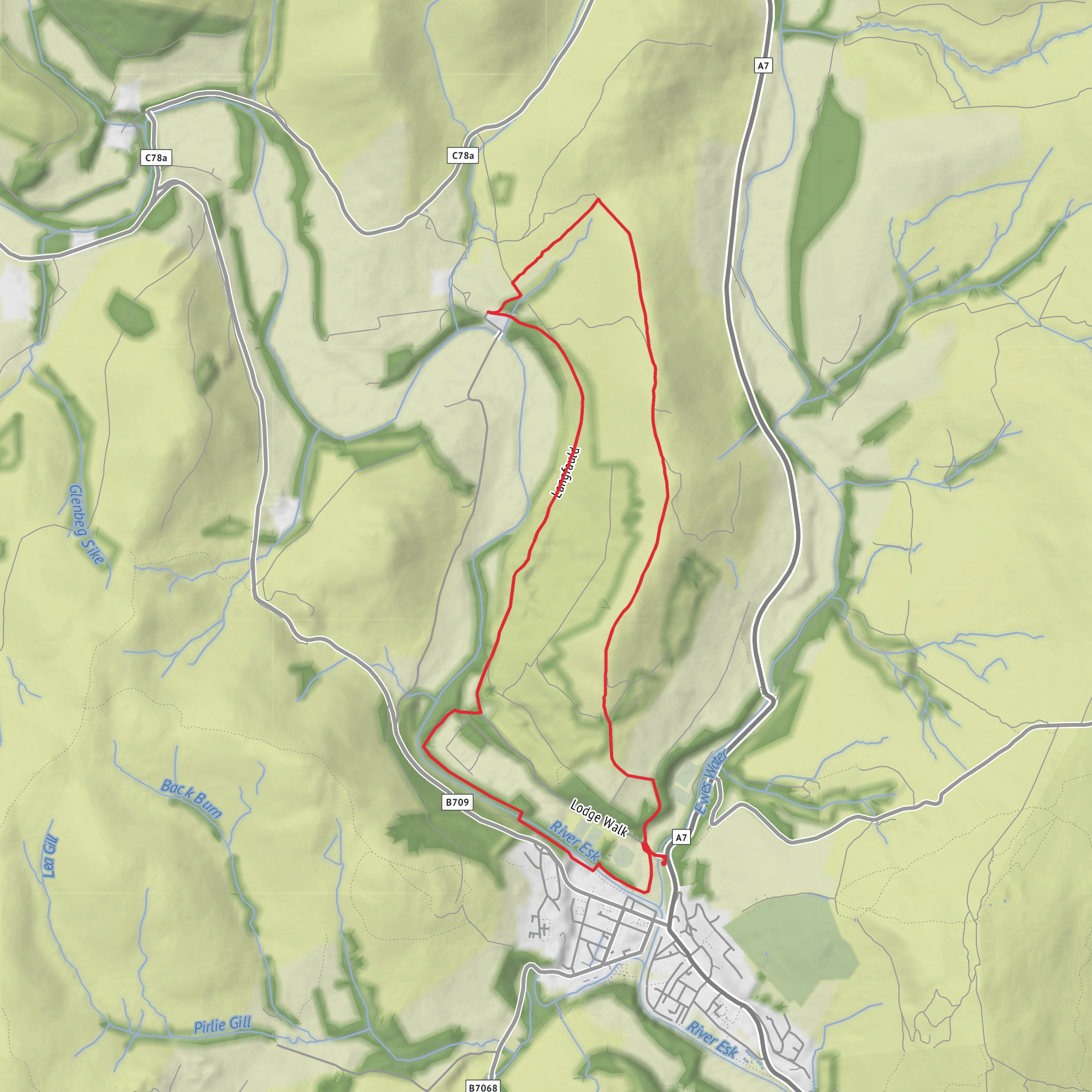
This 9 km / 5.6 mile circuit above Langholm is a varied half-day outing that mixes riverside walking, woodland tracks, open hillside, and a short stretch of rougher ridge walking. With around 200 metres / 656 feet of ascent overall—some sources put it closer to 241 metres / 791 feet—it sits comfortably in the medium category: never truly mountainous, but with enough climbing, uneven ground, and occasional boggy patches to demand decent boots and a bit of care. The usual start is Kilngreen car park, Langholm, DG13 0EP, just north of the town centre by the River Esk and close to Ewes Bridge. (walkhighlands.co.uk)
From the start, the route heads out easily along the river plain before crossing Ewes Bridge and following the road past the sawmill area toward the edge of town. This opening section is straightforward and useful for warming up, with the Esk nearby and Langholm’s green spaces behind you. The first notable landmark is the site of Langholm Castle, where only limited remains survive, and the nearby former Clan Armstrong museum location, both of which tie the walk closely to Border history and the Armstrong name long associated with Eskdale and the wider Debatable Lands. (walkhighlands.co.uk)
Through the woods
After the early road and estate-track section, the walk settles into the wooded part of the circuit around Gallowside Wood and Langfauld Wood. Here the gradient is generally gentle, and the route follows broad tracks through mixed woodland before opening out into younger plantation and more expansive views over the Esk valley. This is often one of the most pleasant parts of the day in poor weather, since the trees offer some shelter from wind. Underfoot, expect compacted forest track at first, then muddier or softer patches as you approach the farm and the open hill. (info.dumgal.gov.uk)
As the trees thin, you begin to see Potholm Farm in the valley and the surrounding Eskdale hills. Looking across toward Milnholm, local route notes point out that earthworks of old settlements can be picked out on the far side of the Esk, which gives an early hint that this is a landscape with much deeper human history than the quiet farmland and forestry first suggest. (info.dumgal.gov.uk)
Wildlife here is typical of the southern uplands edge: woodland birds in the trees, raptors overhead if conditions are right, and grazing livestock once you leave the forest. In spring and summer, thorn trees and rough pasture can hold plenty of small bird activity. Because parts of the upper route cross grazing ground, dogs need especially tight control. Cattle may be present on the descent from Castle Hill. (walkhighlands.co.uk)
Climb to Potholm Hill and Castle Hill
The character of the walk changes at the farm tracks. A right turn at the T-junction begins the steadiest climb of the route, first on a rising track and then over a stile onto open ground. This is where the route feels more exposed and more rural, with fewer obvious landmarks ahead beyond fences, dykes, and the broad shoulder of the hill. Some of this section can be boggy, especially after rain, so waterproof footwear is more than a luxury here. (scotlandstartshere.com)
The line of ascent aims for the saddle between Wrae Hill and Potholm Hill. One of the more interesting details on the route is the place-name Wrae Hass, explained in local route notes as an Old Norse name meaning a good piece of land on a pass or corner of good land on a pass. That small detail hints at the layered linguistic history of the Borders, where Norse, Scots, and older traditions all left traces in the landscape. (info.dumgal.gov.uk)
The final pull to Potholm Hill is not especially long, but it is the most sustained uphill effort of the day. The summit stands at about 310 metres / 1,017 feet, marked by a small cairn, and the remains of an old stone dyke help guide the way along the ridge. In clear
Surfaces
Unknown
Unpaved
Asphalt
Comments and Reviews
User comments, reviews and discussions about the Gallowside Wood, Langfauld Wood, Potholm Hill and Castle Hill Loop, Scotland.
average rating out of 5
0 rating(s)

