
Download
3D Flyover
Add to list
More
11.7 km
~3 hrs 35 min
748 m
Loop
“A wild, wind-brushed circuit of lonely ridges and grassy summits that feels tougher than it looks.”
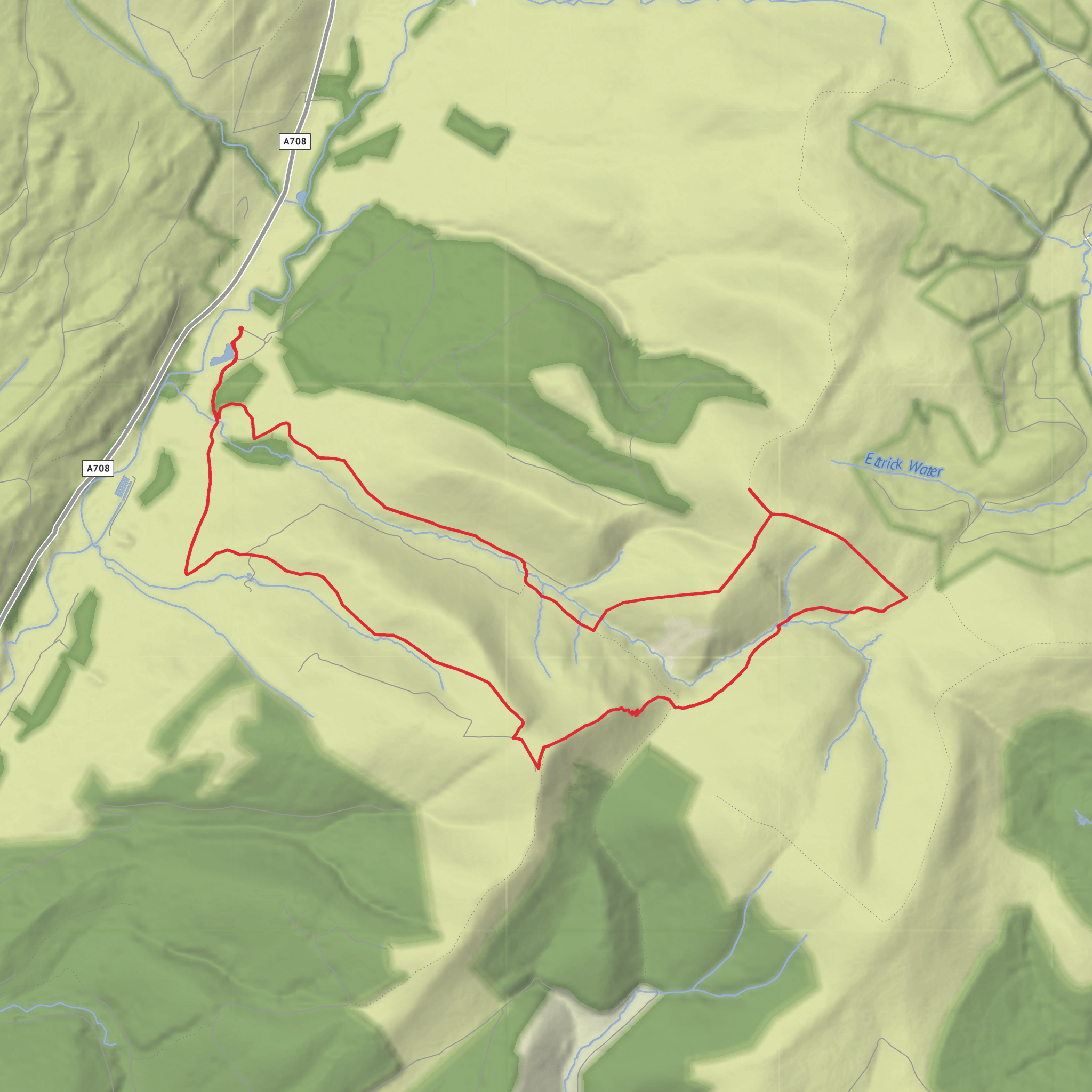
This difficult loop in the Ettrick Hills packs a lot into roughly 12 km / 7.5 miles, with about 800 m / 2,625 ft of ascent, so it feels bigger than the numbers suggest. The route links Croft Head and Capel Fell above the upper reaches of the Selcoth Burn, in a remote corner of the Southern Uplands near the watershed around Ettrick Head. Expect a serious hill day: long grassy climbs, exposed ridges, steep descents, rough hill paths, and sections where the line on the ground can be faint or awkward, especially in poor visibility. Croft Head rises to 637 m / 2,090 ft and Capel Fell to 678 m / 2,224 ft, so although these are not the highest hills in Scotland, they stand in open country where wind, mist, and wet ground can quickly raise the difficulty. (en.wikipedia.org)
The usual start is from the Selcoth area near Roundstonefoot on the A708 northeast of Moffat, using the minor road and track by Selcoth/Ettrick Head as the access point. If you are driving, the practical approach is from Moffat via the A708 through Moffatdale toward Roundstonefoot and the Selcoth turning; parking is typically limited and informal in this area, so it is important not to block gates, tracks, or farm access. The nearest clear road landmark is Roundstonefoot / Moffat Water Hall on the A708, which is the most useful significant landmark for locating the start. Public transport is limited: Moffat is the nearest service town, but the trailhead itself is remote and not well served, so most hikers will need a taxi from Moffat for the final approach unless combining the walk with a longer point-to-point outing on the Southern Upland Way. (scotlandhills.net)
The opening section generally follows estate or hill tracks past Selcoth and up beside the Steinstane Burn toward Croft Head. This first climb is steady but unrelenting, and it gains a large share of the day’s elevation early. Underfoot, you can expect a mix of vehicle track, grassy hill path, and wetter patches. As height builds, the views begin to open across Moffatdale and the surrounding Ettrick Hills, with the broad, rolling Southern Upland landscape stretching away in every direction. Several route descriptions note deer-fence gates on the ascent, so it is worth allowing a little extra time for these interruptions. (walkhighlands.co.uk)
On the high ground
Croft Head is the first major objective and gives a fine sense of the terrain ahead. From here, the route joins or brushes the line of the Southern Upland Way before descending northeast by Cat Shoulder toward the col above the Selcoth Burn. This descent is one of the more memorable parts of the day, with a zigzagging path and increasingly dramatic views into the burn’s steep-sided ravine. In clear weather, Capel Fell dominates the next stage, and the ridge-and-glen topography becomes especially striking. (en.wikipedia.org)
The climb onto Capel Fell is where the walk often earns its difficult rating. The ground can be steep, grassy, and tiring, and in wet conditions traction may be poor. Capel Fell’s summit is broad and relatively featureless, marked only lightly, so navigation matters here when cloud is down. HiiKER is especially useful for checking your exact line across the open hill and for confirming the descent choice, because several trods and hill paths in this area are less distinct than they appear on a map. From the top, there are wide views over the Ettrick Hills and toward the border country, with Croft Head making an impressive companion summit across the intervening ground. (en.wikipedia.org)
Descent and route-finding considerations
The return leg by the Selcoth Burn is often the trick
Comments and Reviews
User comments, reviews and discussions about the Croft Head, Capel Fell and Selcoth Burn Loop, Scotland.
average rating out of 5
0 rating(s)
