Download
3D Flyover
Add to list
More
9.9 km
~2 hrs 41 min
429 m
Loop
“A wild loop above the Devil’s Beef Tub blends sweeping drama, Border history, and serious upland solitude.”
This medium-difficulty loop explores the high rim of the Devil’s Beef Tub in the Moffat Hills, giving a compact but quite serious hill day of about 10 km / 6.2 miles with roughly 400 m / 1,312 ft of ascent. Although the mileage is modest, the route feels bigger than the numbers suggest because much of it is exposed, open, and upland in character, with long stretches on grassy or rough hill paths and very little shelter once you leave the road. (sobt.co.uk)
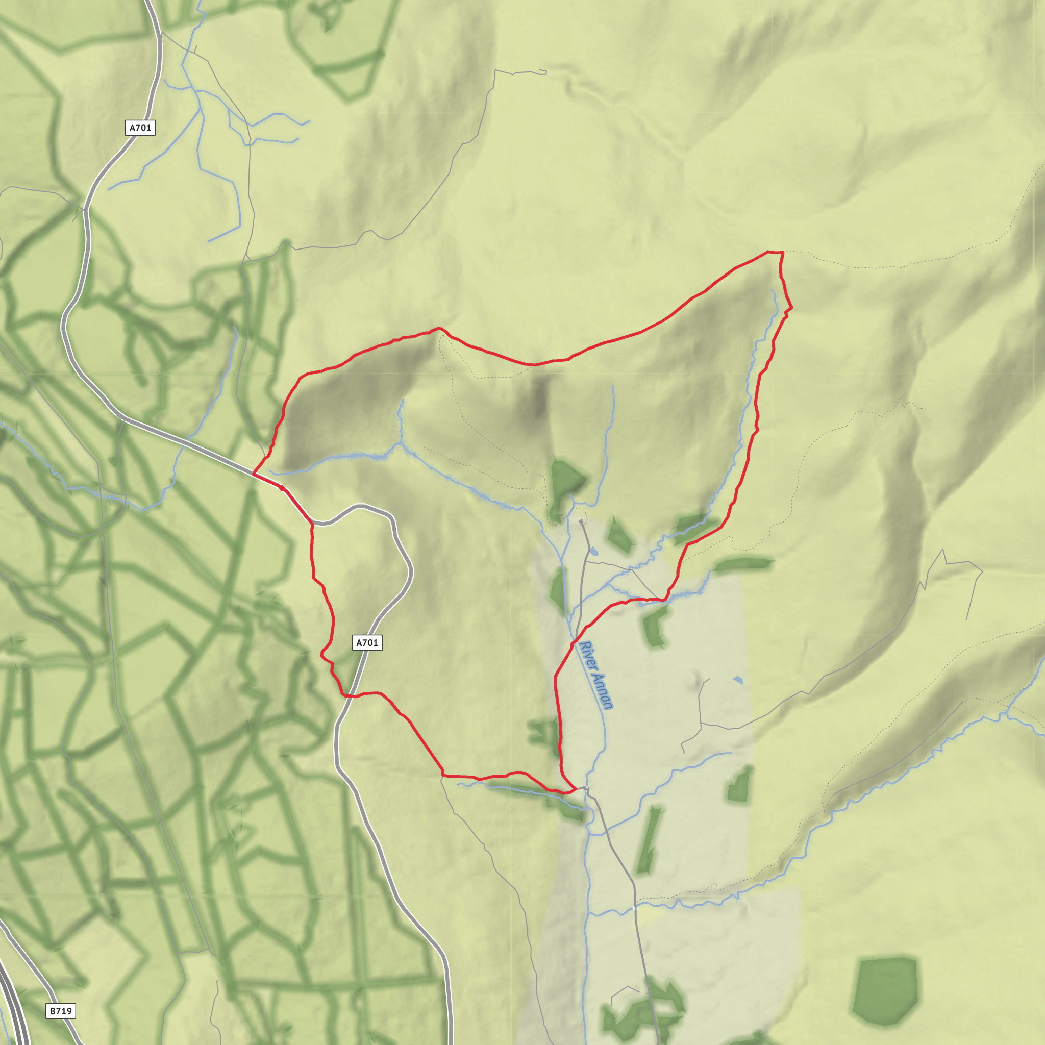
The walk starts near the Devil’s Beef Tub above Moffat, on the minor road that leaves the A701 for Corehead and Annanhead. The nearest clear landmark is the Devil’s Beef Tub viewpoint / layby on the A701, about 5 miles (8 km) north of Moffat, with the hill route beginning from the nearby Annanhead side road and parking area used for access to the surrounding hills. If you are converting a map point to something recognizable for planning, “Devil’s Beef Tub, A701 near Moffat, Dumfries and Galloway” is the most useful destination to enter before refining with HiiKER. (sobt.co.uk)
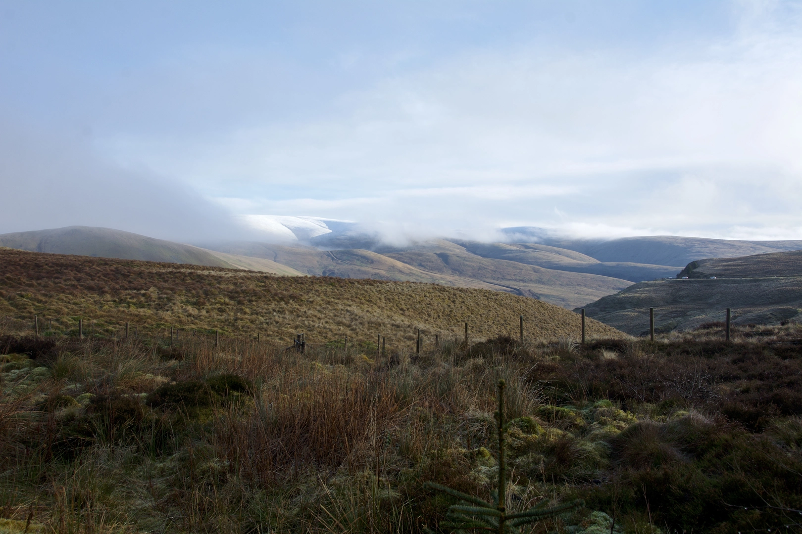
From the start, expect a steady climb onto the broad shoulder of Annanhead Hill, where the landscape quickly opens into a classic Southern Uplands scene of rounded summits, peat-rich ground, and wide skies. The first section is usually the most direct ascent of the day, and it gains height quickly enough to warm you up, but without sustained scrambling or technical ground. In clear weather, the views back into the Devil’s Beef Tub are one of the defining features of the outing: a dramatic hollow enclosed by steep grassy slopes, with the headwaters of the River Annan gathering below. (sobt.co.uk)
Terrain and route character
After Annanhead Hill, the route continues over to Great Hill, keeping to high, rolling ground rather than sharp ridgelines. This is not a rocky mountain walk in the Highland sense; instead, it is a moorland circuit where navigation matters because paths can be faint, the ground can be wet underfoot, and mist can flatten the terrain into a series of similar-looking rises. A medium rating is fair, but hikers should treat it as a proper hillwalk rather than an easy countryside loop. Good waterproofs, wind layers, and confident route-finding with HiiKER are sensible even on a relatively short day. (sobt.co.uk)
The descent side of the loop typically trends toward Tweed Hope and the line of the Annandale Way, giving a change in feel from open summit ground to a more defined valley return. This lower section can be easier going, but after rain it may still be boggy in places, and burns can make the ground slick. The route’s shape means you get a satisfying sense of circling the Beef Tub rather than simply climbing one hill and retracing your steps. (walkingbritain.co.uk)
Landmarks, scenery, and wildlife
The standout landmark is unquestionably the Devil’s Beef Tub itself, a deep natural hollow formed by the surrounding hills including Great Hill, Annanhead Hill, Ericstane Hill, and Peat Knowe. It is one of the most striking landforms in southern Scotland and gives this walk a much more dramatic setting than the route statistics alone might suggest. Sir Walter Scott famously wrote about the hollow’s dark appearance, and even in good weather it has a stern, amphitheatre-like presence. (en.wikipedia.org)
Nature here is typical of high Southern Upland country: rough grasses, heather, rushes, peatland vegetation, and upland burns. Birdlife can include meadow pipits, skylarks, ravens, and raptors using the hill winds, while the quieter slopes and gullies may hold mountain hares or grazing sheep rather than abundant large wildlife. Conditions change the mood of the route enormously: on a bright day it feels spacious and panoramic, while in wind, rain, or low cloud it becomes austere and committing. (sobt.co.uk)
Historical significance
This landscape carries a strong Border history. The Devil’s Beef Tub is closely associated with the Border Reivers, especially the Johnstone clan, who were said to use the hollow to conceal stolen cattle; that history is tied to the origin of the name. The area is also linked with the Covenanters: in 1685, John Hunter
Surfaces
Unknown
Grass
Gravel
Asphalt
Concrete
Comments and Reviews
User comments, reviews and discussions about the Annanhead Hill, Great Hill and Tweed Hope Loop, Scotland.
average rating out of 5
0 rating(s)
