
Download
3D Flyover
Add to list
More
19.8 km
~4 hrs 50 min
529 m
Loop
“A big-sky moorland circuit of rounded tops, where distance, wind and solitude shape the day.”
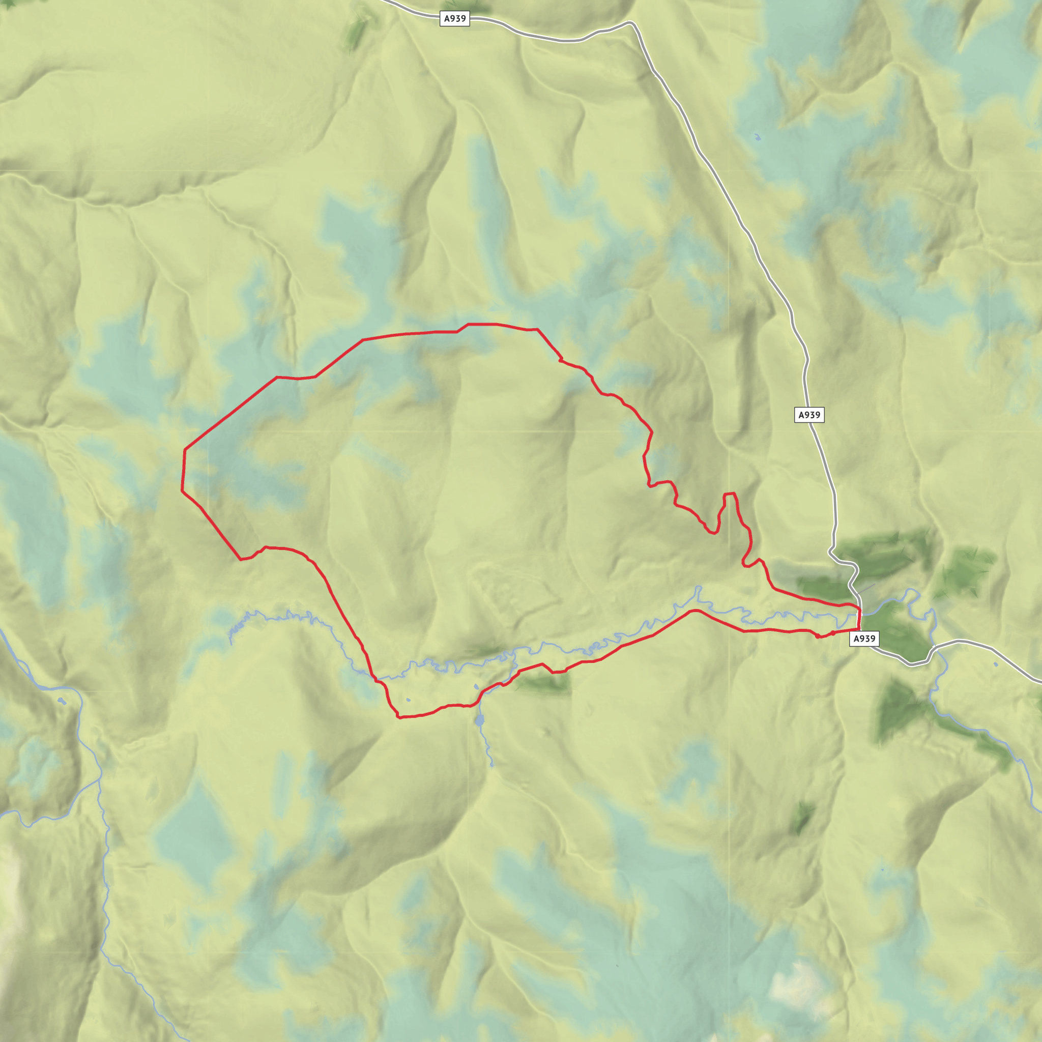
This 20 km / 12.4 mile loop is a broad, high-moor circuit in the eastern Cairngorms, linking the rounded tops of Torran Deallaig, Craig Veann, Tom Buirich and Cairn Vaich. With around 500 m / 1,640 ft of ascent, it fits a solid medium day: not especially technical in dry, clear weather, but long enough and exposed enough to demand proper planning. The terrain is mostly estate track, old hill paths, heather moor, and open upland with a few rougher, wetter sections where the line becomes less obvious. The character of the day is less about steep climbing and more about distance, wind exposure, and navigating across spacious, feature-light ground. The route sits in the high country between Strathdon and Tomintoul, close to the A939 near the former Allargue Arms and within reach of Corgarff Castle and the Lecht area. (walkhighlands.co.uk)
The nearest practical start is the track off the A939 at grid reference NJ224150, which is on the Lecht road between Corgarff and Tomintoul, near the former Allargue Arms/Allergue area. That places the hike head near Allargue, Strathdon, Aberdeenshire, on the A939, with Corgarff Castle the best-known nearby landmark. Walkhighlands identifies this same track as the start for the southern approach to Cairn Vaich and Càrn Ealasaid, and Geograph references the old Allargue Arms in the same stretch of road. (walkhighlands.co.uk)
By car, the approach is straightforward but remote. Most hikers come via the A939, either north from Braemar/Strathdon or south-west from Tomintoul. Parking is usually limited to roadside space by the track entrance, so it is best to arrive early, park tightly without blocking estate access, and be prepared for a narrow, weather-exposed road in winter or after storms. This is a high route over open country, and the Lecht road can feel very isolated even in good conditions. (geograph.org.uk)
Public transport is the weak point. For nearby hill routes on this section of the A939, Walkhighlands lists no public transport to the start, and that is the safest assumption here as well. In practice, the nearest settlements with onward travel options are likely to be Tomintoul, Strathdon, Ballater, or Aberdeen-side connections, but there is no dependable bus-to-trailhead solution for this exact start. Anyone attempting it without a car should check current services carefully in advance and expect a long road walk if a drop-off can be arranged. (walkhighlands.co.uk)
What the route feels like
The opening section is usually the easiest underfoot. Estate tracks lead out across the lower moor, giving quick progress and a gentle warm-up rather than an immediate grind uphill. Around Loinherry and the lower slopes beneath Cairn Vaich, the ground opens into classic northeast Highland moorland: heather, peat, rough grass, and long views over the upper River Don. Reports from this area describe a gradual climb on estate paths and tracks, with grouse moor infrastructure higher up and a broad, high-level feel once most of the ascent is done. (walkhighlands.co.uk)
Cairn Vaich is likely to be the most straightforward summit of the group,
Surfaces
Unknown
Asphalt
Comments and Reviews
User comments, reviews and discussions about the Torran Deallaig, Craig Veann, Tom Buirich and Cairn Vaich Loop, Scotland.
average rating out of 5
0 rating(s)

