
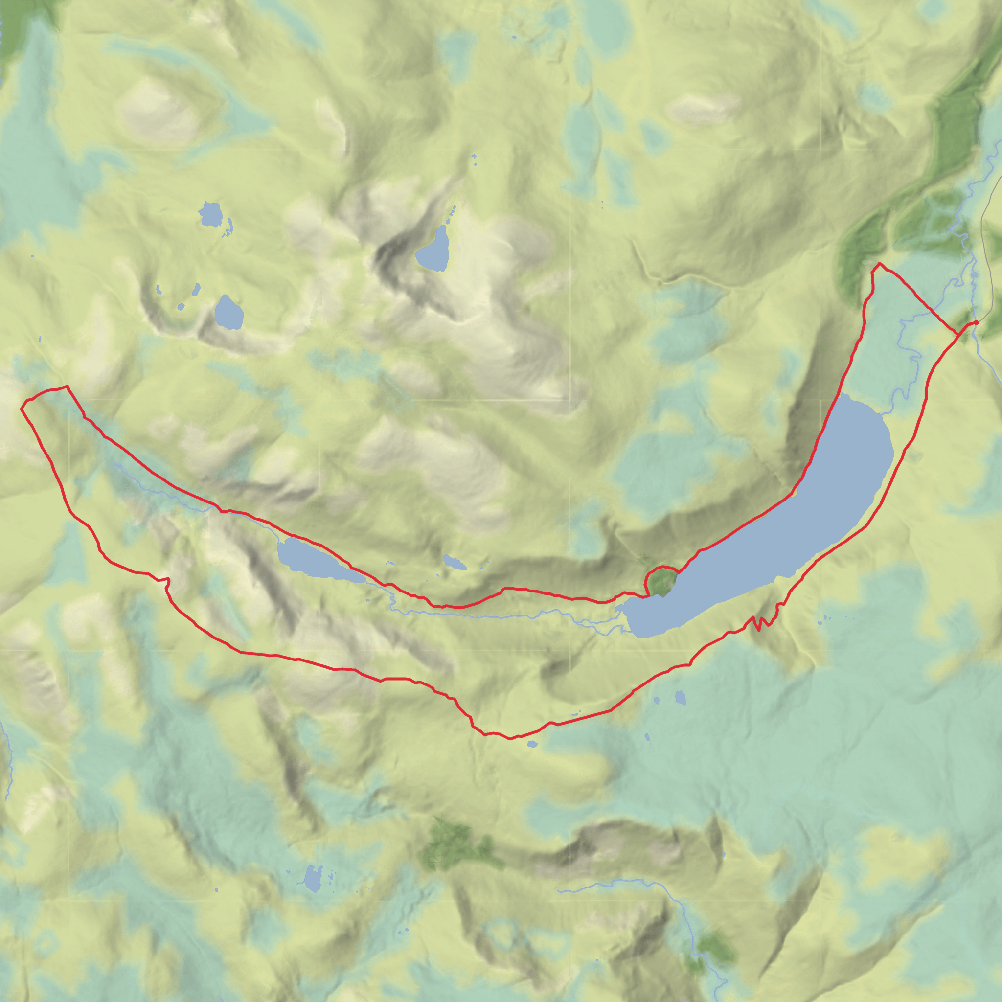
Loch Muick, Dubh Loch, Carn an t-Sagairt Mor, Cairn Bannoch, Broad Cairn and Creag Bhiorach Loop
Download
3D Flyover
Add to list
More
28.6 km
~7 hrs 6 min
829 m
Loop
“A grand, atmospheric Cairngorms circuit pairs Loch Muick’s calm with Dubh Loch drama and airy tops.”
This is a big Cairngorms circuit that links the quieter eastern side of the White Mounth with a long approach around Loch Muick, a dramatic pass by Dubh Loch, and a broad high-level traverse over Carn an t-Sagairt Mor, Cairn Bannoch, Broad Cairn and Creag Bhiorach before returning to the lochside. At roughly 29 km / 18 miles with around 800 m / 2,625 ft of ascent, it sits in that awkward category where the technical ground is often straightforward in dry, clear conditions, but the overall day is still serious because of its length, exposure, and the amount of time spent on open mountain terrain. The route starts near the Spittal of Glenmuick and the Loch Muick car parks on Balmoral Estate, south of Braemar in Aberdeenshire. Loch Muick itself lies about 8 km / 5 miles south of Braemar. (ukhillwalking.com)
For most hikers, the nearest practical start point is the Loch Muick / Spittal of Glenmuick car park, the well-known trailhead at the end of the public road up Glen Muick near Braemar. If you are driving, that is the landmark to aim for rather than a street address. There are large car parks at the road end, and parking is typically managed as a paid facility that helps support path maintenance in the area. (walkhighlands.co.uk)
Public transport is limited here. Braemar is the nearest village with regular bus access, but there is generally no direct public transport to the Loch Muick trailhead itself, so hikers relying on buses usually need a taxi from Braemar or a long road walk or cycle to the start. Some walking groups reference a bus stop at Spittal of Glenmuick for arranged outings, but for independent travel you should plan on Braemar as the last reliable public-transport hub and verify local services before setting out. (ukhillwalking.com)
The day usually begins on good estate tracks and lochside paths around Loch Muick, which can feel deceptively gentle compared with what follows. The loch is one of the classic landscapes of Royal Deeside, set within the Balmoral Estate and backed by the high granite mass of the White Mounth. Early on, the walking is relatively fast, with long views over the water and across to the surrounding hills. This lower section is where many hikers first pass Glas-allt-Shiel, the lodge built on the lochside and closely associated with Queen Victoria’s time at Balmoral. Historic Environment Scotland lists it as a significant historic building, and it remains one of the most distinctive landmarks on the route. (portal.historicenvironment.scot)
Around Loch Muick and into the Dubh Loch country
After the easier lochside miles, the character changes as the route heads toward Dubh Loch, the “dark loch,” a smaller and much more enclosed mountain lake set beneath steep crags. This is one of the most atmospheric parts of the circuit. The cliffs of Creag an Dubh Loch rise sharply above the water, and the terrain feels wilder and more alpine than the broad tracks around Loch Muick. The name is fitting: the loch is shaded by the surrounding rock walls, giving it a darker, more severe appearance than the larger loch below. (en.wikipedia.org)
This section deserves respect in poor weather. Paths can become fainter, the ground can be wet or rough, and the transition from estate path to mountain route is where navigation errors often begin. If cloud drops onto the plateau, the broad upper ground around Carn an t-Sagairt Mor and the connecting ridges can become confusing, especially where paths are intermittent. For planning and on-the-day navigation, HiiKER is the tool to rely on.
The climb away from Dubh Loch is where the day starts to feel like a mountain round rather than a scenic loch walk. Depending on the exact line taken, this ascent can be steep, sustained, and tiring late in the day if you have already covered a lot of distance. Strong pacing matters here. Even though the total ascent is around 800 m / 2,625 ft, the route’s length makes every climb feel bigger than the numbers suggest.
The high traverse: Carn an t-Sagairt Mor to Broad Cairn
Once on the tops, the route opens into a broad upland landscape of stony paths, rolling plateaux, and long connecting ridges. Carn an t-Sagairt Mor reaches 1,047 m / 3,435 ft and is one of the key high points of the circuit. One of the most notable
AI Planner
Days planned around your pace, with somewhere to stay each night.
Surfaces
Unknown
Dirt
Gravel
Wood
Comments and Reviews
User comments, reviews and discussions about the Loch Muick, Dubh Loch, Carn an t-Sagairt Mor, Cairn Bannoch, Broad Cairn and Creag Bhiorach Loop, Scotland.
average rating out of 5
0 rating(s)


