Download
3D Flyover
Add to list
More
9.7 km
~3 hrs 36 min
1007 m
Out and Back
“A wild Cairngorms epic of lonely corries, rough stone, and hard-won summits for well-prepared hikers.”
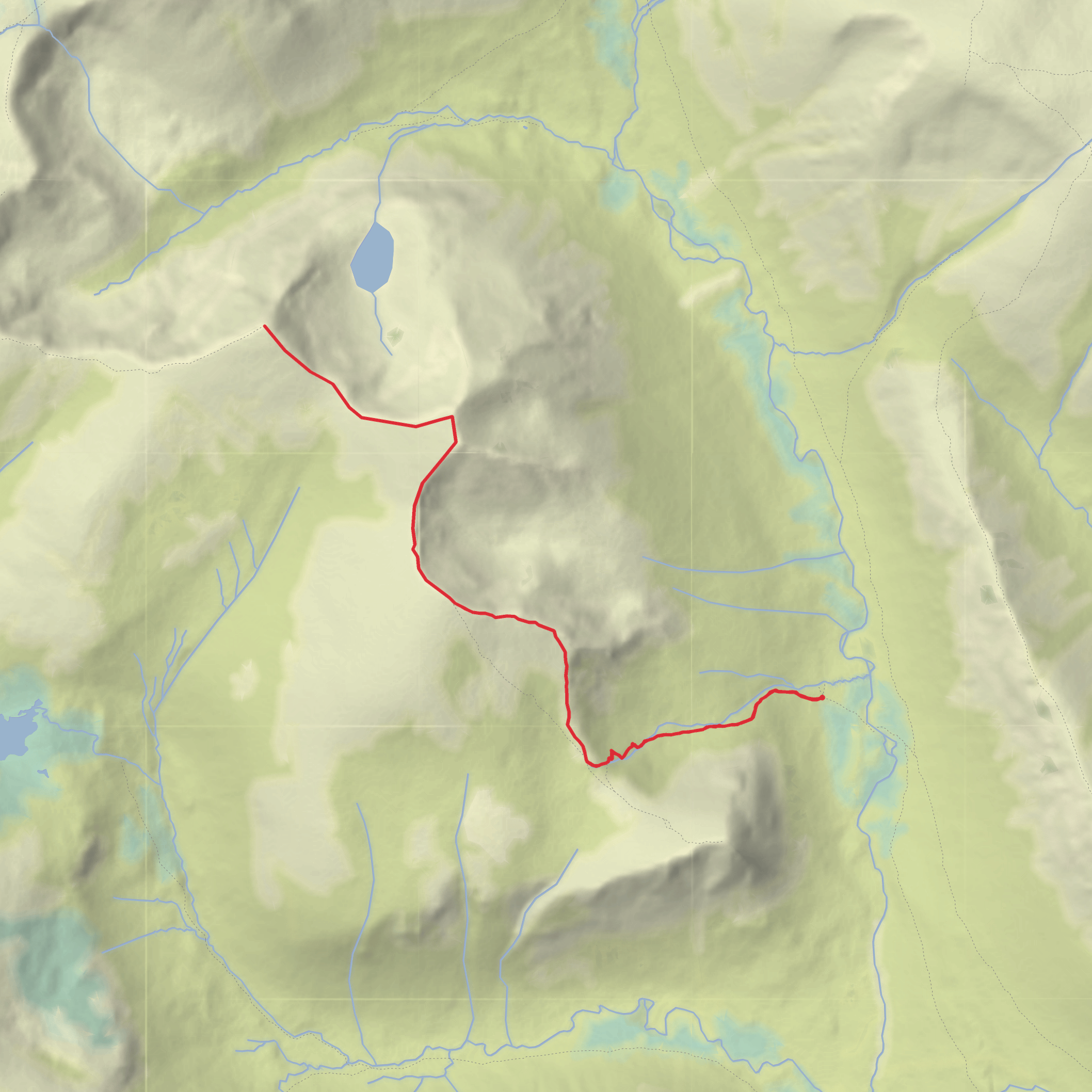
This is a serious Cairngorms mountain day rather than a casual 10 km outing. The line linking Stob Coire an t-Saighdeir, Cairn Toul, and Angel’s Peak sits deep in the central massif above the upper reaches of the River Dee, and most practical approaches make it a very long expedition with rough, committing terrain. Even though your listed figures are around 10 km and 1,000 m / 3,281 ft of ascent, hikers should plan for a much bigger mountain day if starting from the usual access point at Linn of Dee near Braemar. The standard southern approach from Linn of Dee is commonly used for these summits, but it is a remote route with long walk-in mileage, boulder fields, steep corrie rims, and serious navigation demands in poor visibility. (walkhighlands.co.uk)
The usual start is Linn of Dee car park, near Braemar, Aberdeenshire, a well-known access point on the Mar Lodge Estate about 3 miles / 5 km west of Braemar. For sat-nav and trip planning, the nearest significant landmark is Linn of Dee Car Park, Mar Lodge Estate, near Braemar AB35 5YJ; official directions describe access from the A93 via the minor road to Linn of Dee, with OS reference NO096899. The car park has seasonal toilets, and parking charges apply for non-members of the National Trust for Scotland. (visitscotland.com)
By public transport, the realistic hub is Braemar village centre. VisitScotland notes that Stagecoach Bluebird services 201, 202, and 203 serve Braemar from the Aberdeen–Deeside corridor, but there are no public transport services onward from Braemar to Mar Lodge Estate/Linn of Dee, so the final stretch usually requires a taxi, bike, or a road walk. By car, Braemar is the last straightforward place for supplies before heading west to the trailhead. (visitscotland.com)
What the route feels like
From the southern side, the day begins with a long approach through classic Deeside scenery before the route turns into a much steeper mountain ascent. Lower down, the walking is comparatively straightforward on estate tracks and paths, but once the route rises toward the high corries and plateau edge, the character changes quickly: loose rock, broken boulder fields, steep gradients, and long stretches where progress is slower than the map suggests. Reports and route descriptions consistently highlight the rough ground between Stob Coire an t-Saighdeir and Cairn Toul, and the need to keep well back from the corrie edges in mist or winter conditions. (walkhighlands.co.uk)
Stob Coire an t-Saighdeir is often treated as a stepping-stone summit on the way to Cairn Toul, but it is not just a minor bump. At about 1,213 m / 3,980 ft, it marks the start of a high, dramatic section with increasingly expansive views into the Lairig Ghru and across to Ben Macdui when the weather is clear. From there, the traverse to Cairn Toul involves more ascent over stony, often awkward ground, with the summit area perched beside the huge drop into Coire Bhrochain. Walkhighlands specifically warns that the summit area can be dangerous to navigate in poor visibility because of the proximity to major cliffs. (walkhighlands.co.uk)
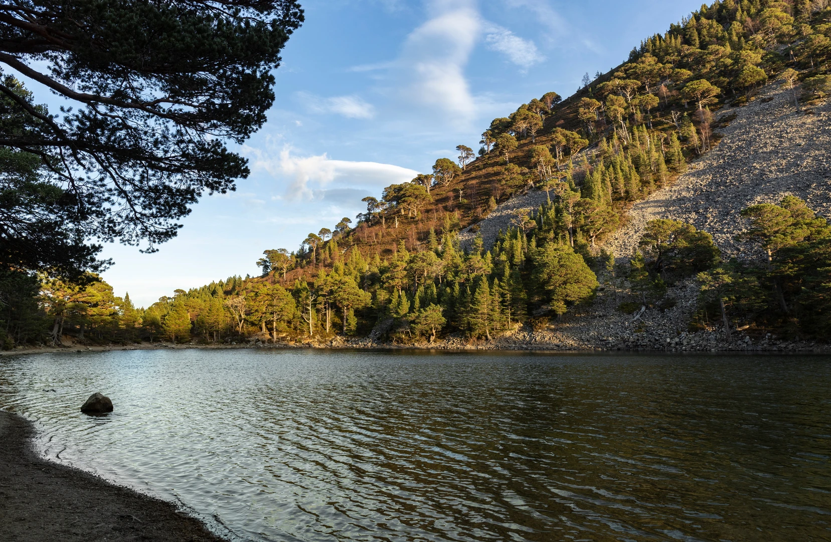
Beyond Cairn Toul, the continuation to Angel’s Peak, properly Sgòr an Lochain Uaine, is one of the visual highlights of the round. The name “Angel’s Peak” is the anglicised nickname, while the Gaelic name refers to the peak above the green lochan below. This section usually involves a descent from Cairn Toul followed by another climb to the summit of Angel’s Peak, so tired legs still have work to do late in the day
Comments and Reviews
User comments, reviews and discussions about the Angel's Peak via Stob Coire an t-Saighdeir and Cairn Toul, Scotland.
average rating out of 5
0 rating(s)
