Download
3D Flyover
Add to list
More
40.4 km
~2 days
2461 m
Multi-Day
“Embark on the Bucegi Massif trail, a breathtaking Romanian adventure steeped in natural and historical wonders.”
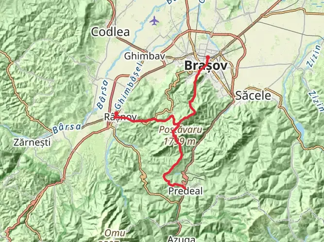
The Bucegi Massif trail, spanning approximately 40 kilometers (about 25 miles) with an elevation gain of around 2400 meters (roughly 7874 feet), is a challenging yet rewarding point-to-point hike located near Prahova, Romania. This trail is not for the faint-hearted, as it is rated difficult due to its steep ascents and technical terrain. Hikers should be well-prepared with proper gear, ample water, and food supplies.
Getting to the Trailhead
To reach the trailhead, hikers can either drive or use public transportation. If driving, the starting point is accessible from the town of Busteni, which is well-connected by road. For those opting for public transport, regular trains and buses run from Bucharest to Busteni. From Busteni, you can take a cable car to Babele, which is one of the most common starting points for hikes in the Bucegi Mountains.
Navigating the Trail
Once on the trail, hikers can use the HiiKER app to navigate the route, which is especially useful in areas where the trail may be less defined. The app provides detailed maps and waypoints to ensure you stay on the correct path.
Landmarks and Scenery
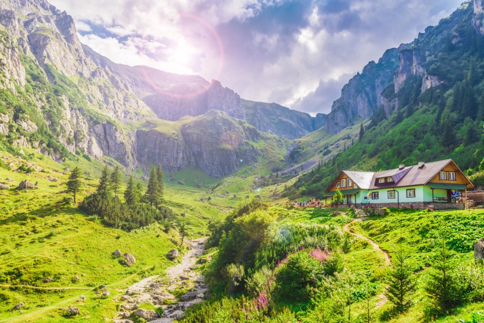
The Bucegi Massif is part of the Southern Carpathians and is known for its unique rock formations, such as the Sphinx and Babele, which are natural wonders resembling human-made structures and are located near the trailhead. The trail offers panoramic views of the surrounding mountains and valleys, with the Piatra Craiului and Leaota mountains visible on clear days.
Flora and Fauna
The region is rich in biodiversity, with dense forests of spruce and pine, interspersed with clearings and meadows that bloom with wildflowers in the spring and summer. Wildlife is abundant, and while hiking, you may encounter species such as chamois, deer, and even bears, so it is important to know how to act if you come across wildlife.
Historical Significance
The Bucegi Plateau is steeped in history and legends, with ties to ancient Dacian culture and later, Roman conquests. The area is dotted with historical monuments and hermitages, some of which date back to the Middle Ages.
Preparation and Safety
Given the trail's difficulty, hikers should be in good physical condition and have experience with mountain hiking. Weather conditions in the mountains can change rapidly, so be prepared with appropriate clothing and check the forecast before setting out. It's also advisable to inform someone of your hiking plans and expected return time.
Remember, safety is paramount, and while the Bucegi Massif offers an unforgettable hiking experience, it demands respect and preparation from all who traverse its paths.

Frequently asked questions
How hard is the Bucegi Massif hike and how much climbing does the route involve?
The Bucegi Massif route is an Extra Difficult multi-day hike. It covers 40.44 km with 2,461 m of elevation gain, so it is a serious mountain outing rather than a casual day walk. The combination of distance, sustained climbing, and high plateau terrain makes it best suited to experienced hikers with strong fitness and solid mountain judgment.
How long does the Bucegi Massif hike usually take to complete?
Bucegi Massif is a 40.44 km multi-day route, so most hikers should plan on more than one day rather than trying to rush it in a single push. With 2,461 m of ascent and difficult terrain, a two-day schedule is a realistic baseline for strong hikers, while slower parties may want extra time for weather, navigation, and breaks at high elevation.
Where do most hikers start the Bucegi Massif hike from near Bușteni?
A common access point for the Bucegi Massif hike is Bușteni, with many hikers using the Bușteni–Babele cable car to reach the high plateau. Babele Cabin sits near 2,206 m and is only a short distance from the Babele rock formations and the Sphinx, making that area one of the best-known starting zones for routes across the massif.
What landmarks can hikers see on the Bucegi Massif hike?
The best-known landmarks on the Bucegi Massif are the Babele rock formations and the Sphinx on the Bucegi Plateau. The route also gives broad views across the Southern Carpathians, with sightlines toward surrounding ranges such as Piatra Craiului and the Leaota Mountains when visibility is clear. These high, open sections are a major part of the hike’s appeal.
What is the weather like on the Bucegi Massif and when is the best time to hike it?
Weather on the Bucegi Massif changes quickly because much of the route is high and exposed, around 2,500 m on the plateau. Wind, low cloud, thunderstorms, and sudden temperature drops are all common mountain hazards, even when lower towns feel mild. The most practical hiking window is usually the snow-free season, when daylight is longer and the plateau is easier to travel safely.
Can the Bucegi Massif hike be reached by public transportation from Bucharest?
Yes. Bușteni is a practical gateway for the Bucegi Massif and is linked to Bucharest by regular rail service, which makes public transport a realistic option for reaching the trail area. From Bușteni, hikers commonly continue toward the massif by cable car to Babele or by mountain access routes starting from town, depending on conditions and route choice.
Are there caves on the Bucegi Massif hike?
The Bucegi Mountains are known for cave and karst features, but the 40.44 km Bucegi Massif hike is primarily a mountain route focused on the plateau, major climbs, and landmark formations such as Babele and the Sphinx. Hikers interested in caves should treat them as separate side attractions in the wider massif rather than assuming the main route is a cave hike.
Comments and Reviews
User comments, reviews and discussions about the Bucegi Massif, Romania.
4.6
average rating out of 5
5 rating(s)