Download
3D Flyover
Add to list
More
6.1 km
~1 hrs 16 min
31 m
Loop
“Explore the serene, flat 6 km Loop around Dyer Pond, rich in nature and history.”
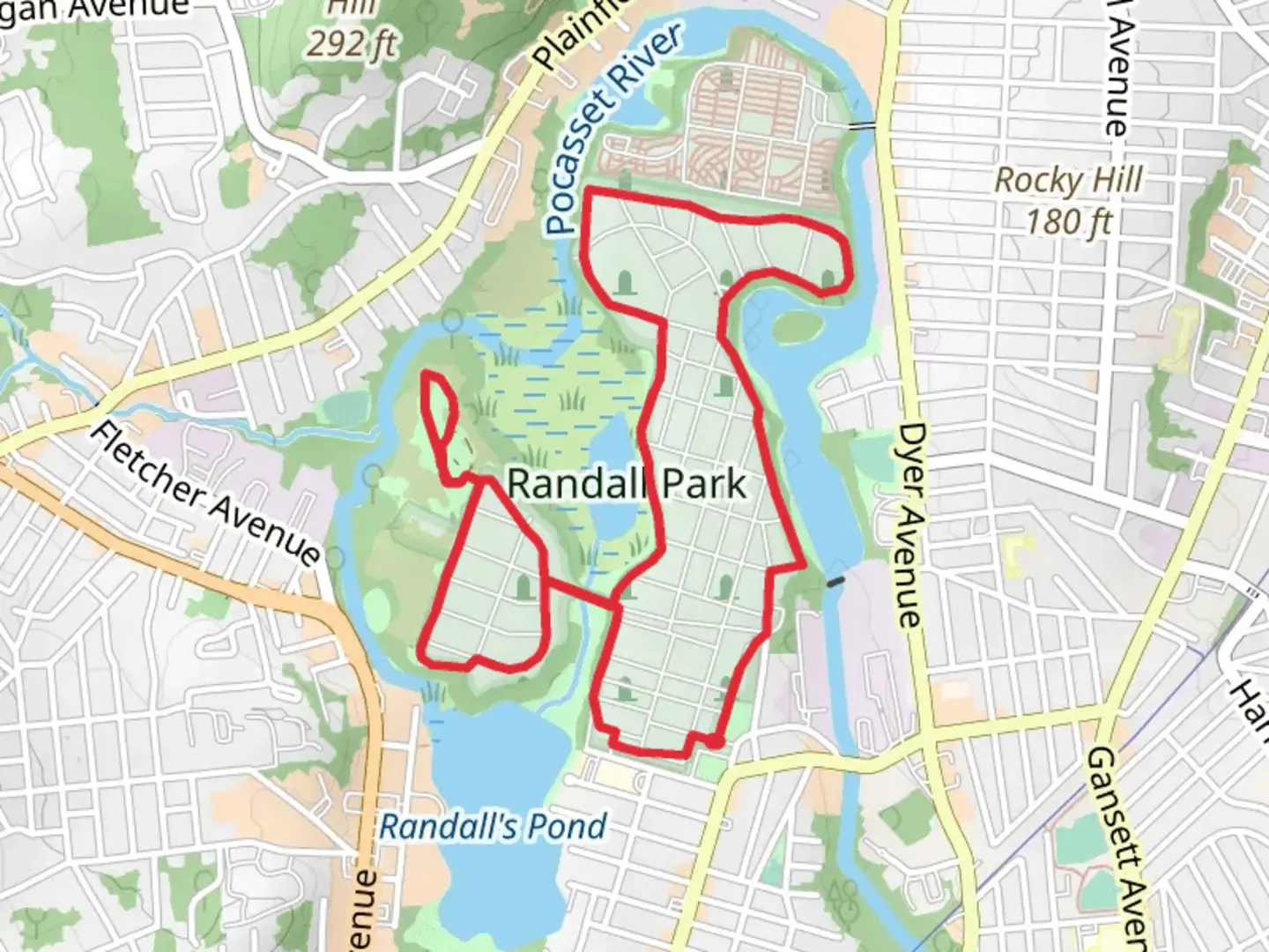
Starting your adventure near Providence County, Rhode Island, the Loop around Dyer Pond is a delightful 6 km (approximately 3.7 miles) loop trail with virtually no elevation gain, making it accessible for a wide range of hikers. The trailhead is conveniently located near the intersection of Snake Hill Road and Winsor Road, providing easy access whether you're arriving by car or public transport.
Getting There
If you're driving, you can park at the small lot near the trailhead on Snake Hill Road. For those using public transport, the nearest bus stop is at the intersection of Snake Hill Road and Winsor Road, serviced by local bus routes. From there, it's a short walk to the trailhead.
Trail Overview
The trail meanders through a serene forested area, offering a peaceful escape from the hustle and bustle of city life. As you begin your hike, you'll be greeted by a canopy of mixed hardwoods and pines, providing ample shade and a cool atmosphere even on warmer days.
Key Landmarks and Points of Interest
- Dyer Pond: About 1.5 km (0.9 miles) into the hike, you'll reach the picturesque Dyer Pond. This tranquil body of water is a great spot for a short break, where you can enjoy the reflections of the surrounding trees on the water's surface. Keep an eye out for local wildlife, including ducks, herons, and occasionally, beavers.
- Historical Significance: The area around Dyer Pond has a rich history, with remnants of old stone walls and foundations from early colonial settlements. These historical markers are scattered along the trail, offering a glimpse into the past.
- Flora and Fauna: The trail is home to a variety of plant species, including mountain laurel, ferns, and wildflowers in the spring and summer months. Birdwatchers will be delighted by the diversity of avian life, including woodpeckers, warblers, and owls.
Navigation and Safety
The trail is well-marked with blazes on trees and occasional signposts. However, it's always a good idea to have a reliable navigation tool like HiiKER to ensure you stay on track. The terrain is relatively flat, but be mindful of roots and rocks that can make the path uneven in places.
Practical Tips
- Footwear: Sturdy hiking boots or trail shoes are recommended due to the uneven terrain.
- Water and Snacks: Bring enough water and some snacks, especially if you plan to take your time exploring the area.
- Weather: Check the weather forecast before heading out, as the trail can become muddy after rain.
- Leave No Trace: As always, practice Leave No Trace principles to keep the trail clean and enjoyable for everyone.
This loop trail around Dyer Pond offers a perfect blend of natural beauty, historical intrigue, and peaceful solitude, making it a must-visit for hikers in the Providence County area.

What to expect?
Activity types
Comments and Reviews
User comments, reviews and discussions about the Loop around Dyer Pond, Rhode Island.
4.46
average rating out of 5
91 rating(s)