Download
3D Flyover
Add to list
More
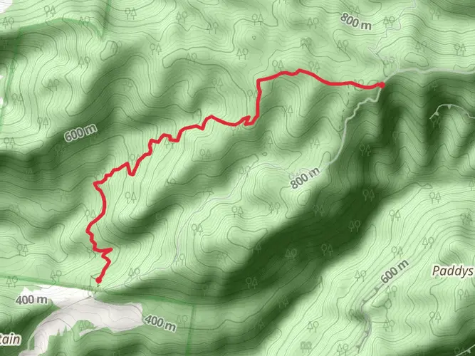
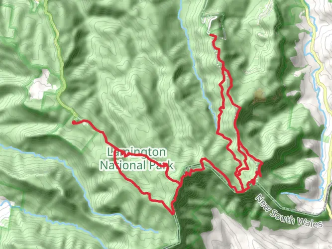
13.2 km
~4 hrs 33 min
1159 m
Multi-Day
The Mount Barney Trail is a 13.2 km trail that starts in Scenic Rim Regional, Scenic Rim Regional, Queensland. Based on our data, the hike is graded as Extra Difficult. For information on how we grade trails, please read measuring the difficulty of a hiking trail on hiiker. Also, check our latest community posts for trail updates. This hike can be completed in approx 4 hrs 34 mins. Caution is advised on trail times as this depends on multiple variables. For more info read about how we calculate hike time.

What to expect?
Activity types
Frequently asked questions
How hard is the Mount Barney Trail in Scenic Rim Regional, Queensland?
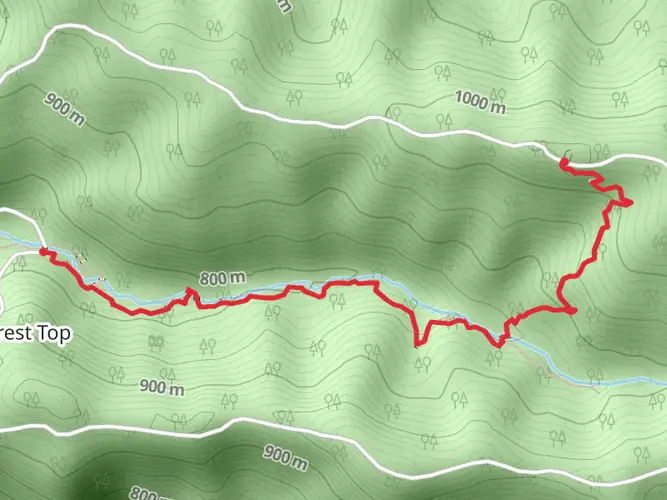
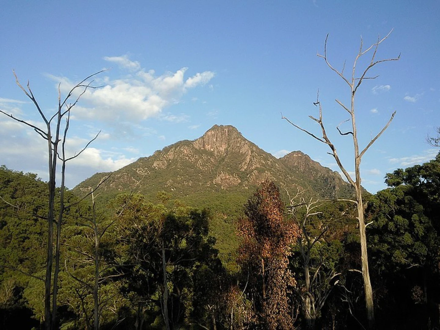
The Mount Barney Trail is rated Extra Difficult and packs 1,159 m of elevation gain into 13.17 km. On Mount Barney, summit routes are steep, unmarked, and involve rock scrambling, loose surfaces, and exposed sections, so this is a serious mountain hike rather than a casual day walk.
How long does the Mount Barney Trail take to complete?
A strong, experienced party should allow a full day, and many hikers treat the Mount Barney Trail as an overnight trip because the route is listed as multi-day. Queensland Parks and Wildlife advises 7 to 9 hours to reach East Peak and return via the South East Ridge route, or 8 to 10 hours via South Ridge, not including longer breaks or slower navigation.
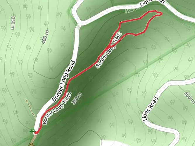
Where do you park for the Mount Barney Trail?
The usual access point for Mount Barney is the Yellow Pinch trailhead in Mount Barney National Park. Queensland Parks and Wildlife maps show Yellow Pinch trailhead and Yellow Pinch lookout as the main starting area for walks on this side of the mountain, with Lower Portals car park serving a different access point in the park.
Are dogs allowed on the Mount Barney Trail?
Dogs are not allowed on the Mount Barney Trail because it is inside Mount Barney National Park. In Queensland national parks, domestic animals are prohibited, so hikers need to leave dogs and other pets outside the park boundary.
Is the Mount Barney Trail suitable for beginners or kids?
The Mount Barney Trail is not a beginner hike. With 13.17 km of distance, 1,159 m of climbing, and extra-difficult terrain, it is better suited to experienced hikers who are comfortable with steep ascents, route-finding, and exposed mountain ground; Queensland Parks and Wildlife also states summit routes are unsuitable for inexperienced people and young children.
What is the best time of year to hike the Mount Barney Trail?
The cooler months are generally the safest and most comfortable time for the Mount Barney Trail. Queensland Parks and Wildlife specifically warns walkers to avoid the heat of the day, and Mount Barney’s steep rock, exposed ridges, and slippery slabs become much more demanding in summer heat or after rain.
What summit or viewpoint do you reach on the Mount Barney Trail?
Mount Barney’s main summit objective is East Peak, which stands at 1,354 m above sea level. The park notes that even after reaching Mount Barney saddle there is still about 267 m of climbing left to the summit, which helps explain why the route feels much harder than the raw 13.17 km distance suggests.
Comments and Reviews
User comments, reviews and discussions about the Mount Barney Trail, Queensland.
5.0
average rating out of 5
2 rating(s)