
Download
3D Flyover
Add to list
More
6.7 km
~1 hrs 29 min
81 m
Loop
“A gentle Terceira loop threads lava-carved history, mossy forest, and quiet volcanic beauty.”
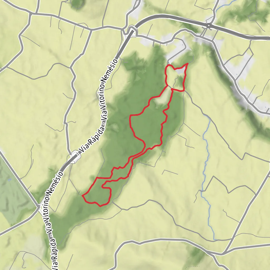
This easy loop on Terceira is a short, low-elevation walk through a protected lava-field forest landscape, with around 7 km / 4.3 miles of walking and roughly 100 m / 328 ft of ascent overall. The official PRC8 TER route is commonly listed at about 5 km / 3.1 miles, but longer loop variations that continue through Biscoito da Fontainha bring the outing closer to the distance you’ve given, so it is worth checking the exact line on HiiKER before setting out. The route begins and ends at the São Brás picnic area, near the signed Zona de Lazer de São Brás, about 17 km / 10.6 miles by road from central Angra do Heroísmo on Terceira Island, Azores. (parquesnaturais.azores.gov.pt)
The start is best understood as being near the São Brás Picnic Park / Zona de Lazer de São Brás, in the parish of São Brás, municipality of Praia da Vitória, Terceira. Official trail information directs drivers to leave the Via Vitorino Nemésio around kilometre 13 toward São Brás/Fontinhas, then follow signs for the leisure area. If arriving by car, this is the most practical access. Public transport on Terceira is more limited than in larger mainland destinations, so hikers relying on buses should expect to plan carefully around local schedules and may still need a short road walk or taxi connection from nearby settlements such as Fontinhas, São Brás, or Praia da Vitória. (parquesnaturais.azores.gov.pt)
One of the biggest appeals here is that the terrain is generally gentle. With a maximum altitude around 277 m / 909 ft and minimum around 195 m / 640 ft on the official trail, the climbing is modest, making this a good choice for families, casual walkers, or anyone wanting a quieter half-day outing rather than a strenuous mountain hike. Even so, the footing can be uneven because the route crosses old volcanic ground, forest tracks, and worn paths where roots, mud, and rock can all appear depending on recent weather. Waterproof footwear is a sensible choice. (parquesnaturais.azores.gov.pt)
What the route is like
From the picnic area, the walk quickly introduces the feature that gives the trail its name: the relheiras, old wheel ruts carved into stone by repeated passage of ox carts over many years. These grooves are among the most distinctive cultural landmarks on the route and are more than just a curiosity—they are physical evidence of how rural transport once worked on Terceira before modern roads and vehicles became dominant. Nearby, there is also a monument honoring the traditional ox cart, reinforcing the agricultural history of the area. (parquesnaturais.azores.gov.pt)
After this historical opening, the route moves into the forested zone of Biscoito das Fontinhas or Biscoito da Fontainha, a protected habitat area shaped by volcanic geology. In Azorean place names, “biscoito” often refers to rough lava terrain, and that character comes through in the landscape: irregular ground, dense vegetation, and a feeling of walking through a green volcanic mosaic rather than open farmland. Some sections feel enclosed and shaded, while others open briefly onto rural lanes and pasture edges. (parquesnaturais.azores.gov.pt)
Roughly midway, hikers may encounter views toward Serra do Cume and Pico Alto, both important geologic landmarks on Terceira. There is also mention in official and tourism material of the Pulho do Salto waterfall near the slope of Ribeira dos Pães, a seasonal point of interest that can be especially attractive after wetter periods. Because water flow can vary, it is best treated as a possible highlight rather than a guaranteed dramatic cascade year-round. (turismo.azores.gov.pt)
Nature, wildlife, and what to look for
This is one of the better short walks on Terceira for noticing the island’s smaller ecological details. The protected area is recognized for habitat management, and official information highlights the presence of endemic arthropod species as well as native and endemic Azorean flora. That means attentive hikers should spend time looking closely at the forest structure, mossy ground, ferns, heather, and native plantings rather than expecting only big panoramic viewpoints. In places near the start, there is also a forest nursery area associated with native species conservation and reforestation efforts. (parquesnaturais.azores.gov.pt)
Birdlife is often more noticeable by sound than by sight in the wooded sections, and the mix of forest edge, pasture, and watercourse habitat can make the route feel lively even on a short outing. As with many Azorean trails, conditions can shift quickly with moisture: after rain, expect
Surfaces
Unknown
Grass
Gravel
Comments and Reviews
User comments, reviews and discussions about the Relheiras de São Brás and Biscoito da Fontainha Loop, Portugal.
average rating out of 5
0 rating(s)


