
Download
3D Flyover
Add to list
More
6.3 km
~1 hrs 40 min
247 m
Loop
“A compact upland loop blending cryptomeria woods, moody plateau views, and the quiet ecological richness of Lagoa do Cerro.”
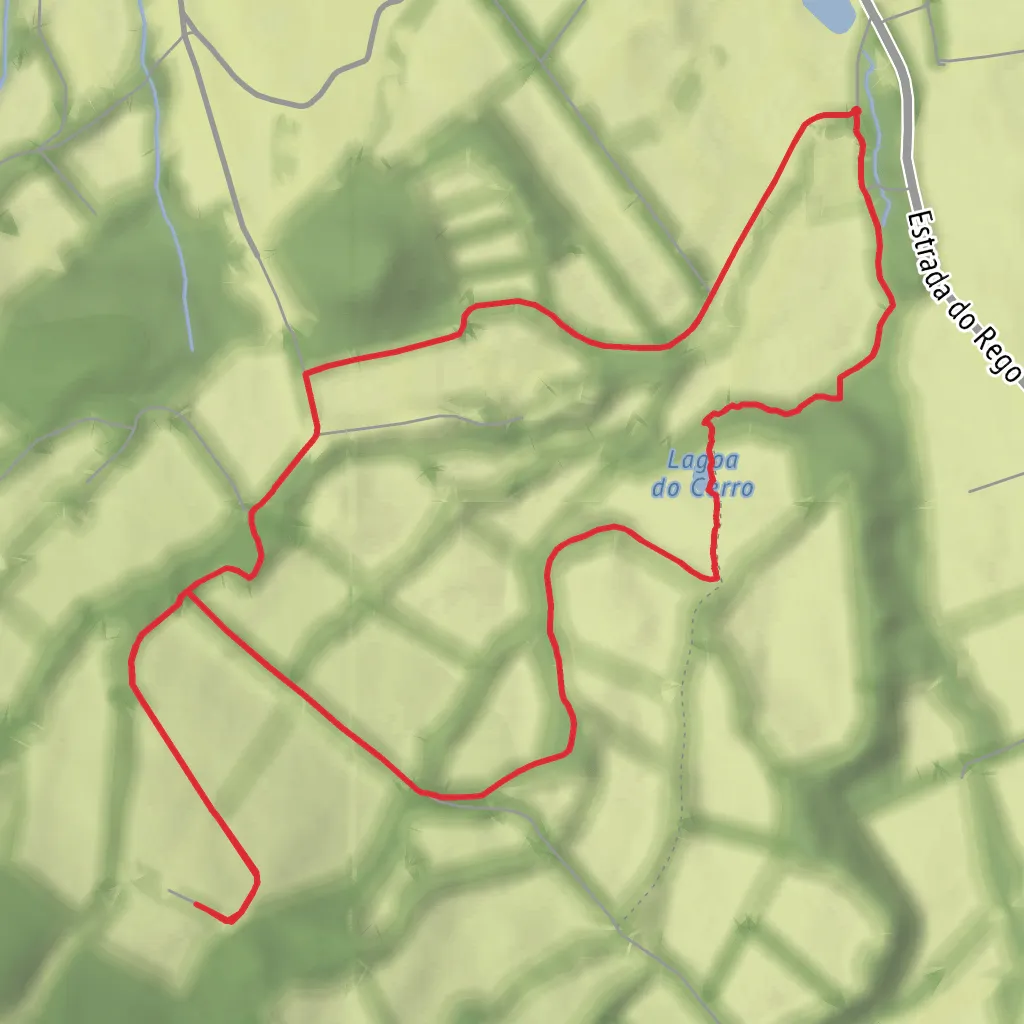
This short upland loop on Terceira Island packs a surprising amount into roughly 6.4 km / 4.0 miles, with about 200 m / 656 ft of climbing. Although often graded on official Azores material as an easier circular route, it can feel more like a solid medium outing when the plateau is wet, windy, or foggy, so it is best approached as a hike that is short in distance but more serious in mountain character than the numbers suggest. The route starts near the artificial reservoirs above Altares, at approximately 38.760806, -27.279153, which corresponds to the Altares uplands near the Lagoa do Cerro trailhead, Terceira, Azores, Portugal. Official Azores trail information places the start beside these reservoirs and describes the route as a circular walk through high ground above the parish of Altares. (turismo.azores.gov.pt)
The first part of the walk usually follows broad tracks and lanes through stands of Cryptomeria japonica before moving into more open pasture and upland terrain. Expect a steady rather than punishing climb, with the route spending much of its time above 500 m / 1,640 ft elevation and reaching a high point around 612–650 m / 2,008–2,133 ft, depending on the source and exact point measured. In clear weather, this higher section opens wide views over the north side of Terceira, including landmarks such as Picos Vermelhos and the Narião massif. (turismo.azores.gov.pt)
Terrain and what to expect
Underfoot, this is a mixed-surface hike. You can expect forestry tracks, grassy sections, damp ground near the wetland, and potentially slick patches after rain. Because the route crosses exposed upland country, conditions can change quickly: mist can flatten visibility, wind can make the open sections feel much colder than expected, and wet ground can turn an otherwise straightforward loop into a more careful walk. Official guidance for the trail specifically recommends going in good weather and good visibility, with suitable footwear for slippery surfaces. (turismo.azores.gov.pt)
A useful way to think about the route is in three parts. The opening 1.5 to 2 km / 0.9 to 1.2 miles is the approach through managed woodland and pasture. The middle section carries you across the highest ground, where the landscape feels broader and more exposed. The final portion bends toward Lagoa do Cerro, the ecological centerpiece of the loop, before returning to the reservoirs and closing the circuit. Total hiking time is commonly given as about 2 hr 30 min, which allows for a relaxed pace and time at viewpoints. (turismo.azores.gov.pt)
Lagoa do Cerro and the natural setting
Lagoa do Cerro is the feature that gives the walk its identity. Rather than a dramatic crater lake, it is a high-altitude wetland of strong biological and landscape value. Azores tourism information highlights it as an important area for birdwatching, with an observation structure that allows hikers to look over the habitat without stepping into its sensitive margins. Wetlands like this play an important role in flood control, groundwater recharge, water-cycle regulation, nutrient retention, biomass production, and climate mitigation. (turismo.azores.gov.pt)
The trail also passes through protected land within the Terceira Natural Park, specifically areas tied to the Central Plateau and Northwest Coast habitat management zone and the Serra de Santa Bárbara and Mistérios Negros Natural Reserve. That protected status is a clue to what makes this walk special: it is not just a scenic loop, but a route through one of Terceira’s most ecologically valuable upland landscapes. (turismo.azores.gov.pt)
Plant life here includes a mix of production forest and native Azorean vegetation. Official descriptions note species such as cedro-do-mato (Juniperus brevifolia), urze (Erica azorica), ginjeira-brava (Prunus azorica), azevinho (Ilex azorica), silva-mansa (Rubus hochstetterorum), Sphagnum mosses, and the rare aquatic fern Isoetes azorica. For hikers, that means the route is especially rewarding for anyone interested in island botany, peatland habitats, and the contrast between native vegetation and planted cryptomeria forest.
Surfaces
Unknown
Gravel
Comments and Reviews
User comments, reviews and discussions about the Ponte Velha and Lagoa do Cerro Loop, Portugal.
average rating out of 5
0 rating(s)

