
Download
3D Flyover
Add to list
More
5.1 km
~1 hrs 17 min
155 m
Loop
“A compact volcanic loop of shadowy lava, misty ponds, and ever-changing island moods.”
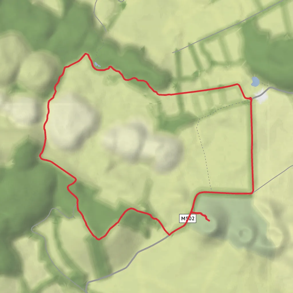
This compact loop on Terceira packs a surprising amount into roughly 5.2 km / 3.2 miles, with about 200 m / 656 ft of cumulative ascent, even though the official trail’s minimum and maximum elevations sit around 545 m and 641 m. The walking is varied rather than relentlessly steep, so the “medium” feel usually comes from muddy ground, exposed volcanic terrain, short ups and downs, and the need to stay attentive on narrow sections rather than from any single hard climb. Officially, the Mistérios Negros PRC1TER is classified as a circular route, and the standard route begins and ends beside Lagoa do Negro and the Gruta do Natal support house, near the forest road known as Caminho Florestal 24. (parquesnaturais.azores.gov.pt)
For the nearest clear trailhead landmark, plan for the start at Lagoa do Negro / Gruta do Natal, Terceira Island, Azores, which is the best-known access point and the most practical location to enter into navigation. The trail lies inland, about 12 km / 7.5 miles by road from the center of Angra do Heroísmo, reached via Regional Road ER3-1 and then the junction with Caminho Florestal 24. (parquesnaturais.azores.gov.pt)
Reaching the start is easiest by car. From Angra do Heroísmo, allow roughly 20–30 minutes depending on conditions, following the inland road network toward Lagoa do Negro and Gruta do Natal. Parking is typically associated with the trailhead area near the cave support building and lagoon. Public transport on this interior part of Terceira is limited and generally not the most reliable option for hikers trying to match trail timing, so most walkers either drive, use a taxi, or arrange a transfer from Angra do Heroísmo or Praia da Vitória. Because schedules can change seasonally, it is wise to confirm local bus availability in advance if you are not driving. The most useful way to preview the route layout and junctions is with HiiKER. (parquesnaturais.azores.gov.pt)
The route begins gently enough on a dirt track near introduced cryptomeria, then quickly shifts character as it crosses pasture and moves into denser native vegetation. Early on, the walking can feel deceptively easy, but this is where hikers should settle into a steady pace and pay attention to footing. Wet grass, slick soil, and shallow ruts are common in this high, humid part of the island. Waterproof footwear is a smart choice here, and gaiters can be useful after rain. The Azores Natural Parks page specifically recommends suitable hiking footwear, water, sun protection, and weather-ready clothing, which is sensible because conditions can change quickly even on a short outing. (parquesnaturais.azores.gov.pt)
What you’ll see along the loop
One of the most memorable sections is the passage by the Lagoinhas do Vale Fundo, three small ponds set into this volcanic landscape. Only one typically holds water year-round, and these pools are noted as an important stop for some migratory birds. In winter and spring, this area is often at its most atmospheric, with wetter ground, greener vegetation, and more standing water around the ponds. (parquesnaturais.azores.gov.pt)
Beyond the ponds, the trail moves into the terrain that gives Mistérios Negros its name: dark trachytic lava domes and stark volcanic ground with sparse vegetation. This is one of the most geologically distinctive walks on Terceira, and it offers a strong sense of how recent volcanic activity shaped the island. The official trail information links the route to the Caldeira de Santa Bárbara and Mistérios Negros geosite within the Azores UNESCO Global Geopark, and notes that the black lava accumulations here are associated with the 1761 eruption. (parquesnaturais.azores.gov.pt)
At the higher parts of the loop, expect broader views across the central massif of Terceira, with nearby volcanic forms such as Pico Gordo and Pico Gaspar becoming more prominent. The route then descends through alternating stands of cryptomeria and pasture edges before passing the geodetic marker at Pico da Cancela and reaching the road section. This road stretch is not the most dramatic part of the hike, but it provides a breather before the final return. (parquesnaturais.azores.gov.pt)
Optional detour to Pico Gaspar
A marked side trail leads to Pico Gaspar, and if included, this is one of the best short additions on the route. The official description highlights it as an area especially rich in endemic vegetation. This detour is where the hike can feel a little more demanding than the raw
Surfaces
Gravel
Asphalt
Dirt
Comments and Reviews
User comments, reviews and discussions about the Mistérios Negros, Lagoinha de Vale Fundo and Pico Gasper Loop, Portugal.
average rating out of 5
0 rating(s)

