
Download
3D Flyover
Add to list
More
14.3 km
~3 hrs 14 min
223 m
Point to Point
“A vivid descent from airy highlands through lava-sculpted vineyards to Biscoitos’ shimmering Atlantic edge.”
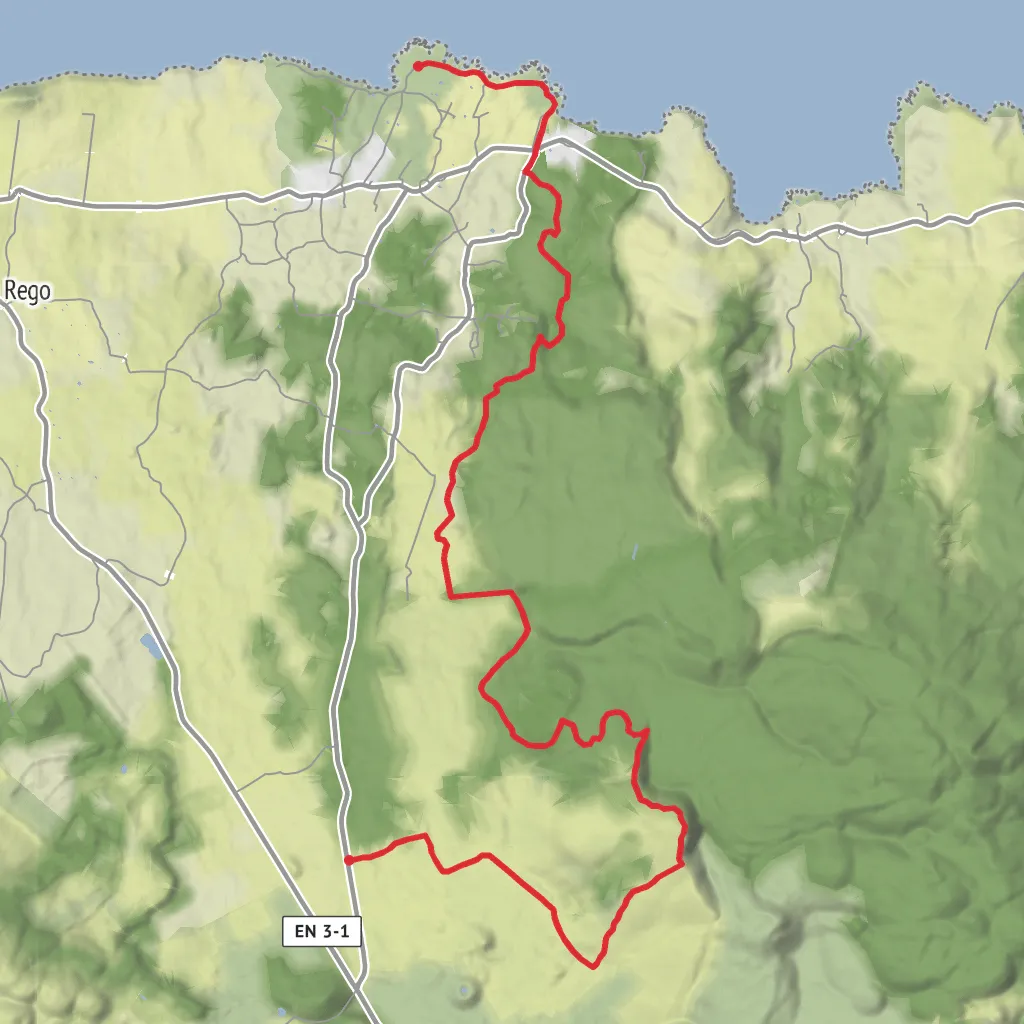
This roughly 14 km / 8.7 mile point-to-point walk on Terceira links the upland area of Malha Grande with the north-coast village and bathing area of Biscoitos, combining easy-to-moderate walking with a gentle overall descent and only about 200 m / 656 ft of climbing if you follow it in the downhill direction. The official Azores trail listing gives the route as 14.2 km / 8.8 miles and describes it as a linear trail averaging about 3 hours 30 minutes. (trails.visitazores.com)
The trailhead is in the Malha Grande area, near the junction with Regional Road ER3-1 on Terceira Island, while the finish is by the natural swimming pools and seafront at Biscoitos. If you are converting the start location into a practical landmark for planning, the nearest significant reference is the Malha Grande trail access off ER3-1, above Biscoitos and close to the Rocha do Chambre trail network; the finish is at the Biscoitos natural pools and Avenida do Mar. (exploreterceiraisland.com)
Expect a route with a strong sense of progression. It begins in the island’s interior on dirt track and pastoral lanes, rises briefly toward the high ground near Rocha do Chambre, then trends down through volcanic terrain, woodland, old orchard country, and finally the coastal wine landscape of Biscoitos. The official route notes endemic heather, pasture edges, forest paths, lapilli tracks, rocky lava outcrops, a small bay at Baía das Pombas, World War II military trenches, and the basalt-built vineyard landscape before ending at the sea. (trails.visitazores.com)
What the walk feels like
The opening section is the most rural and open, with farm tracks and grazing land broken by low native vegetation. Early on, the path passes through stands of Erica azorica, the Azorean tree heather, before climbing toward the Rocha do Chambre viewpoint. This is where the route feels broadest and most exposed, with long views over the interior and toward the caldera of the Pico Alto volcano. The highest point marked on the official trail information is about 704 m / 2,310 ft. (trails.visitazores.com)
From there, the character changes. The trail drops toward Vale do Azinhal and skirts the area of Gruta dos Balcões, a lava tube associated with Terceira’s last terrestrial eruption in 1761. As you descend, the ground becomes more obviously volcanic, with rocky outcrops and darker, rougher textures underfoot and around the pasture margins. This middle stretch is often the most interesting for hikers who enjoy geology, because the route moves through a landscape shaped by relatively recent lava flows and volcanic cones linked to Pico Vermelho, Pico do Fogo, and Pico das Caldeirinhas. (trails.visitazores.com)
Lower down, the trail alternates between woodland, lapilli road, and older cultivated areas before reaching Rua Longa and the coast. Once you arrive near Baía das Pombas and Avenida do Mar, the walk becomes much more cultural in feel: sea views open up, the terrain flattens, and the route passes into the protected vineyard landscape for which Biscoitos is well known. The basalt patchwork here is not decorative; it is part of a traditional wine-growing system built around volcanic stone walls and plots that shelter vines from wind and salt. (trails.visitazores.com)
Landmarks, history, and what to look out for
One of the most distinctive historical features on this walk is the military trenches near Biscoitos. These trenches form part of Terceira’s coastal defensive system from the Second World War. Local heritage information identifies them at Outeiro dos Lagadouros and explains that they worked in coordination with nearby defensive positions including Forte de São Pedro and the Forte da Rua Longa. (freguesiabiscoitos.com)
The route also carries geological significance well beyond a normal coastal walk. The interior section passes through terrain tied to the 1761 eruption and the Malha Grande–Balcões cave system, while the coast at Biscoitos is built from older basaltic lava flows that helped create the island’s characteristic rocky shoreline. The Az
Surfaces
Unknown
Dirt
Asphalt
Unpaved
Comments and Reviews
User comments, reviews and discussions about the Malha Grande and Trincheriras Militares, Portugal.
average rating out of 5
0 rating(s)

