
Download
3D Flyover
Add to list
More
5.7 km
~1 hrs 38 min
299 m
Point to Point
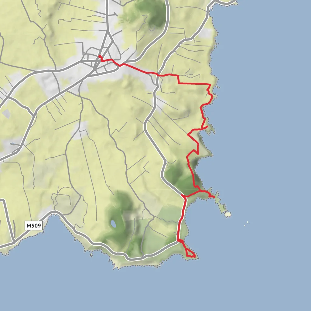
This coastal route on Terceira links a string of old defensive sites with open sea views, low cliffs, pasture, and a historic village finish. At around 6 km / 3.7 miles with roughly 300 m / 985 ft of ascent, it is a solid medium walk: not especially long, but it includes repeated ups and downs, exposed coastal sections, uneven ground, and a few places where the route leaves the road for pasture tracks and cliffside paths. The usual start is near Ponta das Contendas Lighthouse, on the regional road by Baía das Mós, about 400 m east of the lighthouse, where the official trail information panel is located. The walk ends in the centre of Vila de São Sebastião, beside the parish church. (visitazores.com)
If you are driving, the simplest approach is to head for Farol da Ponta das Contendas, São Sebastião, Terceira, then park carefully near the trail information area by Baía das Mós / Ponta das Contendas where permitted. By road, the trailhead is about 15 km / 9.3 miles from central Angra do Heroísmo, and São Sebastião itself lies roughly 13 km / 8 miles from Angra and about 8 km / 5 miles from Praia da Vitória, which helps when planning a car shuttle or taxi between start and finish. Public transport on Terceira is more limited than in larger destinations, so the practical option is usually to take a bus or taxi toward São Sebastião and then arrange the short transfer to Ponta das Contendas; check current local timetables before setting out. For navigation on the ground, use HiiKER and do not rely on waymarking alone in poor visibility. (parquesnaturais.azores.gov.pt)
The opening section heads south toward Ponta das Contendas, also known as Ponta de Santa Catarina, where the lighthouse and broad views over the south coast immediately set the tone. This is one of the best places on the route to look out over the ocean toward the Ilhéus das Cabras, the largest islets in the Azores, and to get a sense of how exposed this coastline is to wind and swell. The terrain here can feel more committing than the distance suggests, especially in wet weather, because grassy and earthen sections may become slick and the cliff edge is never far away. (angrosfera.cmah.pt)
Along the forts and bays
From the headland, the trail drops toward the remains of Forte da Greta, the first major landmark on the walk. This fort occupied a commanding position above the coast and was built in the late 16th century as part of the island’s defensive network during the succession crisis and the period of attacks by pirates and corsairs. Even where only fragments survive, the placement tells the story: these were not ornamental ruins, but practical artillery positions chosen to control vulnerable landing points. (angrosfera.cmah.pt)
Nearby lay Forte de Santa Catarina das Mós, another coastal defense work from the same era, now largely lost to the sea. This stretch around Baía da Mina is one of the most historically significant parts of the route. Sources note that on 26–27 July 1583, Castilian forces managed to land here, helping bring Terceira’s resistance to Philip II of Spain to an end. Walking this section, hikers are moving through one of the island’s key invasion corridors, where geography and military history are tightly linked. (angrosfera.cmah.pt)
After returning briefly to the road for about 550 m / 0.34 miles, the route passes greenhouse cultivation and skirts Baía da Mina before leaving the tarmac again near Pico da Maria Vieira. This middle part mixes agricultural landscape with increasingly wild coastal scenery. Expect gates, pasture margins, and rougher footpaths rather than a continuous built trail. Good footwear matters here, especially if the ground is muddy or livestock has churned up the track. (angrosfera.cmah.pt)
A worthwhile spur leads down to the ruins
Surfaces
Grass
Unknown
Asphalt
Dirt
Ground
Comments and Reviews
User comments, reviews and discussions about the Fortes de São Sebastião via Forte da Greta and Garajau, Portugal.
average rating out of 5
0 rating(s)


