
Download
3D Flyover
Add to list
More
4.0 km
~1 hrs 5 min
180 m
Loop
“A compact volcanic adventure with misty rims, emerald hollows, and sweeping Atlantic drama.”
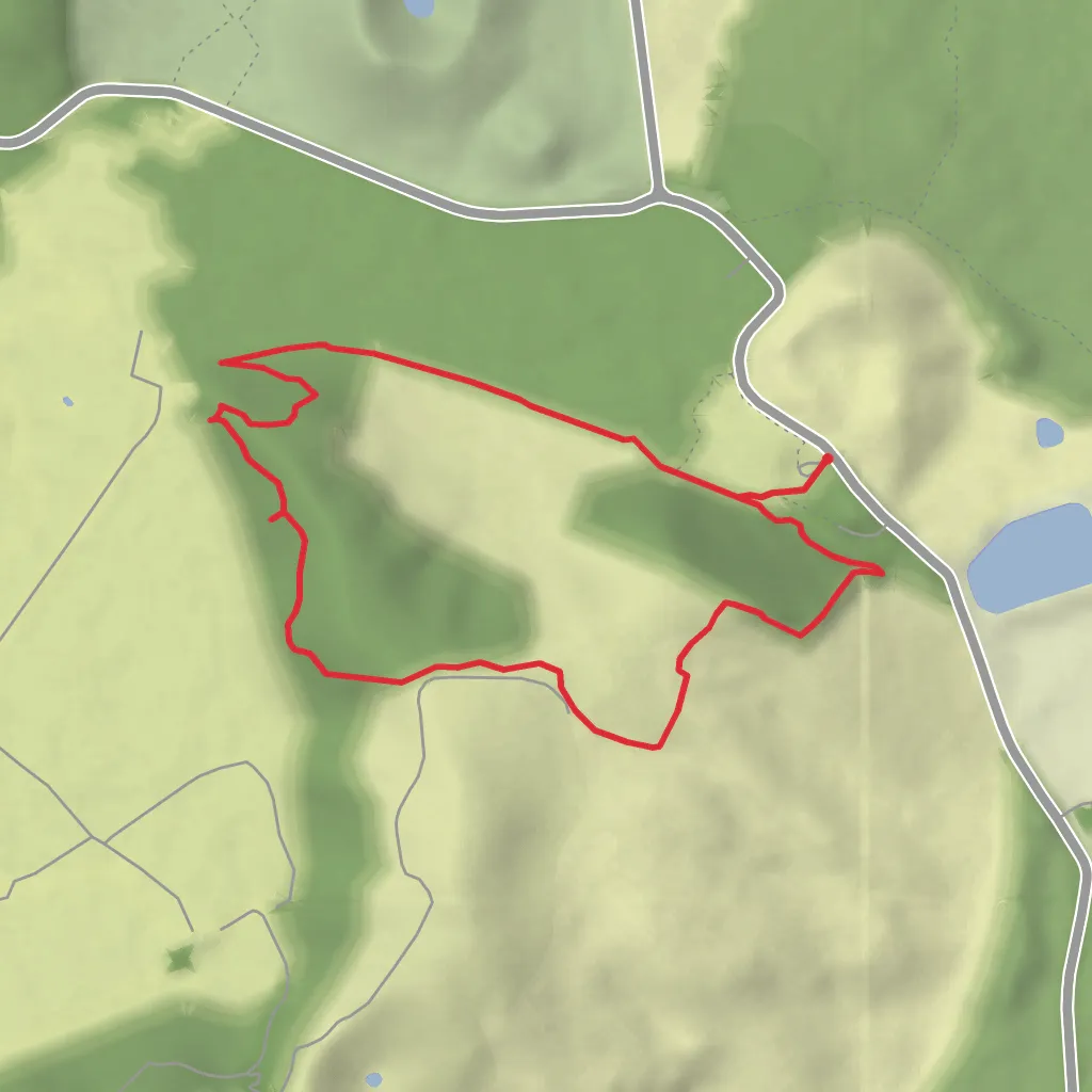
This is a short but surprisingly varied volcanic walk that links several of Faial’s most dramatic upland features: the rim viewpoints of the Cinco Picos area, the escarpment known as Fajã da Redonda, and the broad volcanic depression of Caldeira from the Passagem das Bestas area. Over roughly 4 km / 2.5 miles with about 200 m / 656 ft of ascent, it packs in crater scenery, open highland pasture, native vegetation pockets, and sweeping Atlantic views. Although the distance is modest, the terrain and exposure make it feel more serious than a simple stroll, so it suits hikers who are comfortable with uneven ground, changing weather, and occasional steep or rough sections.
The route begins near Passagem das Bestas, a highland access point in the central part of Faial Island in the Azores, best understood as being near the road network that serves the Caldeira Natural Reserve and the upland interior between Horta and the island’s volcanic center. If you are planning logistics, the nearest major reference point is Horta, the island’s main town and transport hub. From Horta, the trailhead is typically reached by car via the mountain roads leading toward Caldeira and the central plateau. Parking is usually informal roadside parking near the access point, so arrive early in better weather if you want the easiest space and the clearest views.
Public transport on Faial is limited compared with larger destinations, and service to the island’s upland interior is not always convenient for hikers aiming for a precise start time. Most walkers either drive, arrange a taxi from Horta, or combine a drop-off with a pre-booked pickup. If relying on navigation, use HiiKER to confirm the exact start location and current route line before setting out, especially because upland junctions and agricultural tracks can look similar in mist.
What the route feels like
From the start, expect a high, open landscape shaped by volcanism and weather. The walking is generally on a mix of dirt track, grassy ground, and rougher footpath, with some sections that may be muddy after rain. Because the hike is only around 4 km / 2.5 miles, many people underestimate it, but the 200 m / 656 ft of climbing can feel concentrated if the route rises in short bursts. The “medium” difficulty rating is appropriate: it is not especially long, but footing, exposure, and visibility can all affect the day.
The first part usually feels like an approach through open upland terrain, where the landforms begin to reveal themselves gradually rather than all at once. As you gain height, the route starts to deliver broader views across the volcanic interior. On a clear day, the contrast between green pasture, dark lava-derived soils, and the blue Atlantic is one of the defining features of the walk. In cloud, the same landscape becomes atmospheric and disorienting, with crater rims and hollows appearing suddenly out of the mist.
The Cinco Picos area is one of the key landscape features. The name refers to a volcanic complex whose topography is broken into ridges, cones, and crater-like forms. Rather than a single dramatic summit, this is a more intricate volcanic landscape, and the route gives a sense of how the island was built by repeated eruptions and collapse events over long periods. Expect viewpoints where the ground falls away sharply enough to make careful foot placement important, especially if grass is wet.
Landmarks and volcanic scenery
Fajã da Redonda is one of the most distinctive features on this outing. In Azorean geography, a fajã often refers to a flatter area associated with collapse or lava accumulation near the coast, but here the name is tied into the island’s rugged volcanic morphology and escarpment scenery. The route’s relationship with this feature gives the walk a dramatic edge, with terrain that feels sculpted rather than simply eroded. Depending on the exact line taken, you may encounter stretches where the path skirts slopes or rims with wide views over lower ground and out toward the sea.
Caldeira is the other major landmark and one of Faial’s defining natural monuments. This vast volcanic crater dominates the island’s center and is one of the most important geological features in the Azores. Even on a short route, any approach to the Caldeira area adds a sense of scale that far exceeds the mileage. The crater’s broad, enclosed form contrasts with the sharper ridges and smaller volcanic structures nearby. If visibility is good, this is where the walk feels biggest, with the landscape opening into a huge natural basin lined by steep green walls.
Because the route is in the uplands, weather can transform these landmarks quickly. A sunny start can turn into dense fog within minutes, and wind can be much stronger here than in Horta or at sea level. That means the same viewpoints that are the highlight of the hike can also become the places where extra caution is needed.
Nature and wildlife
Faial’s central highlands support a mix of pastureland, heath-like vegetation, and remnants or restorations of native Azorean flora. You may see species such as heather, juniper, and other moisture-loving plants adapted to the island’s cool, cloud-influenced uplands, alongside introduced grasses and hydrangeas in some areas. Mosses, lichens, and ferns often thrive where humidity stays high, especially around sheltered hollows and crater edges.
Birdlife is often one of the more noticeable wildlife elements on this walk. Expect common small birds in open country and around scrub, and keep an eye out overhead for seabirds or raptors depending on season and conditions. The Azores are also known for their importance in Atlantic migration, so birders may find the uplands rewarding during passage periods. Livestock may be present in adjacent grazing areas, so leave gates as you
Surfaces
Dirt
Unpaved
Comments and Reviews
User comments, reviews and discussions about the Dos 5 Picos, da Faja de Redonda and da Caldeira from Passagem das Bestas, Portugal.
average rating out of 5
0 rating(s)

