
Download
3D Flyover
Add to list
More
3.8 km
~1 hrs 2 min
168 m
Point to Point
“A rolling cliffside ramble revealing basalt wonders, hidden bays, and wild Azorean birdlife.”
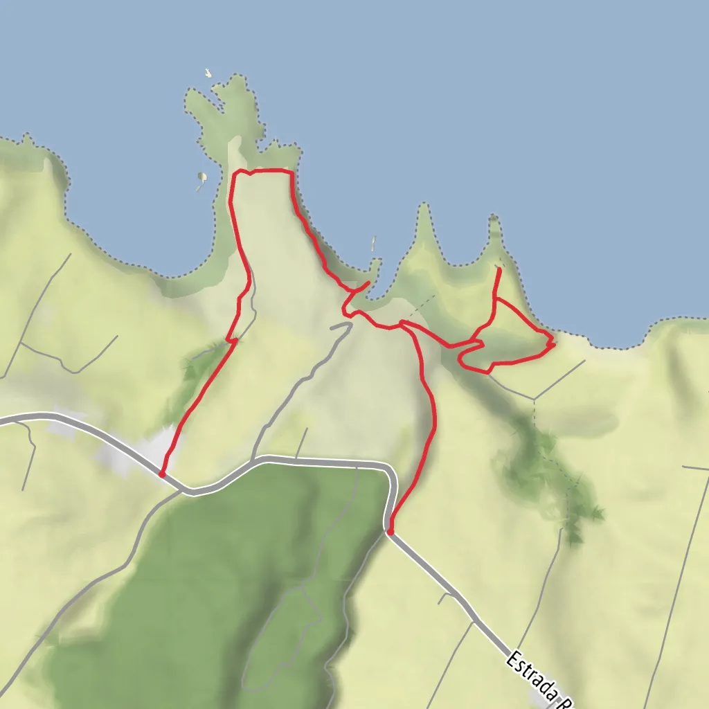
This short coastal walk on Terceira’s north shore packs a surprising amount into roughly 4 km / 2.5 miles, with about 200 m / 656 ft of cumulative ascent and descent on an undulating line between Agualva and Quatro Ribeiras. The official trail information places the route at about 3.8 km / 2.4 miles with an average walking time of around 2 hours, and it begins at the parking area on Canada da Alagoa, Agualva, Praia da Vitória, Terceira, beside the regional road and above the Miradouro da Lagoa da Fajãzinha. (trails.visitazores.com)
The route descends first toward Alagoa da Fajãzinha, a notable geosite also called Fajã da Alagoa. This is an old bay gradually filled by sediments carried down by the Grota da Alagoa, now edged by a rounded-stone beach. That opening section gives a good sense of the terrain for the rest of the hike: short, sharp changes in gradient rather than one long climb, with grassy and earthen footpaths, exposed coastal edges, and sections where the sea and wind can make conditions feel more serious than the distance suggests. Although often listed as easy in official material, a medium effort estimate is reasonable for hikers who are cautious on uneven ground or uncomfortable near cliffs. (trails.visitazores.com)
What the route is like
From the start, the trail drops from the roadside toward the coast, then threads westward along a deeply indented shoreline. Expect a sequence of small bays, cliff-top stretches, and short rises that repeatedly open and close the view. The highest coastal bluffs along this section reach about 70 m / 230 ft, and the path’s rolling profile is what creates most of the day’s effort rather than any single sustained ascent. (trails.visitazores.com)
One of the most distinctive landmarks is the prismatic basalt in the cliffs, where cooling lava formed striking column-like patterns. The trail also passes trachytic fossil cliffs, tied to eruptive phases on Terceira within roughly the last 23,000 years, making this a particularly rewarding walk for anyone interested in volcanic landscapes. These rock formations are among the strongest visual features of the route, especially where the coast has been cut into steep walls above the Atlantic. (trails.visitazores.com)
Farther along, the route reaches Baía das Pombas and the cave known as Furna das Pombas, a sea-eroded cavity associated with this bay. Near the end, older trail descriptions note a hazardous fishermen’s path continuing closer to the ocean beyond the main route; that spur is not part of the marked walk and should be avoided, especially in wet or windy weather. (visitazores.com)
Landmarks, nature, and wildlife
This trail lies largely within a protected area of the Terceira Natural Park, specifically a habitat/species management zone along the Costa das Quatro Ribeiras, so the scenery is not just dramatic but ecologically important. The cliff vegetation includes several Azorean endemic plants, notably Azorina vidalii (vidália), Erica azorica (Azorean heather), Rumex azoricus, and Spergularia azorica. In places, the coastal flora softens the dark volcanic rock and gives the route a distinctly Macaronesian character. (trails.visitazores.com)
Birdlife is another highlight. Official trail information notes the possibility of seeing Cory’s shearwaters, common terns, and occasionally grey herons, sanderlings, and Kentish plovers. Other regional material for this trail also mentions rock doves and the Azorean wood pigeon. Early morning or late afternoon tends to be best for scanning the bays and cliff ledges, and calm seas make it easier to pick out movement offshore. (trails.visitazores.com)
Historical significance of the area
The walk is primarily known for geology and coastal habitat
Surfaces
Asphalt
Dirt
Unknown
Cobblestone
Grass
Comments and Reviews
User comments, reviews and discussions about the Baías da Agualva and Furnas das Pombas, Portugal.
average rating out of 5
0 rating(s)


