
Download
3D Flyover
Add to list
More
5.3 km
~1 hrs 14 min
110 m
Point to Point
“A misty plunge from wind-brushed highlands to coffee-growing coastal calm, rich in contrast and character.”
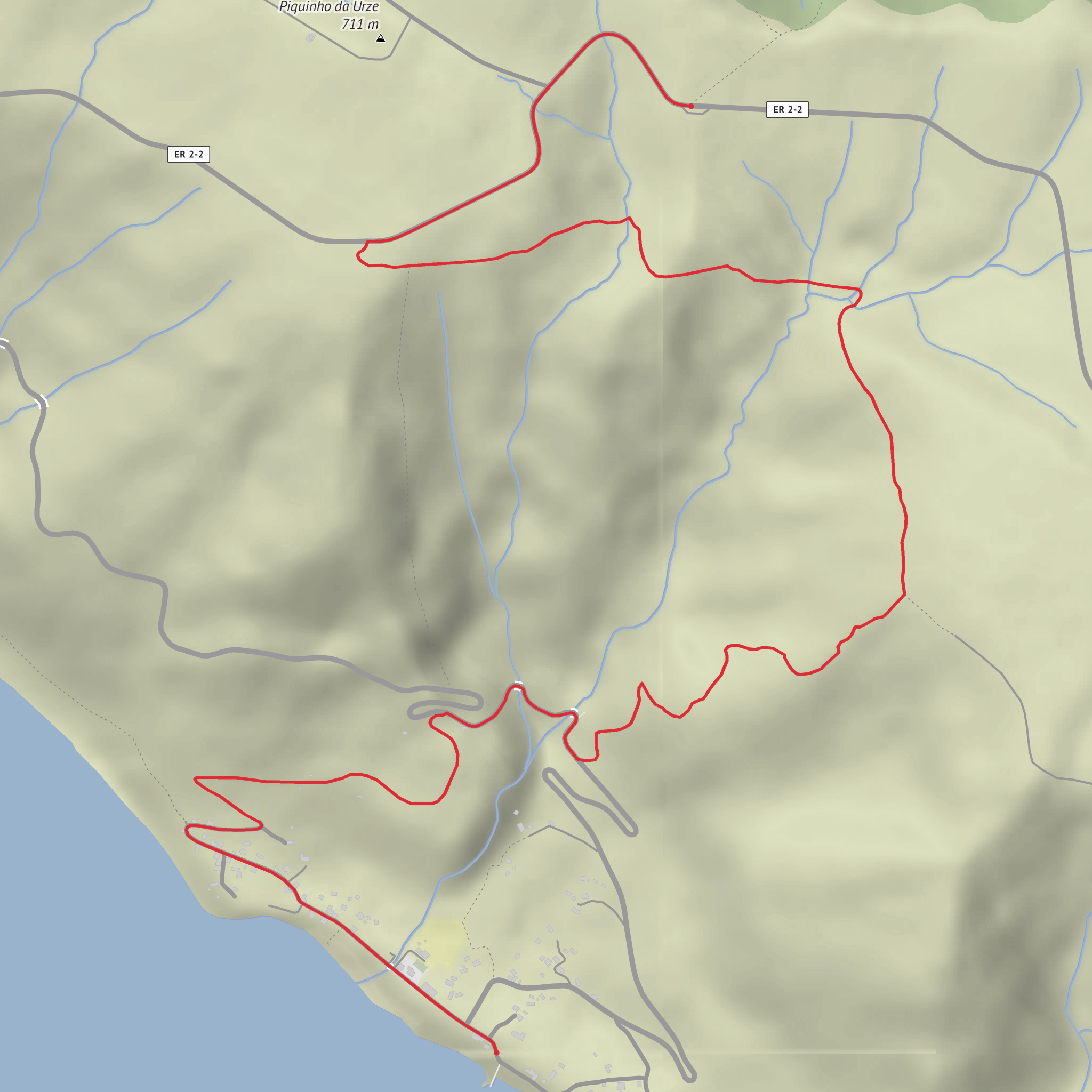
This is a short but memorable descent on São Jorge’s south side, dropping from the high pastureland of Serra do Topo to the coastal plain of Fajã dos Vimes. Although the route is only about 5 km / 3.1 miles with roughly 100 m / 330 ft of climbing overall, it feels more substantial than the numbers suggest because most of the outing is defined by a steep downhill line, changing weather, and a dramatic shift from open uplands to a sheltered fajã at sea level. The official trail begins near the Serra do Topo Wind Farm on the regional road, which is the clearest landmark for the trailhead. (trilhos.visitazores.com)
The walk starts in a cool, exposed upland environment where cloud, mist, and wind can move in quickly. Early on, the route follows a dirt track and then begins its descent through vegetation typical of São Jorge’s higher slopes. Expect a strong sense of transition as the island’s volcanic structure becomes obvious: broad interior high ground above, then very steep escarpments falling toward one of the island’s characteristic fajãs, the flat coastal platforms created by landslides and cliff collapse. São Jorge is especially known for these fajãs, which are among the island’s defining geological and cultural landscapes. (trilhos.visitazores.com)
What the route feels like
For the first section, the trail moves away from the road near the wind farm and heads into open countryside. The footing is usually straightforward at the top, but once the descent begins, hikers should expect steeper grades and potentially slick ground if it has rained recently. On São Jorge, wet grass, mud, and loose stone can make even a medium-rated trail feel more demanding, especially on the downhill. Trekking poles can help with balance, and checking the route in HiiKER before setting out is worthwhile because the trail links with other signed routes in the area. (trilhos.visitazores.com)
As the path drops, the scenery becomes more enclosed and greener. The official trail notes endemic Azorean flora along this section, including Azorean heather and Azores juniper, with other native species present in the surrounding vegetation. Hydrangeas are also common on São Jorge’s trails and roadsides, especially near settled areas and junctions, adding color in season. Birdlife is usually more noticeable than large wildlife here; hikers may hear or spot common island birds moving between hedges, pasture edges, and wooded patches. (trilhos.visitazores.com)
The final approach reaches the paved road on the fajã and leads into a much warmer, more sheltered setting than the one at the top. That contrast is one of the best parts of the hike: within a relatively short distance, the route moves from breezy uplands to a cultivated coastal plain with houses, gardens, and small agricultural plots. (trilhos.visitazores.com)
Landmarks, culture, and historical context
Fajã dos Vimes is one of the most culturally distinctive fajãs on São Jorge. Its microclimate has allowed the cultivation of coffee, something notably rare in Europe, and the area is also known for traditional hand weaving on wooden looms. That gives the end of the hike more than just scenic value; it is also one of the island’s best places to see how geography shaped local livelihoods. The warm, fertile conditions of the fajã supported crops and settlement patterns very different from those on the exposed plateau above. (visitazores.com)
Historically, the fajãs of São Jorge were places of both opportunity and isolation. Their fertile soils supported small-scale agriculture, while their position beneath towering cliffs made access difficult and sometimes hazardous. In Fajã dos Vimes, historic watermills were once supported by local watercourses, reflecting the importance of agriculture and water management in the area. The wider island is also deeply shaped by volcanic geology and cliff collapse, which created these low coastal shelves in the first place. (en.wikipedia.org)
If time allows after the hike, the village area is worth lingering in. The local church area and the lanes through the fajã help show the traditional settlement pattern, and this is also where other walking connections continue onward, including the route toward Lourais and Fajã de São João. (visitazores.com
Surfaces
Unknown
Asphalt
Gravel
Paved
Concrete
Comments and Reviews
User comments, reviews and discussions about the Serra do Topo to Fajã dos Vimes, Portugal.
average rating out of 5
0 rating(s)
