
Serra do Topo to Fajã dos Cubres via Caldeira de Santo Cristo
Download
3D Flyover
Add to list
More
9.0 km
~2 hrs 6 min
183 m
Point to Point
“A dramatic descent through windswept uplands, hidden sanctuaries, and rare lagoons to São Jorge’s wild coast.”
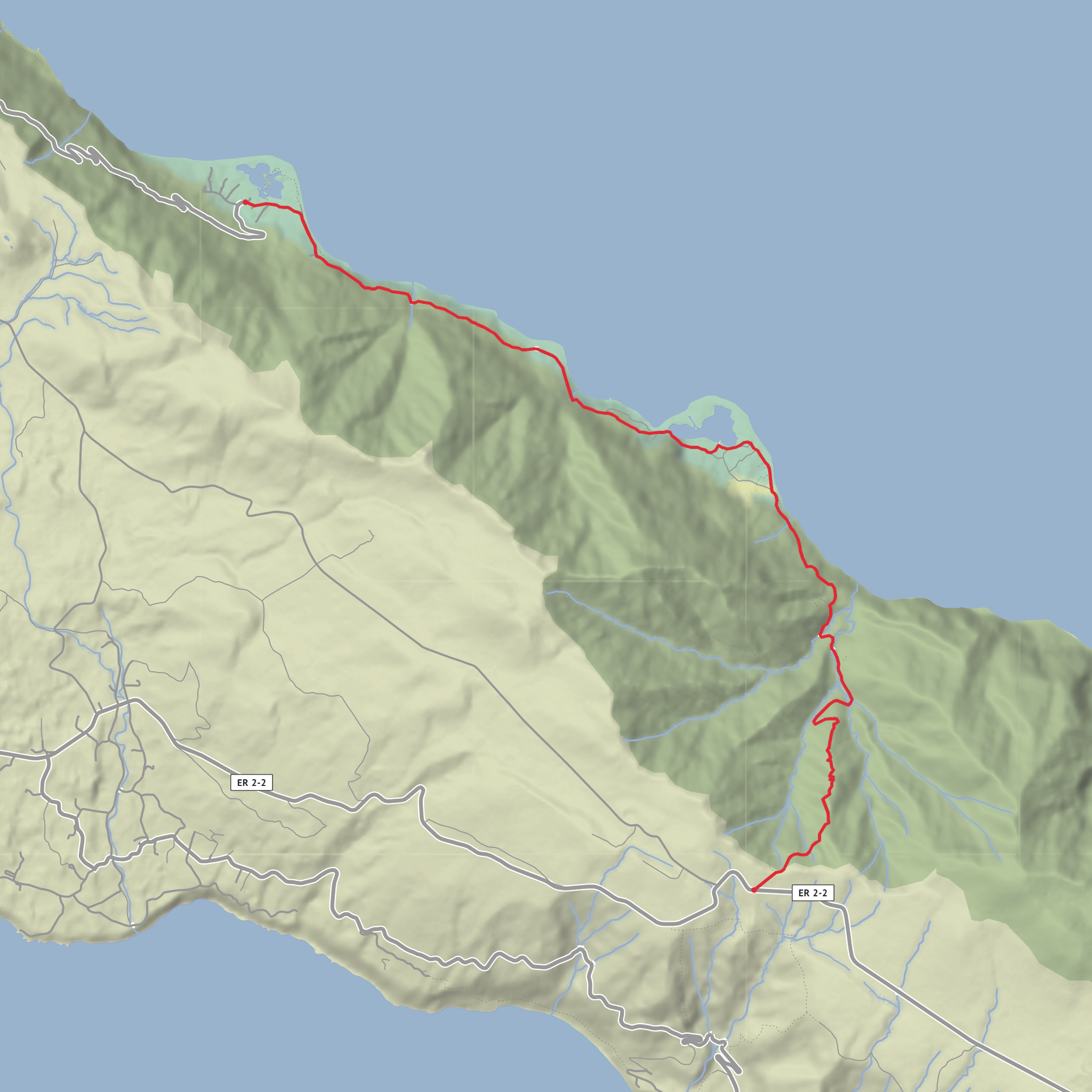
This is one of São Jorge’s classic descents: a point-to-point coastal hike that starts on the high pasturelands near the Serra do Topo Wind Farm and drops to the north coast through Caldeira de Cima, Fajã da Caldeira de Santo Cristo, and finally Fajã dos Cubres. The official trail is listed at about 9.3 km / 5.8 miles, with a typical walking time of around 2 hours 30 minutes, and it is generally rated medium because the route is not especially long but includes a sustained descent, uneven ground, and sections that can be slippery. (trails.visitazores.com)
The start is best described as by the Serra do Topo Wind Farm on the regional road in the Serra do Topo uplands, São Jorge, Azores, rather than a street address. The route begins beside the road and heads onto a dirt track through open highland terrain before committing to the long downhill toward the fajãs below. (trails.visitazores.com)
Expect the walk to feel much more like a descent through changing ecological zones than a simple coast path. The upper section is open, breezy, and exposed, with broad views over São Jorge’s dramatic escarpments. As you lose height, the trail narrows and becomes more enclosed, moving through vegetation and old access paths that historically linked the island’s plateau with the isolated settlements on the coast. (trails.visitazores.com)
Terrain and what the walk feels like
From the wind farm, the trail crosses upland ground with endemic Azorean vegetation before reaching the descending section toward Caldeira de Cima. The footing changes as you go: dirt track at first, then steeper traditional trail, stonework, and damp sections where water runoff can make the surface slick. The official trail notes a shelter on the way down, then a crossing at Ponte da Tia Júlia, followed by a right-hand spur to Cascata Pequena. There are also fountains or water points along the descent and a viewpoint where the first full look into Caldeira de Santo Cristo opens up. (trails.visitazores.com)
Although the total elevation gain is modest at roughly 200 m / 656 ft, the more important number for planning is the descent from the high interior to sea level. Knees and ankles tend to do more work here than lungs, especially in wet weather. Trekking poles can be useful, and footwear with reliable grip matters more than speed. If cloud sits low on the plateau, visibility at the top can be limited even when the coast is clearer below.
Landmarks along the route
A major highlight is Fajã da Caldeira de Santo Cristo, one of São Jorge’s most distinctive coastal flats. The trail passes the Sanctuary of Senhor Santo Cristo and the Fajã da Caldeira de Santo Cristo Interpretation Centre, which was created to explain the geological, biological, and human history of these fajãs. The building itself is a reconstruction of an older dwelling, preserving a traditional façade. (trails.visitazores.com)
The lagoon at Caldeira de Santo Cristo is especially significant. Together with Fajã dos Cubres, it forms the only coastal lagoon system in the Azores, and this habitat is protected and treated as a priority conservation area. These fajãs are detrital platforms formed by material that fell from the steep cliffs above, creating the rare flat coastal landscapes that make São Jorge so distinctive. (parquesnaturais.azores.gov.pt)
After leaving Caldeira de Santo Cristo, the trail continues northwest along the coast toward Fajã do Belo and then on to Fajã dos Cubres. The official route notes that Fajã do Belo remained inhabited until the 1980 earthquake, which gives this section a strong sense of how fragile and isolated life on the fajãs could be. You may also notice old steel cables along the route, once used to transport firewood to populated areas—small but vivid reminders of the practical ingenuity needed in this landscape. (trails.visitazores.com)
The hike ends near the Church of Nossa Senhora de Lourdes in Fajã dos Cubres, which is the clearest landmark for pickup or onward travel. (trails.visitazores.com)
Nature and wildlife
The upper trail passes through native flora that can include Azorean heather (Erica azorica), Juniperus brevifolia, and Azorean holly (Ilex azorica). Birdlife is one
Surfaces
Dirt
Cobblestone
Asphalt
Unknown
Grass
Comments and Reviews
User comments, reviews and discussions about the Serra do Topo to Fajã dos Cubres via Caldeira de Santo Cristo, Portugal.
average rating out of 5
0 rating(s)
