
Download
3D Flyover
Add to list
More
52.5 km
3 days
1753 m
Multi Day
“A windswept journey from haunted cliffs to tranquil fajãs, revealing São Jorge’s wild volcanic soul.”
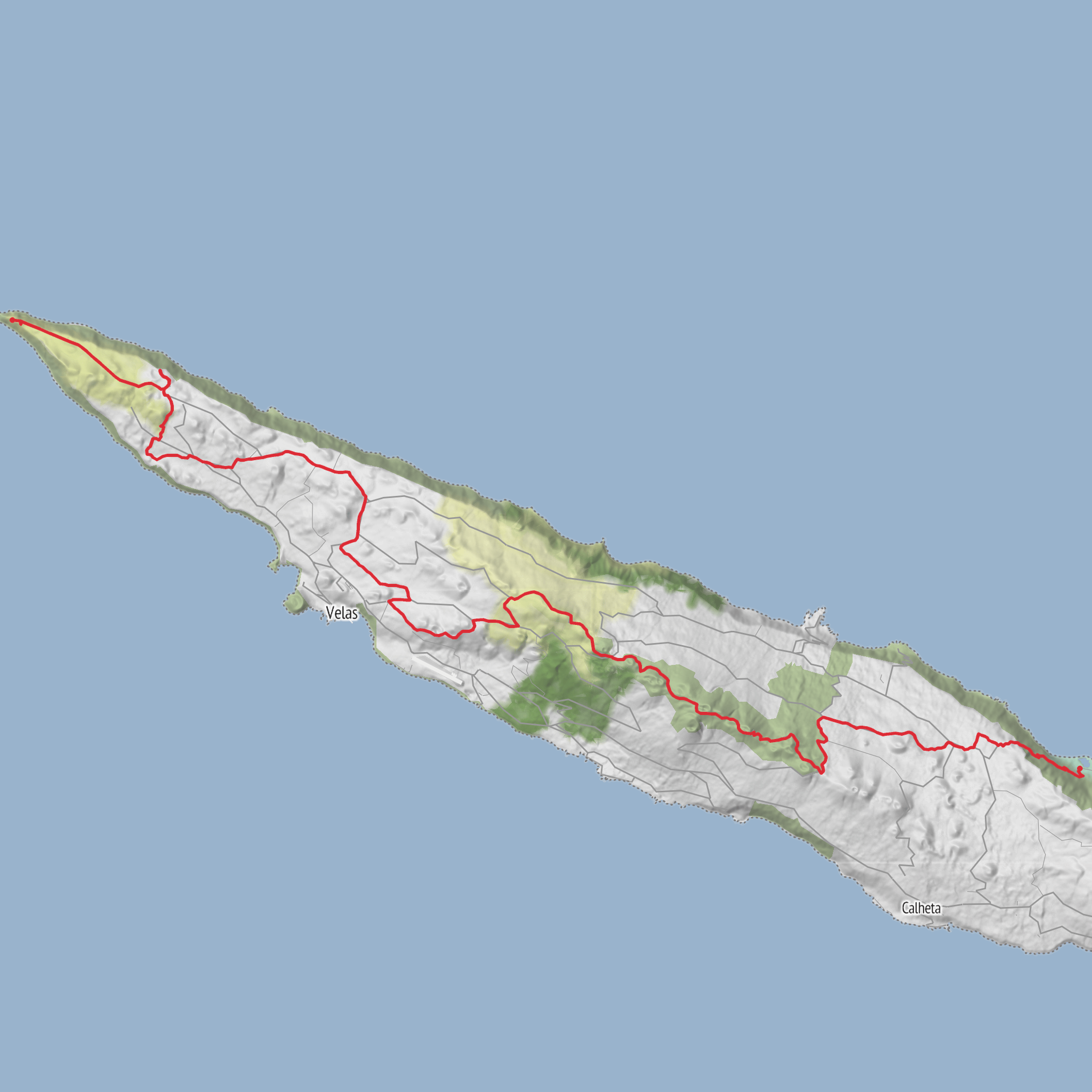
This long west-to-north crossing of São Jorge runs about 52.9 km/32.9 miles from Farol dos Rosais, Ponta dos Rosais, 9800-206 Rosais, Velas to Fajã dos Cubres, linking the island’s far western headland with one of its best-known north-coast fajãs. Official trail information classifies it as a linear, hard route with an average time of about 15 hours, split into two logical stages of roughly 21.8 km/13.5 miles and 30.2 km/18.8 miles. Even if your own estimate puts it closer to medium, it is best planned as a demanding outing because of its length, exposure, and the amount of time spent on high ground. (trails.visitazores.com)
The route begins beside the ruins of the Rosais Lighthouse at Ponta dos Rosais, a dramatic volcanic headland with sea cliffs around 200 m/656 ft high. This opening section is immediately memorable: open Atlantic views, sheer cliff scenery, and a strong sense of isolation at the island’s edge. The lighthouse itself carries some of the area’s modern history, having opened in 1958, then been affected by the 1964 Rosais seismic crisis and nearby submarine eruption, and later abandoned after cliff collapses associated with the January 1, 1980 earthquake. That history is part of what gives the western tip of São Jorge its stark, unsettled character. (trails.visitazores.com)
From there, the trail alternates between the island’s interior plateau and the escarpments that plunge toward the sea, showing off the landform São Jorge is famous for: the fajãs, flat coastal shelves created by lava flows, landslides, or both. The island itself is defined by a long central volcanic ridge with hundreds of cones, and this route is one of the best ways to understand that geography on foot. (trails.visitazores.com)
What the route feels like
The first stage heads from Ponta dos Rosais toward Santo Amaro, passing a detour to a restored whale lookout and then the Sete Fontes Forest Park. The whale lookout reflects São Jorge’s whaling past, when coastal vigias scanned the sea and signaled crews below; the Rosais lookout was built around 1957/1958 and remained in use into the 1980s. Sete Fontes adds a softer contrast to the exposed coast, with ponds, picnic areas, and plant nurseries. After that, the route drops carefully toward Rosais, where slippery ground is specifically noted, then continues inland toward Beira, an important stop because it is associated with the production of São Jorge cheese, one of the island’s best-known cultural products. (trails.visitazores.com)
The second stage is the bigger undertaking. From Santo Amaro, the trail climbs into the central volcanic cordillera, spending long stretches between about 800 and 1,000 m / 2,625 and 3,281 ft. This is the section where weather matters most. In clear conditions, the high ground can be spectacular, with repeated views toward Pico and Faial, especially from the Miradouro do Canal near the Macelas Forest Reserve. In poor visibility, the same terrain can feel committing and much more serious, so this is not the day to gamble on fog, wind, or heavy rain. (trails.visitazores.com)
As the route turns north, it passes through habitat areas with endemic Azorean vegetation, including Azorean heather, Azorean holly, and Azores juniper. The descent toward the north side brings a different mood from the open ridge: more woodland, more shelter, and then a return to settled landscapes near Norte Pequeno before the final approach to Fajã dos Cubres. (turismo.azores.gov.pt)
Landmarks, nature, and wildlife
The standout landmark at the start is the Rosais Lighthouse complex, but
AI Planner
Days planned around your pace, with somewhere to stay each night.
Surfaces
Asphalt
Gravel
Unknown
Dirt
Ground
Unpaved
Comments and Reviews
User comments, reviews and discussions about the Grande Rota de São Jorge (Oeste) - São Jorge, Portugal.
average rating out of 5
0 rating(s)



