
Download
3D Flyover
Add to list
More
8.1 km
~2 hrs 13 min
363 m
Loop
“A lush coastal loop above Fajã Grande weaves cliffs, waterfalls, hydrangeas, and Atlantic drama.”
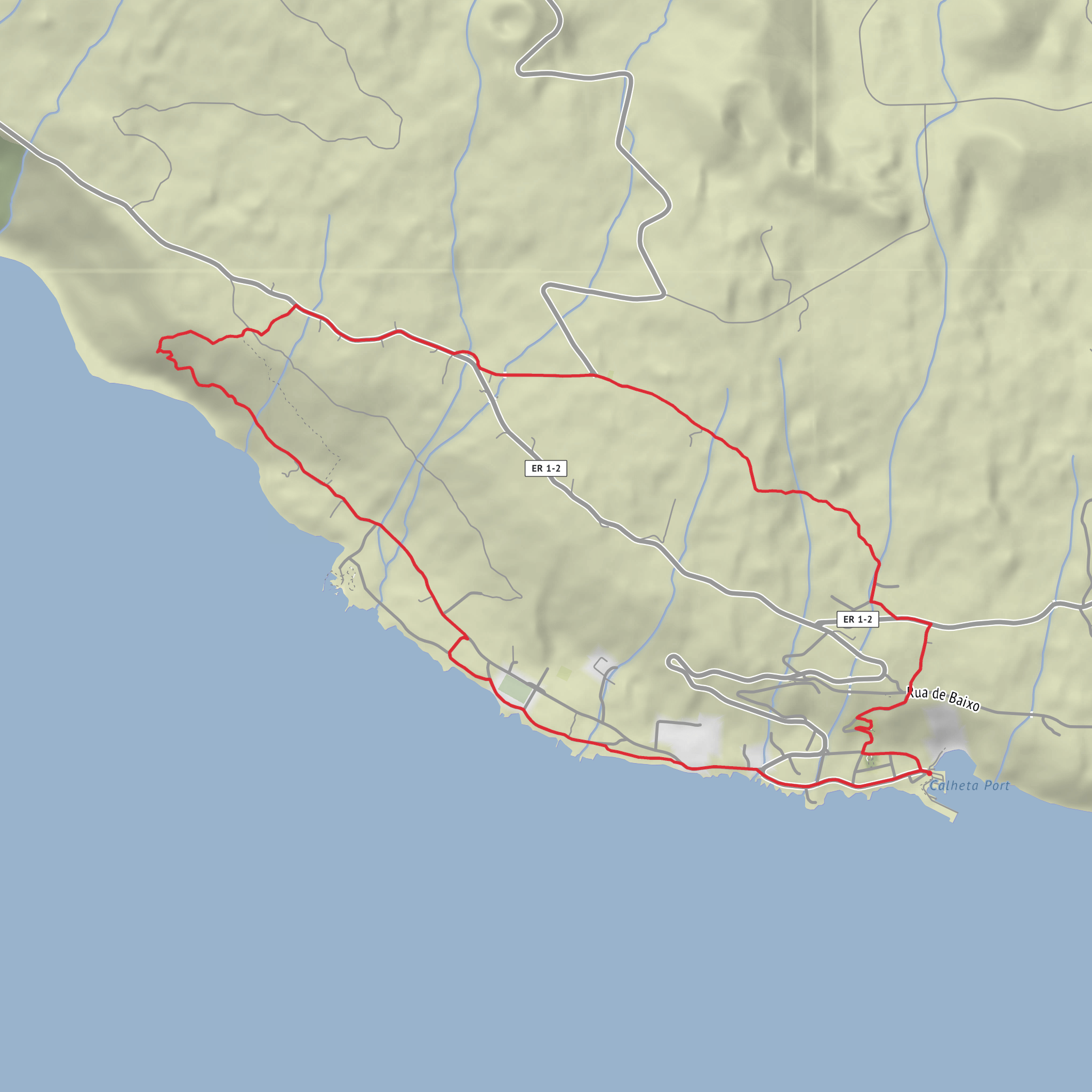
This medium-difficulty loop of about 8 km / 5 miles with roughly 400 m / 1,300 ft of ascent explores the dramatic west side of Flores around Fajã Grande, one of the most striking coastal settlements in the Azores. Fajã Grande sits on a broad coastal platform beneath the towering escarpment of Rocha da Fajã, where cliffs rise to more than 600 m above the village and countless watercourses spill toward the Atlantic. The setting is defined by a mix of volcanic landforms, pasture, stone walls, hydrangea-lined lanes, streams, and sea views, so hikers should expect a route that feels varied from start to finish rather than a single continuous mountain path. (visitazores.com)
The nearest clear landmark for the hike start is Fajã Grande village, near the bathing area and Porto da Fajã Grande, on the west coast of Flores. The bathing area has useful trailhead-style facilities including parking, toilets, showers, and nearby services, making it the most practical place to begin and end a village-based loop in this area. (turismo.azores.gov.pt)
Reaching the start is straightforward by car and possible by bus with more planning. By car, most visitors arrive from Flores Airport near Santa Cruz das Flores and follow the island road network across Flores to Fajã Grande; the drive is scenic but often narrow and wet, which matters on an island known for frequent rain. By public transport, Line 3 serves the west-side villages including Lajedo, Mosteiro, Fajãzinha, Cuada, and Fajã Grande, though published timetable information indicates no service on weekends and holidays, so schedules should be checked carefully before relying on it. For navigation on the ground, it is worth loading the route in HiiKER before setting out, especially if cloud, rain, or overgrown junctions reduce visibility. (horarios.visitazores.de)
What to expect on the route
From Fajã Grande, the loop typically begins with a steady climb away from the coast, gaining much of the 400 m / 1,300 ft in the first half. That ascent is the main reason the walk earns a medium rating: the distance is modest, but the gradients can feel sharp on wet stone, muddy earth, and old rural tracks. Expect a combination of paved village lanes, agricultural access tracks, and narrower footpaths. In damp weather, the route can become slippery, particularly where moss, runoff, or clay-rich soil cover the trail. Flores is lush precisely because it is wet, so waterproof layers and shoes with dependable grip are more important here than the mileage alone might suggest. General official trail guidance for Flores also emphasizes checking weather and trail conditions before heading out. (azores.com)
As height is gained, the views open quickly over the fajã itself and the broken coastline to the south toward Fajãzinha. One of the defining features of this landscape is the contrast between the flat coastal shelf and the immense wall of green cliffs above it. These fajãs are important not only for their beauty but also for their geological significance: they are low coastal platforms formed from lava flows and slope deposits, shaped by the island’s volcanic history and constant erosion from water and landslides. The west coast between Fajãzinha and Fajã Grande is widely recognized as one of the most beautiful coastal geolandscapes in the Azores. (viewpoints.azores.gov.pt)
If the loop incorporates the Poço do Bacalhau side, that is one of the standout landmarks. The waterfall drops more than 100 m and is among the best-known natural sights on Flores. Even when approached on a shorter local circuit rather than the full official linear trail from the central plateau, it adds a dramatic finish or midpoint, depending on direction of travel. Spray, wet rock, and slick ground are common near the falls, so extra care is needed there. (trails.visitazores.com)
Nature, wildlife, and landscape character
Flores is the westernmost island of the Azores and is famous for its water-rich terrain: crater lakes on the uplands, streams cutting through deep green slopes, and waterfalls pouring off the escarpments toward the sea. Around Fajã Grande, hikers move through a landscape of pasture, hedgerows, hydrangeas, ferns, and moisture
Surfaces
Unknown
Asphalt
Cobblestone
Grass
Gravel
Unpaved
Concrete
Comments and Reviews
User comments, reviews and discussions about the Faja Grande and Caminho das Fontes Loop, Portugal.
average rating out of 5
0 rating(s)
