
Download
3D Flyover
Add to list
More
13.3 km
~2 hrs 52 min
130 m
Loop
“A gentle roll through Sintra’s Saloia heartland, where Roman stones, windmills, and golden fields linger.”
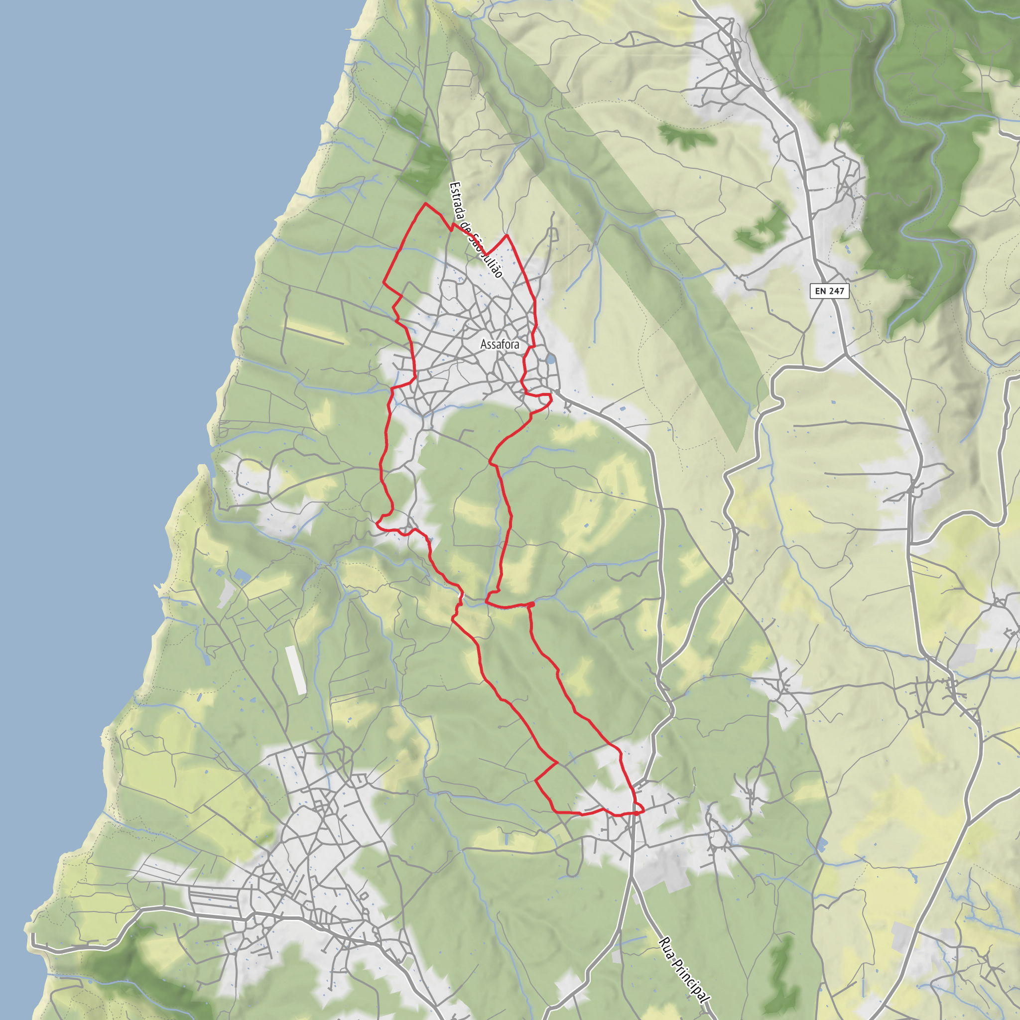
This easy countryside circuit in the rural Sintra area covers about 13 km / 8.1 miles, with roughly 100 m / 328 ft of climbing by your estimate, though published route data commonly places the total ascent closer to 244–245 m / about 800 ft over 13.2–13.5 km / 8.2–8.4 miles. It is a loop on mostly dirt farm tracks, footpaths, and short paved stretches through villages, so it is better thought of as a gentle rolling walk rather than a completely flat one. The route begins at the church in São João das Lampas, near the Igreja Matriz de São João das Lampas, a late 15th- to early 16th-century parish church that serves as the usual trailhead landmark. (sapatrilhas.pt)
From the start, the walk heads into the old Saloia countryside of Sintra, a landscape shaped by small-scale farming, wind exposure, and long-settled village life. Expect open fields, low stone walls, cultivated plots, and broad rural views rather than mountain scenery or dense forest. The terrain is generally forgiving, making it suitable for walkers who want a half-day route without major technical challenges, but sturdy footwear still helps because dirt sections can become muddy or uneven after rain. Route markings are traditionally yellow and red, and for digital navigation it is sensible to load the route in HiiKER before setting out. (walksintra.com)
What the route passes
One of the most notable early landmarks is the area around Catribana, where the trail passes the restored Roman bridge and Roman road. This is one of the most historically significant features on the walk. The bridge stands over the Samarra stream near Catribana, and a surviving stretch of Roman paving remains visible nearby. The site is generally understood to have linked local Roman-era settlements or villas within the ancient territory of Olisipo. For hikers, this adds a strong archaeological dimension to an otherwise pastoral route. (walksintra.com)
Beyond Catribana, the route continues through country lanes and tracks toward Cortezia, then skirts Assafora before looping back to São João das Lampas. These villages are part of a region where traditional agriculture remained important for centuries, and the walk is especially good for noticing vernacular rural architecture, small chapels, farm buildings, and the rhythm of village life that differs from the palace-and-forest image many visitors associate with Sintra. Old windmills are another recurring feature of the landscape and a reminder of the area’s grain-growing past and its exposure to Atlantic winds. (walksintra.com)
A worthwhile optional detour comes just after Catribana: about 500 m / 0.3 miles off route, a signed road leads toward Praia da Samarra. If you want to extend the outing slightly, this side trip adds a coastal element and a change of scenery from inland farmland to the nearby Atlantic edge. (walksintra.com)
Nature and wildlife
Although this is not a wilderness trail, the route has plenty of natural interest. The mix of meadows, hedgerows, stream margins, and cultivated land supports common rural birdlife such as swallows, wagtails, sparrows, finches, and raptors overhead, especially kestrels or buzzards in open country. In spring, field margins can be colorful with wildflowers, while summer often brings dry grasses and a more golden landscape. Because much of the route crosses exposed farmland, shade can be limited, and wind can be surprisingly strong even on warm days. (walksintra.com)
Wildlife encounters are usually subtle rather than dramatic. Small reptiles may bask on warm paths, insects are abundant in the warmer months, and after wet weather the lower sections near watercourses can be slick. If you are hiking during hunting season in rural Portugal, wearing visible clothing is a sensible precaution on open-country trails. Farm dogs, passing vehicles on village roads, and muddy tractor tracks are often more relevant hazards here than steep drops or scrambling terrain.
Difficulty and what to prepare for
Even though the route is often described as low in technical difficulty, the published ascent figures suggest more undulation than the “around 100 metres” estimate implies. Most hikers should still find it straightforward, but it helps to plan for 3 to 4 hours of walking depending on pace
Surfaces
Unknown
Paved
Unpaved
Asphalt
Ground
Cobblestone
Comments and Reviews
User comments, reviews and discussions about the PR9 - SNT - Rota das Aldeias, Portugal.
average rating out of 5
0 rating(s)
