
Download
3D Flyover
Add to list
More
8.1 km
~2 hrs 12 min
352 m
Point to Point
“Santa Maria’s south coast unfolds in fossil-rich cliffs, quiet coves, and wind-brushed paths.”
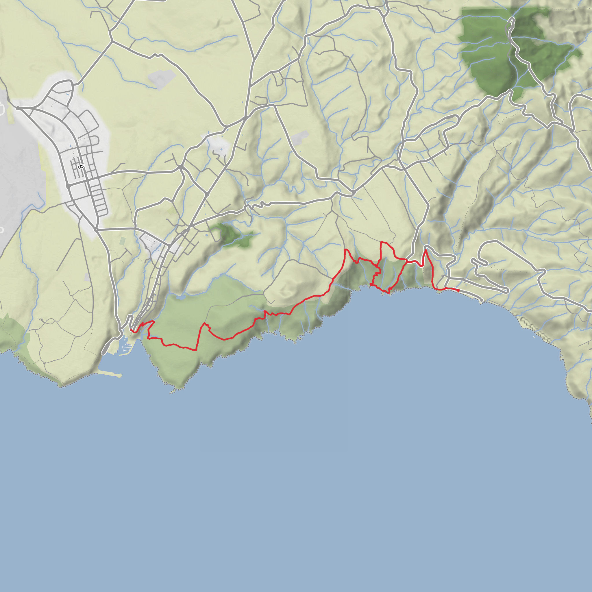
This medium-difficulty coastal walk on Santa Maria covers about 8 km / 5 miles with roughly 400 m / 1,312 ft of ascent, linking some of the island’s most distinctive geology with broad sea views, small coves, old agricultural ground, and one of the Azores’ most important fossil and volcanic landscapes. The route is commonly associated with the Costa Sul PR05 SMA trail and the protected area around Pedreira do Campo, Figueiral, and Prainha, on Santa Maria’s south coast. Expect a mix of dirt track, coastal path, short steeper rises and descents, and exposed sections where sun, wind, and slippery ground can make the hike feel harder than the distance suggests. (trails.visitazores.com)
The usual trail start is near the Dalberto Pombo Environmental Interpretation Centre / Casa dos Fósseis, just outside Vila do Porto, Santa Maria, Azores, rather than at an unnamed remote trailhead. Older official trail material places the start near Vila do Porto, and current Azores material describes the route as beginning at Casa dos Fósseis and continuing east through the natural monument toward Praia Formosa. (trails.visitazores.com)
If arriving by car, the simplest access is from Vila do Porto, following local roads toward the south coast trail access points; parking is also available near Pedreira do Campo via Caminho do Facho, Almagreira, which can be useful if you are planning a shorter out-and-back around the geosite rather than the full through-hike. If using public transport, services on Santa Maria are limited and can be seasonal or infrequent, so hikers should check local island bus options in advance and be prepared to use a taxi for either the start near Vila do Porto or the finish around Praia Formosa / Almagreira. Because this is a linear route, arranging a return ride is often the most practical option. (exploresantamaria.pt)
What the route is like
From the western side near Vila do Porto, the trail heads into open countryside and then into the protected coastal zone. The walking is not especially technical, but the route undulates enough that the cumulative climbing adds up. Over 8 km / 5 miles, 400 m / 1,312 ft of ascent means several moderate gradients rather than one single long climb. In dry weather the footing is usually straightforward on farm tracks and established paths, but after rain the earth can become slick, especially on descents toward the coast and around rocky sections. (trails.visitazores.com)
One of the defining features is the transition between inland pasture and dramatic coastal geology. As the route approaches Pedreira do Campo, the landscape becomes more interpretive and visually striking. This former quarry exposes a long section of submarine basaltic lava flows and fossil-bearing marine sediments, making it one of the most scientifically important geological sites in the Azores. The protected monument covers about 230 hectares and is part of the Azores UNESCO Global Geopark network. (parquesnaturais.azores.gov.pt)
The trail then continues toward Prainha, where the scenery opens to a small bay and white coastal features that are unusual within the archipelago. From there, the route continues along the south coast toward Praia Formosa, a better-known beach area that often serves as the practical endpoint for through-hikers on this trail. (trails.visitazores.com)
Landmarks, geology, and historical interest
Pedreira do Campo is the standout landmark. It is an old quarry face about 260 m / 853 ft long, cut into submarine volcanic formations. What makes it exceptional is the combination of volcanic rock and marine fossil deposits in the same exposed sequence, offering a rare record of Santa Maria’s geological past. This is not just scenic terrain; it is a place of real paleontological and volcanological importance. (parquesnaturais.azores.gov.pt)
The Interpretive Circuit of Pedreira do Campo adds context to the walk, with a boardwalk and interpretive infrastructure designed to explain the geological and fossil heritage of the site. Hikers interested in the science of the island should allow extra time here rather than treating it as a quick pass-through. (parquesnaturais.azores.gov.pt)
The wider region also has historical depth. Santa Maria is the oldest island in the Azores in geological terms, and this south-coast corridor reflects both natural and human history: quarrying, small-scale agriculture, and coastal defense. Near Prainha there are remains associated with the Forte da Prainha, a historic coastal fortification that once formed part of the island’s defensive network, though it is now in ruins.
Surfaces
Unknown
Ground
Gravel
Asphalt
Wood
Concrete
Cobblestone
Comments and Reviews
User comments, reviews and discussions about the Costa Sul, Prainha and Pedreira do Campo - Santa Maria, Portugal.
average rating out of 5
0 rating(s)


