
Download
3D Flyover
Add to list
More
7.3 km
~3 hrs 9 min
1015 m
Out and Back
“A fierce volcanic ascent to Portugal’s rooftop, where stark beauty and shifting weather demand respect.”
This is a short but very demanding mountain route of about 7 km / 4.3 miles, climbing roughly 1,000 m / 3,280 ft, so it packs a full alpine-style effort into a relatively compact distance. With an estimated Extra Difficult rating, hikers should expect a steep, sustained ascent, limited recovery terrain, and a descent that can feel just as taxing as the climb. Even strong walkers should plan for a serious outing rather than a casual half-day stroll, especially if the route is exposed to wind, cloud, or wet ground.
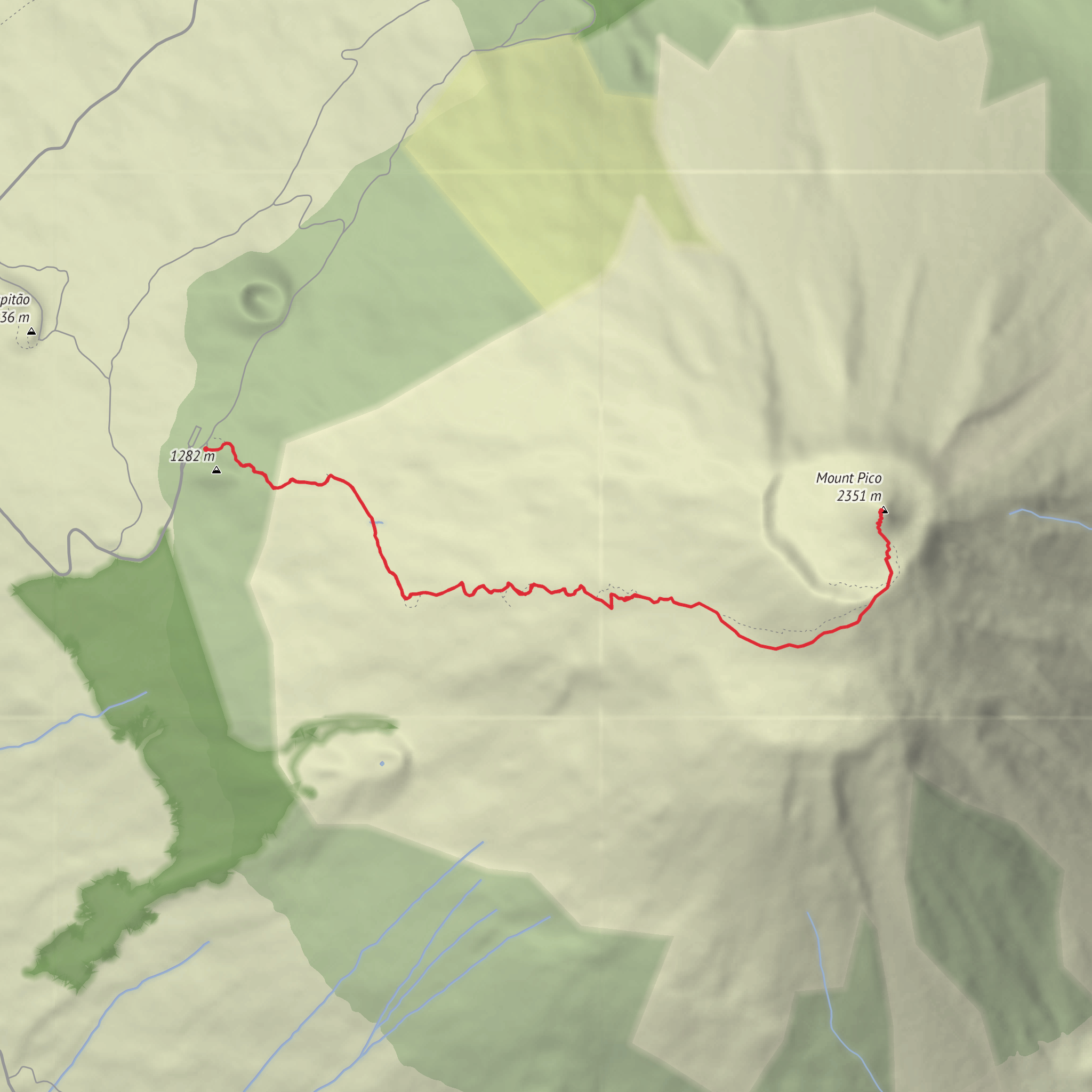
The trail is commonly associated with the climb to Pico Mountain on Pico Island in the Azores, Portugal, with the trailhead at or near Casa da Montanha / Mountain House, the main access point for the summit route and the most significant landmark used for navigation and registration. If you are planning from coordinates, the nearest meaningful destination to use is Casa da Montanha, Criação Velha / Madalena, Pico Island, Azores. This is the standard starting point for the island’s summit ascent.
The route usually begins on volcanic ground at moderate elevation and rises steadily toward Portugal’s highest peak. Although the total distance is not especially long, the gradient is the defining challenge. Much of the climb is on uneven lava rock, ash, gravelly volcanic soil, and rough mountain terrain that can be slippery in mist or rain. Trekking poles can help on the descent, but footing and pacing matter more than speed. Hikers should be prepared for a route where progress is often slower than the distance suggests.
What to expect on the climb
The lower part of the trail typically starts in open volcanic landscape with sparse vegetation and broad views when the weather is clear. Early on, the path may feel manageable, but the climb quickly becomes more relentless. As elevation builds, the terrain grows rockier and more exposed, and the route often follows a marked mountain corridor rather than a soft forest trail. Expect long uphill stretches with little shelter.
Around the middle section, the mountain environment becomes more dramatic. The volcanic character of Pico is the main attraction: dark basalt, cinder, fractured lava formations, and a stark high-altitude landscape that feels very different from greener coastal parts of the island. In clear conditions, the expanding views over Pico Island, the Atlantic, and neighboring islands are a major reward. In poor visibility, however, this same terrain can feel disorienting, which makes careful route-following essential. For navigation planning, HiiKER is the best tool to review the route profile, elevation trend, and key waypoints before setting out.
Higher up, the route steepens again and often becomes more physically and mentally demanding. The summit area is not just a simple hilltop; it is part of a volcanic complex with crater features and rugged ground. Depending on the exact line taken and current access rules, hikers may reach the main summit zone and, in some cases, continue toward the highest point known as Piquinho, a steeper final rise that can require extra care on loose rock and exposed terrain. This upper section is where weather changes are felt most strongly, with wind, cold, and cloud arriving quickly.
Terrain, weather, and hazards
The biggest mistake on this hike is underestimating it because of the modest mileage. A 7 km / 4.3 mile route with 1,000 m / 3,280 ft of ascent is extremely steep by normal hiking standards. That means calves, lungs, and knees all get worked hard, especially on the return.
Key things to watch for include:
- Rapid weather change: Pico Mountain is well known for cloud build-up, strong wind, and sudden drops in visibility.
- Slippery volcanic rock: Wet basalt and loose gravel can make both ascent and descent awkward.
- Exposure: There may be little protection from sun, wind, or cold.
- Fatigue on descent: The downhill can be punishing on tired legs and easy to rush.
- Navigation issues in mist: Even on a marked route, fog can make the landscape feel featureless.
Because of the mountain’s seriousness, hikers should carry layers for cold and wind, waterproofs, enough food and water, sun protection, and a headlamp if there is any chance of a delayed return. Sturdy footwear with good grip is important. Check mountain access requirements locally before departure, as some summit routes in protected areas operate with registration, time controls, or weather-related restrictions.
Nature and wildlife
Pico’s upper slopes are shaped more by geology than dense vegetation, so the natural interest here is often in the volcanic landscape itself. Lower down, hikers may notice hardy Azorean plant communities adapted to wind, exposure, and porous volcanic soils. Conditions become increasingly austere with height, and the mountain’s ecology reflects that transition.
Wildlife is usually subtle rather than abundant on the climb itself. Birdlife may be the most noticeable, especially seabirds or island species seen or heard lower down and around the broader mountain environment. Insects and small hardy species are more likely than large mammals, as the Azores do not have the kind of large wild terrestrial animals hikers might expect on continental mountain routes. The real natural spectacle is the mountain’s volcanic structure and the sweeping ocean setting around it.
Historical and regional significance
This hike leads into one of the most important landscapes in Portugal. Pico Mountain is the highest point in the country and a defining symbol of the Azores. Its volcanic origin is central to the identity of Pico Island, whose communities have long lived with and adapted to a rugged Atlantic environment shaped by lava, stone, wind, and sea.
The wider region also has strong cultural significance tied to viticulture and settlement on volcanic terrain. Pico Island is famous for its traditional vineyard landscape, where vines were historically protected by stone walls built from black volcanic rock.
Comments and Reviews
User comments, reviews and discussions about the Trilho do Pico, Portugal.
average rating out of 5
0 rating(s)


