
Ponta da Ilha to Ponta da Baleia, Baia de Engrade and Baia do Ceu Abraao
Download
3D Flyover
Add to list
More
5.9 km
~1 hrs 15 min
52 m
Point to Point
“A vivid coastal ramble through vineyards, lava headlands, and lighthouse bays, with rough basalt demanding care.”
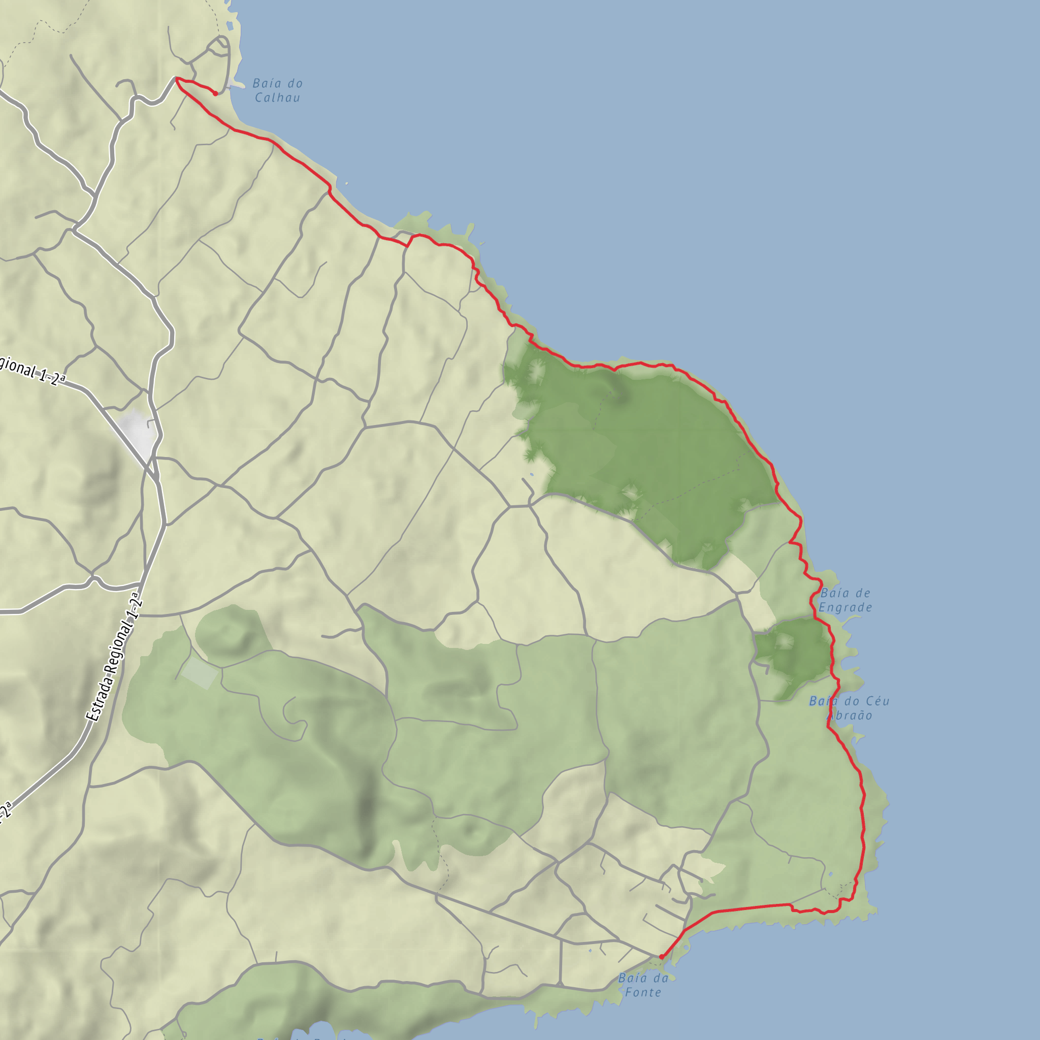
This coastal walk on the eastern tip of Pico Island links Porto do Calhau in Piedade with Porto da Manhenha, passing the headlands and bays of Ponta da Ilha, Ponta da Baleia, Baía da Engrade, and Baía do Céu de Abraão. The route is about 6.1 km / 3.8 miles one way, and although you listed it as easy, hikers should expect stretches of very uneven basalt underfoot that can make it feel more demanding than the modest ~100 m / 330 ft of ascent suggests. The official Azores trail listing describes this route as linear, beginning at Porto do Calhau in the parish of Piedade and ending at the quay in Manhenha. (trails.visitazores.com)
The start is best understood as being near Porto do Calhau, Piedade, Lajes do Pico, Pico Island, Azores, rather than an unnamed trailhead. From there, the path climbs briefly on asphalt for about 200 m / 0.1 mi, then turns onto older local lanes near the Ermida de Nossa Senhora de Cima da Rocha, a chapel dating to 1854. After that, the trail continues for roughly 2 km / 1.2 mi through vineyard country and past old support buildings once tied to the island’s wine-growing landscape. (trails.visitazores.com)
Terrain and what to expect
The first section is gentle in gradient and gives a good introduction to the cultural landscape of eastern Pico: low stonework, scattered houses, and agricultural traces shaped by wind, lava, and centuries of rural use. This part is usually the easiest walking of the day, with the route following marked ground signs rather than a single broad track. (trails.visitazores.com)
The character changes once the trail reaches the coast. Here, the route runs beside the sea over basalt slabs and lava rock, and this is the section to take seriously even in dry weather. The footing is irregular, angular, and sometimes awkward, so sturdy shoes with reliable grip are far better than casual trainers. In wet or windy conditions, the exposed rock can feel slick, and sea spray can add to the hazard. After about 1.5 km / 0.9 mi along this rougher shoreline, the trail climbs a stairway and reaches the houses of Engrade by a gravelly volcanic lane. (trails.visitazores.com)
From Engrade, the route either heads more directly toward Manhenha or continues left on the more scenic line around the bays. For the walk you’re describing, the coastal continuation is the key attraction, as it threads past Baía da Engrade and Baía do Céu de Abraão before reaching the lighthouse area and then the final 700 m / 0.4 mi on asphalt down to Porto da Manhenha. (trails.visitazores.com)
Landmarks along the route
One of the most distinctive landmarks is the Farol da Ponta da Ilha, commonly associated with Manhenha. It stands at the easternmost part of Pico and began operating on 21 July 1946. The lighthouse is unusual in form, with a central tower integrated into a U-shaped building, and it was connected to Manhenha by road in 1959. It gives the latter part of the walk a strong sense of place and serves as a clear navigational objective as the coast bends around the headland. (visitazores.com)
The bays themselves are a major part of the appeal. Baía da Engrade lies between Baía do Céu de Abraão and Are
Surfaces
Unpaved
Unknown
Asphalt
Comments and Reviews
User comments, reviews and discussions about the Ponta da Ilha to Ponta da Baleia, Baia de Engrade and Baia do Ceu Abraao, Portugal.
average rating out of 5
0 rating(s)
