
Download
3D Flyover
Add to list
More
8.5 km
~2 hrs 9 min
271 m
Point to Point
“A reflective coastal journey through orchards, black basalt, vineyards, and Pico’s haunting whaling heritage.”
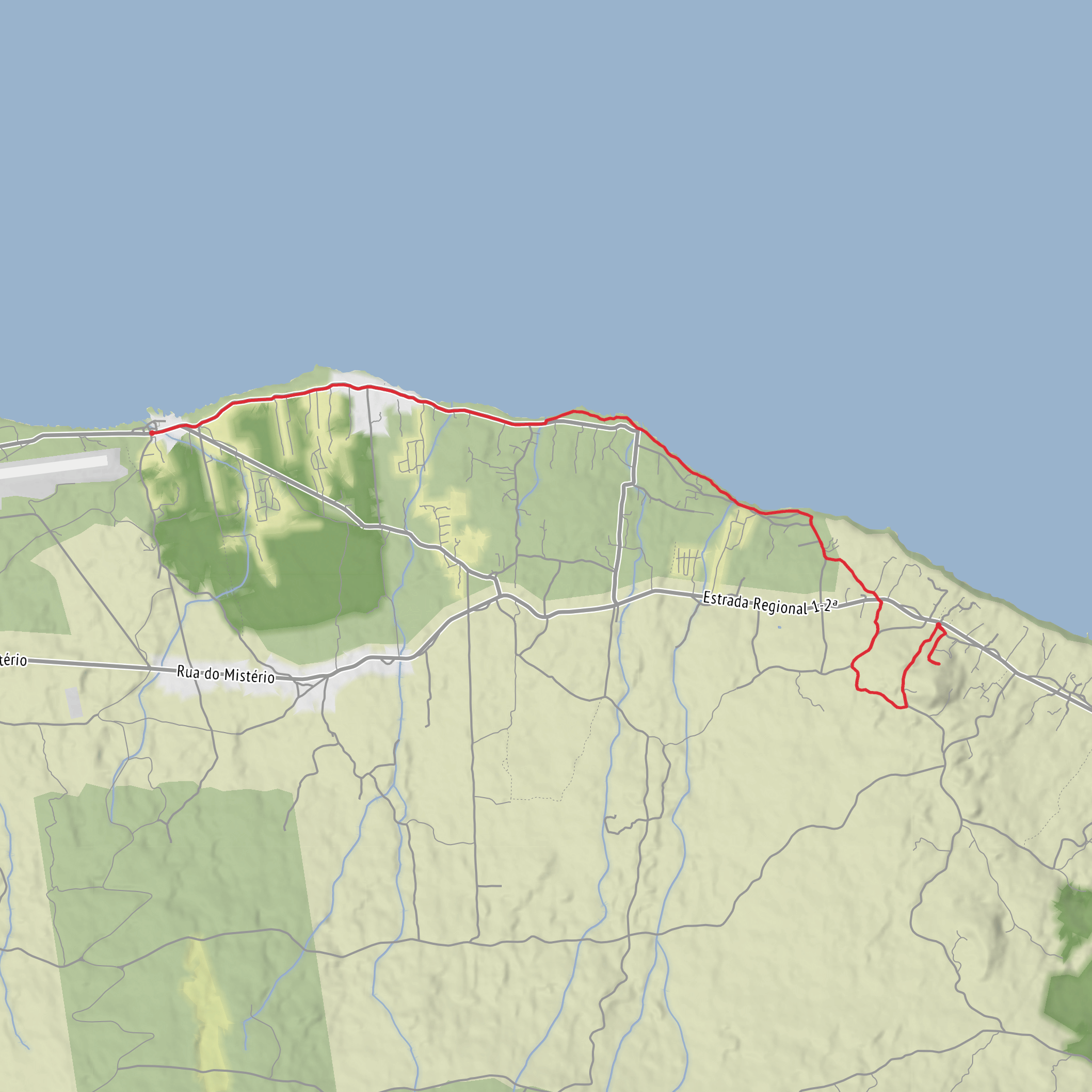
This point-to-point coastal walk on Pico Island links the hamlet of Santana with Lajido de Santa Luzia through a striking mix of orchards, basalt shoreline, old vineyard country, and reminders of the island’s whaling past. The route is about 8.7 to 9 km / 5.4 to 5.6 miles, with roughly 300 m / 985 ft of cumulative ascent, and is generally considered a medium outing for most hikers, even though some official listings classify it as easier overall. The main reasons it can feel more demanding are the uneven volcanic rock, short steeper rises, and the need to stay attentive on mixed surfaces including asphalt, rural lanes, and rough basalt. (acores9.com)
The start is near the regional road at the boundary between Santana and São Vicente Ferreira, in the parish area of Santo António on Pico Island, rather than Madeira’s municipality of Santana. If you are plotting the trail in HiiKER, look for the trailhead near the roadside access above the coast between Santana and São Vicente Ferreira, with the nearby whale lookout access path marking the correct area. The finish is at the Interpretation Centre for the Landscape of the Culture of the Vineyard of Pico Island in Lajido de Santa Luzia, a well-known landmark and the most useful end-point reference for navigation and pickup planning. (acores9.com)
If arriving by car, the simplest plan is to leave one vehicle near the interpretation centre at Lajido de Santa Luzia and drive a second vehicle to the roadside start near Santana. If you only have one car, a taxi transfer back from Lajido is usually the most practical option because this is not a loop. Public transport is possible in principle because bus services on Pico connect places including São Roque, Santo António, São Vicente, Santana, Santa Luzia, and Madalena, but schedules are limited and should be checked carefully before committing to the walk. The route passes through small settlements rather than major transport hubs, so timing matters. (horarios.visitazores.de)
What the route feels like
From the start, the trail quickly introduces the character of Pico’s north coast: cultivated land giving way to open sea views and dark volcanic stone. A short detour leads to the old whale lookout, often referred to as Vigia da Baleia. This is one of the most historically interesting spots on the walk, because these lookouts were once used to scan the Atlantic for whales, part of an industry that shaped Pico for generations from the late 18th century onward. Today the lookout is more evocative than functional, but it helps frame the landscape you are about to cross. (visitazores.com)
After the lookout, the trail descends through orchards and vineyards toward Baía do Gasparal. This early section is a good place to expect loose ground, occasional rough steps, and potentially slippery footing if it has rained. The descent is not huge in mountain terms, but it is enough to remind hikers that the return logistics matter: once you continue onward, you are committing to a linear route rather than an easy turn-around stroll. (acores9.com)
At around the first couple of kilometres, the coast becomes the dominant feature. Near the bay, the route passes a tidal well, a small but memorable landmark tied to local adaptation in a place where fresh surface water was scarce. It is the kind of feature that can be easy to miss if you move too quickly, but it says a lot about how coastal communities here made practical use of a harsh volcanic environment. (acores9.com)
Ponta Negra, basalt coast, and the climb inland
Beyond the coastal houses, the trail heads toward Ponta Negra. This is one of the most visually distinctive parts of the hike, where the route transitions onto darker, rougher volcanic terrain. Expect a lane bordered by vegetation such as heather and invasive incense/cheesewood, then stretches of basalt underfoot. The footing here can be awkward rather than technical: uneven rock, irregular edges, and slick patches in damp weather are the main concerns. Good grip matters more than heavy boots, though many hikers will prefer sturdier footwear over lightweight road shoes
Surfaces
Asphalt
Unknown
Gravel
Comments and Reviews
User comments, reviews and discussions about the Lajido to Santana via Ponta Negra and Vigia Baleeria, Portugal.
average rating out of 5
0 rating(s)
