
Download
3D Flyover
Add to list
More
9.2 km
~1 hrs 59 min
92 m
Point to Point
“A gentle upland loop where mirrored lake, volcanic ridges, and windswept pasture reveal Pico’s soul.”
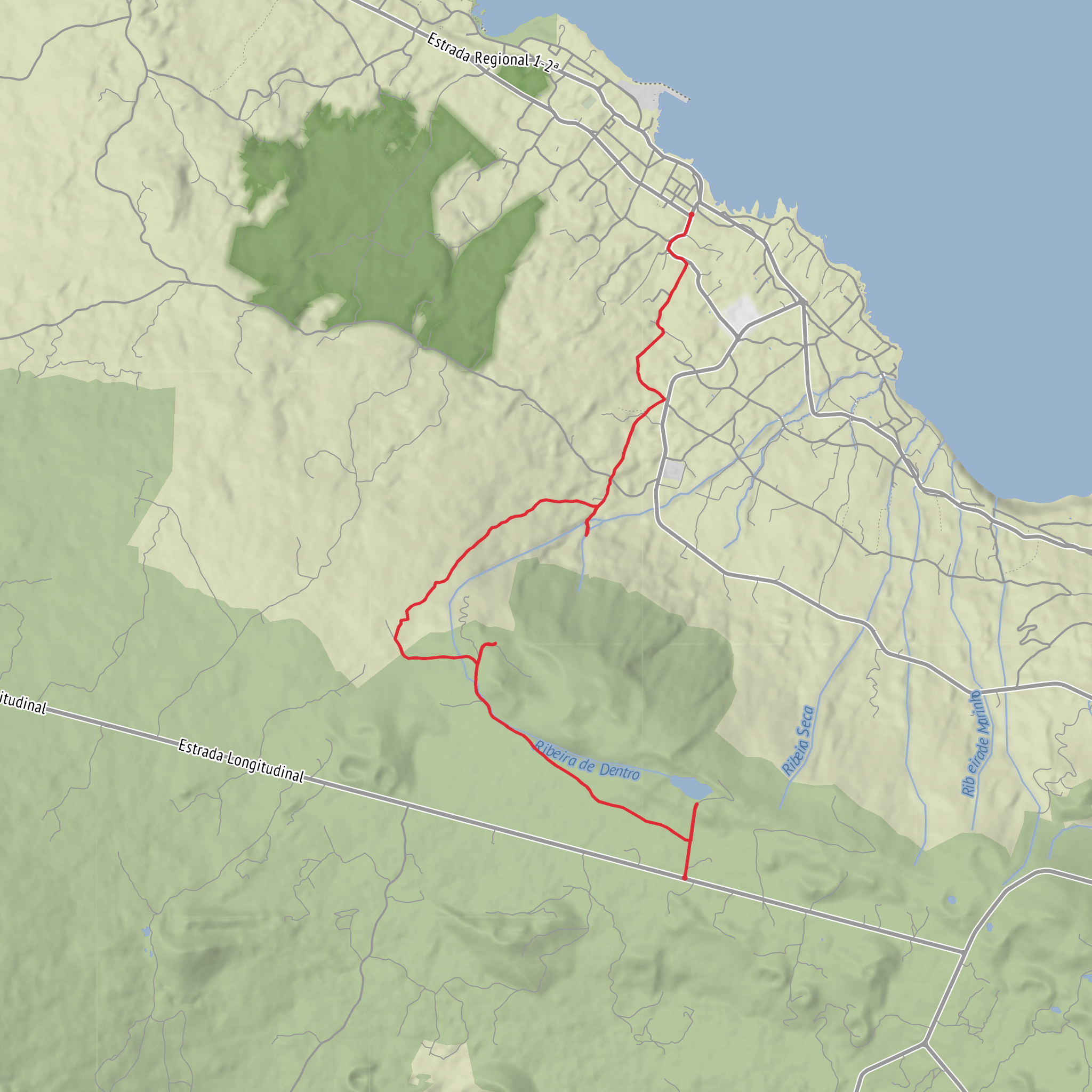
This easy loop of about 9 km / 5.6 miles with roughly 100 m / 330 ft of elevation gain explores one of Pico Island’s best-known upland landscapes: Lagoa do Capitão, the slopes around Cabeço do Piquinho, and the pastoral interior near Canarias. The route sits on Pico’s central plateau near Lagoa do Capitão on Estrada Regional ER3-2, São Roque do Pico, Pico Island, Azores, a useful landmark for navigation and parking. Lagoa do Capitão itself lies at about 826 m / 2,710 ft above sea level, so even though the walking is rated easy, conditions can feel cooler, windier, and mistier than on the coast. (cm-saoroquedopico.pt)
The opening section is usually the gentlest, following broad tracks and rural lanes through open pasture and volcanic highland scenery. The lake is the visual anchor early on, often reflecting Montanha do Pico in calm weather, while the north side opens toward São Roque do Pico and, on clear days, the Pico–São Jorge Channel and the island of São Jorge beyond. This part of the walk is more about steady scenery than steep effort, and the low overall ascent makes it suitable for hikers looking for a relaxed outing rather than a strenuous climb. (parquesnaturais.azores.gov.pt)
What to expect on the route
Around the first few kilometres, the trail passes through a mix of dirt track, grazing land, and patches of native vegetation. At roughly 3 km / 1.9 miles, there is an opportunity to skirt Cabeço do Piquinho, where a modest rise rewards you with broader views over the island’s north coast. Because the total elevation gain is only around 100 m / 330 ft, this higher point feels more like a scenic bump than a major climb, but it is one of the most worthwhile viewpoints on the walk. (parquesnaturais.azores.gov.pt)
The terrain is generally straightforward, but hikers should still expect uneven volcanic ground in places, occasional muddy patches after rain, and exposed stretches with little shelter from wind. In fog, the open plateau can feel disorienting, so carrying offline mapping in HiiKER is a sensible precaution even on an easy route. Waterproof layers are worth packing year-round because weather on Pico’s interior can change quickly. These are especially important if cloud drops over the lake or the ridge around Cabeço do Piquinho. (trails.visitazores.com)
Nature, wildlife, and landscape
This area lies within a protected central landscape zone of Pico and is notable for its endemic Azorean flora. Near the lagoon and along the fault-scarp landscape, hikers may see species such as Erica azorica along with Azorean juniper, laurel, and other Macaronesian vegetation. The lake and its margins also create habitat for wetland and upland birdlife, so it is worth slowing down in quieter sections to scan the water and surrounding vegetation. (parquesnaturais.azores.gov.pt)
Geologically, Lagoa do Capitão is more than just a scenic lake. Official regional material describes it as part of a tectonic and volcanic landscape, with a prominent fault scarp to the north and a setting tied to the São Roque–Piedade volcanic ridge. That gives the walk an added layer of interest: the broad, calm pastureland is actually shaped by the same volcanic forces that built Pico Island and the great cone of Montanha do Pico. (parquesnaturais.azores.gov.pt)
Historical significance of the area
The wider region reflects Pico’s long relationship with farming, upland grazing, and settlement spread between the coast and interior. The trail’s pastoral sections are part of that story, with traditional agricultural land use still visible in the field patterns and access tracks. Lagoa do Capitão is also one of the island’s most recognized inland landmarks, long valued for both its scenery and its role within the central highland landscape of São Roque do Pico. (cm-saoroquedopico.pt)
If your route links with or passes near older local paths descending toward settled areas, that can also hint at how these upland tracks historically connected interior pasture to coastal communities. On Pico, those communities were shaped by fishing, agriculture, and later whaling, especially around São Roque do Pico, which gives the surrounding landscape a cultural backdrop beyond the immediate lake views. This is less a monument-heavy walk than a landscape walk where geology, farming, and island history all overlap. (visitazores.com)
Getting to the start
By car,
Surfaces
Unknown
Asphalt
Ground
Cobblestone
Grass
Comments and Reviews
User comments, reviews and discussions about the Lagoa do Capitão, Cabeco do Piquinho and Canarias, Portugal.
average rating out of 5
0 rating(s)
