
Download
3D Flyover
Add to list
More
3.3 km
~56 min
163 m
Loop
“A steep, history-laced climb above São Roque rewards careful walkers with mills, cobbles, and shimmering sea views.”
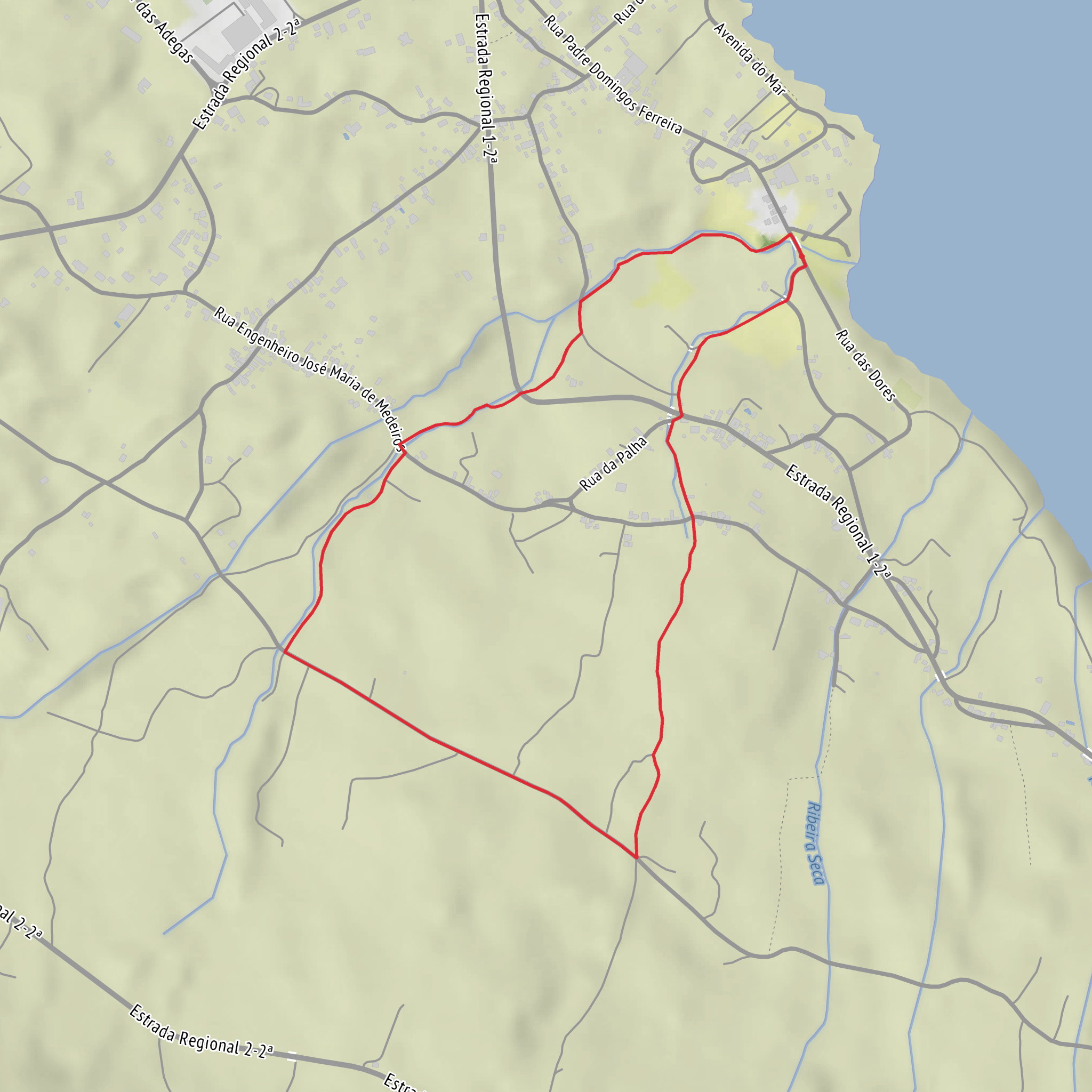
This short circular walk on Pico begins in the historic heart of São Roque do Pico, near the Igreja Matriz de São Roque and the old bridge at Ponte Nova, which is the nearest clear landmark to the mapped start point. The official trail coordinates, 38°30′47.68″N, 28°18′12.29″W, place the start by the church-and-bridge area in town rather than at an isolated rural trailhead. (visitazores.com)
Although you listed the route as around 3 km, the official trail information puts it at about 3.3 to 3.4 km—roughly 2.1 miles—with the high point reaching around 155 to 173 m above sea level. That makes the total climbing feel close to 200 m / 656 ft in practical terms, especially because the ascent is concentrated into a relatively short section. Officially it is often graded easy, but hikers who are less comfortable on steep stone lanes, slick surfaces, or narrow descending paths may find it closer to an easy-to-moderate or medium outing. (visitazores.com)
The route starts gently enough in an urban setting, but very quickly turns uphill. After leaving the bridge area, the trail follows a short paved approach for about 80 m / 0.05 mi before turning onto the old stone-paved lane beside a watercourse. From there, the character of the walk changes immediately: this is the most physical part of the loop, with a steady climb on old cobbles and uneven footing. Over roughly the first 1.2 km / 0.75 mi, you gain most of the elevation, moving from near sea level to the upper part of the route. (acores9.com)
What to expect on the climb
The name Ladeira dos Moinhos points directly to one of the route’s defining features: the old watermills scattered along the ascent. These mills are tied to the island’s traditional use of watercourses and small-scale grain processing, and they give the trail much of its historical character. Rather than a wilderness path, this is a cultural landscape walk where built heritage, agriculture, and village life are closely layered together. (acores9.com)
The climb runs beside a stream channel, and that means moisture is a constant factor. Even in dry weather, the stone can be polished and slick; after rain, the cobbles and the lower descent path can become notably slippery. Good footwear matters more here than the short distance might suggest. Trekking poles are optional, but many hikers will appreciate them on the descent. If checking route guidance beforehand, use HiiKER for mapping and navigation support.
As you rise, openings behind you begin to reveal views over São Roque do Pico, its rooftops, the coastline, and the Atlantic beyond. Because the route is short and close to town, these views come quickly, and they are one of the main rewards for the initial effort. The upper section is not especially high by mountain standards, but the combination of sea-level start and elevated village outlook gives the walk a strong sense of vertical relief. (acores9.com)
Upper section, descent, and route character
At around 1.2 km / 0.75 mi, the main climb eases and the trail meets asphalt. You then turn right and follow the road for about 700 m / 0.4 mi. This middle section is less rugged and gives you a chance to recover while taking in broader views over the town and coast. Traffic is generally local rather than heavy, but this is still a road segment, so hikers should stay alert and walk on the verge where possible. (acores9.com)
A second right turn marks the start of the descent. This lower return section is narrower and can feel more technical than the
Surfaces
Unknown
Asphalt
Grass
Concrete
Comments and Reviews
User comments, reviews and discussions about the Ladeira dos Moinhos and Ponte Nova Loop, Portugal.
average rating out of 5
0 rating(s)
