
Download
3D Flyover
Add to list
More
9.5 km
~2 hrs 16 min
222 m
Point to Point
“A reflective ramble through basalt-walled vineyards and ancient lanes, where Pico’s wine heritage meets sea views.”
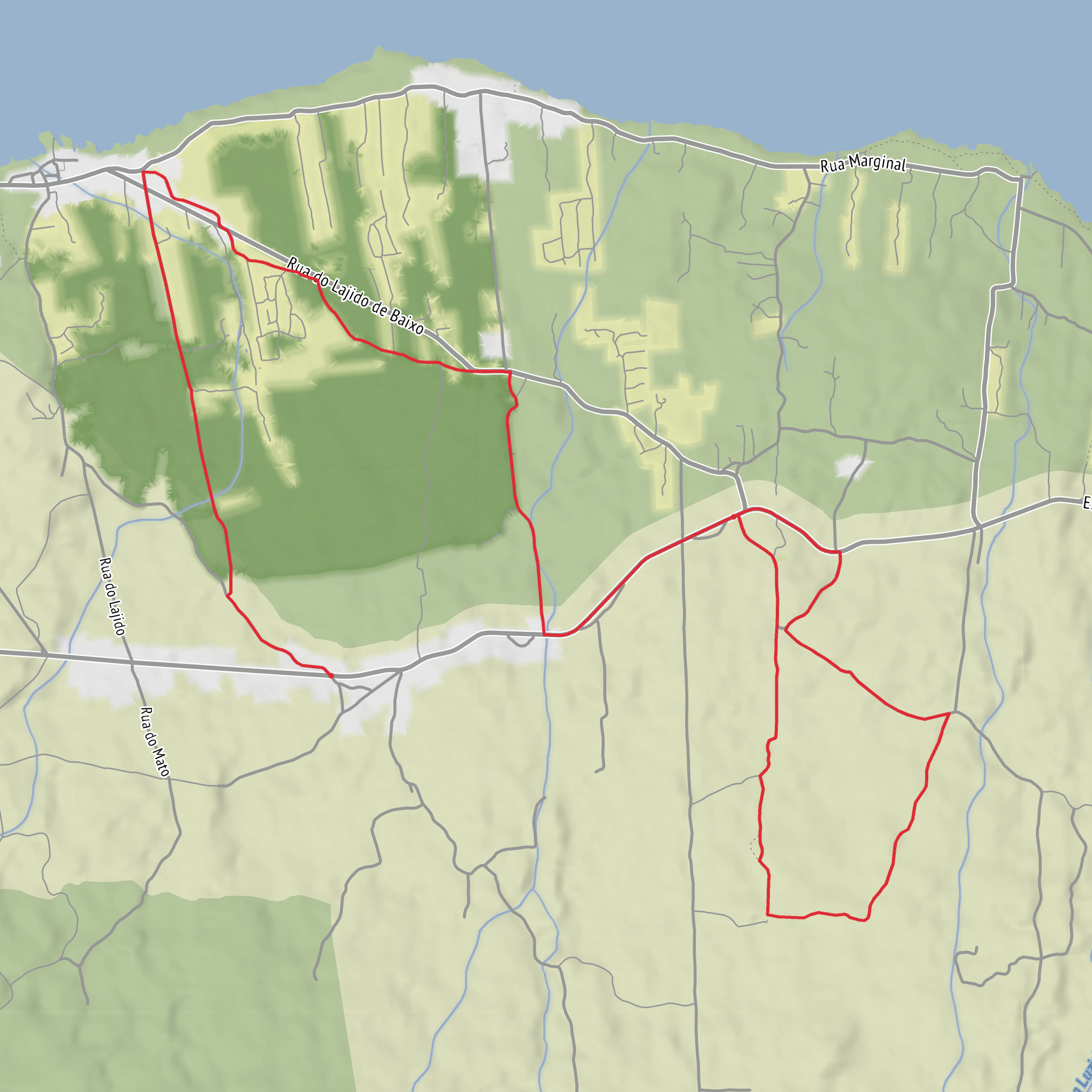
This roughly 10 km / 6.2 mile medium walk on Pico Island follows old rural and wine-growing access lanes between the upper part of Santa Luzia and the coast, then returns inland through historic stone-walled tracks. Expect about 200 m / 656 ft of total ascent, with the route generally taking around 3 hours depending on stops. The trail is known officially as PR01PIC Caminhos de Santa Luzia, beginning near Miraguaia in the parish of Santa Luzia and finishing near the Igreja de Santa Luzia. The start is best understood as being near Miraguaia, Santa Luzia, São Roque do Pico, Pico Island, Azores, along the regional road; the finish is near Igreja de Santa Luzia, Santa Luzia, São Roque do Pico, Pico Island, Azores. (parquesnaturais.azores.gov.pt)
The character of the walk is shaped by Pico’s UNESCO-listed vineyard landscape. Much of the route passes through the protected wine culture area, where black basalt walls form a striking patchwork around vines and fig trees. These dry-stone enclosures were built to shelter crops from Atlantic wind and salt spray, and they are one of the defining cultural landscapes of the island. (parquesnaturais.azores.gov.pt)
What the route feels like
The opening section starts on or near the regional road by Miraguaia before dropping toward the sea. Early on, there is a short paved stretch, but the trail soon narrows into an old lane that can feel uneven underfoot, with rough stone, irregular surfaces, and enclosed walls. This first descent is one of the most distinctive parts of the walk: it follows former access routes once used to reach vineyards and cultivated plots closer to the coast. (parquesnaturais.azores.gov.pt)
As the route approaches the lower ground around Lajido, the landscape opens out into traditional vineyard country. Here, hikers should expect broad views over lava-built terrain, low stone walls, old wine cellars, and seasonal houses. In dry weather the footing is usually straightforward, but the volcanic rock can be abrasive and slippery when damp, so sturdy footwear matters. Sun exposure can also be significant because many sections are open and reflective off dark basalt. (parquesnaturais.azores.gov.pt)
One of the most interesting details along the route is the presence of rilheiras—grooves worn into basalt by ox carts that once transported wine. These tracks are a direct physical trace of the island’s agricultural past and are among the most memorable historic features on the walk. The route also passes the Forno dos Frades, seen today in ruins but still recognizable by its prominent stone chimney. (parquesnaturais.azores.gov.pt)
Landmarks and historical setting
The trail’s historical significance is unusually strong for a walk of this length. These “Caminhos de Santa Luzia” were old communication routes linking inland settlement with the coast, and parts of the path date back to the 17th and 18th centuries. In places, the old road surface survives in natural rock or small stone paving slabs, bordered by high dry-stone masonry walls and occasional ruined gateways. (parquesnaturais.azores.gov.pt)
Near the latter part of the route, the walk passes the Igreja de Santa Luzia, whose original construction dates to the 18th century. This gives the hike a strong sense of continuity between parish life, farming, and the wine economy that shaped northern Pico for centuries. (parquesnaturais.azores.gov.pt)
If time allows near the coastal section around Lajido, the area is also known for its geological interest and wine heritage interpretation, including the local museum area mentioned by regional trail information. (trails.visitazores.com)
Nature, terrain, and what to watch for
Although this is as much a cultural walk as a natural one, the setting is still very much defined by Pico’s volcanic environment. Expect basalt underfoot, dense vegetation in enclosed lanes, and open coastal vineyard scenery lower down. The contrast between shaded, wall-lined canadas and exposed lava-field vineyard sections is one of the route’s main pleasures. (parquesnaturais.azores.gov.pt)
Wildlife is likely to be subtle rather than dramatic. Hikers should look for common Azorean birdlife in hedges, agricultural margins, and coastal airspace, along with insects and lizards in sunny stonework. The vegetation can be lush in sheltered sections, especially where walls trap moisture and reduce wind. Because the route crosses working cultural landscape, it is also worth watching for agricultural activity and respecting private plots and stone boundaries. This wildlife note is an inference from the described habitats and route setting rather than a species list published for the trail.
Surfaces
Unknown
Asphalt
Ground
Paved
Unpaved
Comments and Reviews
User comments, reviews and discussions about the Caminhos de Santa Luzia and Rua de Cima, Portugal.
average rating out of 5
0 rating(s)
