
Download
3D Flyover
Add to list
More
9.6 km
~2 hrs 41 min
454 m
Loop
“A windswept caldera loop blending hard-earned views, volcanic drama, and Graciosa’s wild geological heart.”
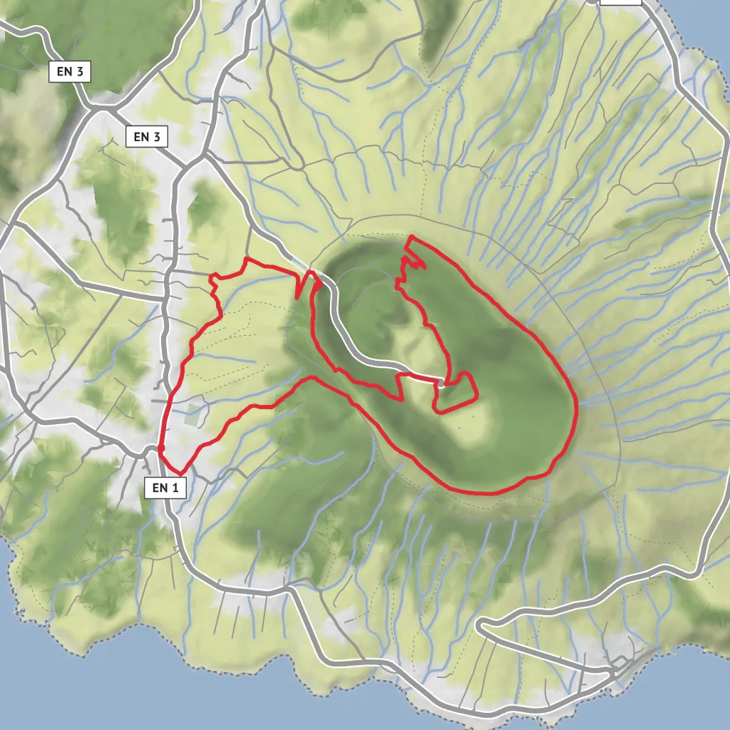
This 9.7 km / 6.0 mile loop on Graciosa Island packs a lot into a relatively short day: a steady climb from the village of Luz, a circuit along the rim of the island’s great volcanic caldera, the highest point on Graciosa at 405 m / 1,329 ft, and a descent toward one of the Azores’ most remarkable volcanic caves, Furna do Enxofre. The official trail starts in front of Igreja de Nossa Senhora da Luz in the parish of Luz, which is the clearest known landmark for the trailhead. (trails.visitazores.com)
Although you’ve listed the hike as medium, it is worth planning for something that can feel a notch harder in real conditions. The official Azores trail listing classifies it as hard, with an average walking time of about 3 hours 30 minutes, and the route includes a sustained climb, exposed rim walking, and uneven volcanic terrain. With roughly 500 m / 1,640 ft of ascent, hikers should expect a proper half-day outing rather than a casual stroll. (trails.visitazores.com)
The route begins in the village streets around Luz and climbs via Canada do Beco toward the caldera rim. That opening section is where most of the elevation gain is concentrated, so the first part of the walk tends to feel like the working section of the day. As you rise, the agricultural and village setting gives way to the higher volcanic landscape that defines the island’s interior. Once on the rim, the trail broadens in character: the gradient eases in places, views open dramatically, and the loop becomes more about position and scenery than pure climbing. (trails.visitazores.com)
What to expect on the rim
The caldera itself is a volcanic depression set atop what the Azores tourism authority describes as the smallest stratovolcano in the Azores. The trail circles this elevated basin, and the rim section is the visual highlight of the hike. From the high ground, especially near the island high point at 405 m / 1,329 ft, there are broad views across Graciosa’s patchwork of fields, low hills, and coast. On clear days, it is sometimes possible to see other islands of the Central Group from the summit area. (trails.visitazores.com)
Underfoot, expect a mix of rural track, forested sections, and volcanic ground that can be damp or slick depending on recent weather. The caldera rim is not especially high by alpine standards, but it can feel exposed when wind and mist move in. Low cloud can reduce visibility quickly, so this is a route where checking conditions beforehand and carrying an offline track in HiiKER is sensible even on a relatively short loop.
Inside the caldera are several notable volcanic features. The area includes two small hydromagmatic cones and subterranean cavities such as Furna da Maria Encantada, Furna do Abel, and the best-known site, Furna do Enxofre. The cave is reached via its visitor area and is one of the geological signatures of Graciosa. Official tourism information describes it as a volcanic cavity about 194 m / 636 ft long and 40 m / 131 ft high, containing a freshwater lake and a mud fumarole. (trails.visitazores.com)
Nature, wildlife, and protected landscape
This hike crosses a landscape with multiple layers of protection. The trail lies largely within the Natural Monument of Caldeira da Graciosa, and the area also carries recognition as a Ramsar wetland, a core zone of the Graciosa Biosphere Reserve, and a geosite within the Azores Geopark. That protected status reflects both the geological importance of the caldera and the ecological sensitivity of the basin and its surrounding slopes. (trails.visitazores.com)
Vegetation on the route is a mix of native and introduced species. The inner slopes of the caldera are heavily associated with cryptomeria forest, which forms the island’s largest forest patch, but hikers can also look for native Azorean plants including Erica azorica (heath), Laurus azorica (Azorean laurel), and Morella faya. (trails.visitazores.com)
Birdlife is another point of interest. The cal
Surfaces
Unknown
Grass
Cobblestone
Asphalt
Comments and Reviews
User comments, reviews and discussions about the Subida ao Cume, Furna do Enxofe and Caldeira Loop, Portugal.
average rating out of 5
0 rating(s)

