
Download
3D Flyover
Add to list
More
11.3 km
~2 hrs 32 min
172 m
Point to Point
“From crater rim to seabird coast, this Graciosa walk threads lava, watercraft, and island resilience.”
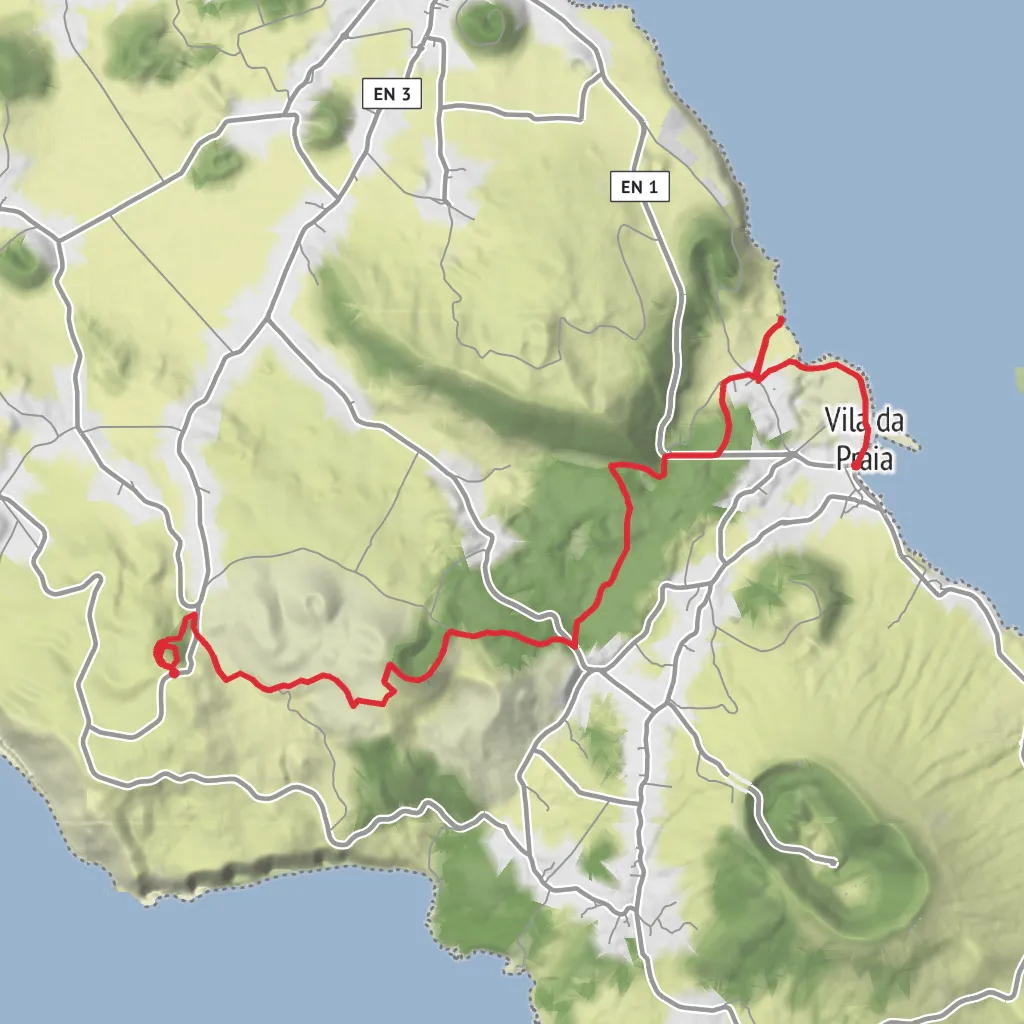
This easy coastal-and-volcanic walk on Graciosa links a striking volcanic feature with the island’s water heritage and the shoreline near Praia, covering about 11 km / 6.8 miles with roughly 200 m / 656 ft of ascent. The route begins near Caldeirinha de Pêro Botelho, a known landmark in the parish of Guadalupe, Santa Cruz da Graciosa, where a viewpoint sits above a volcanic pit formed within a spatter cone. Official Azores trail information describes this as a small route focused on geology, traditional water infrastructure, and the coast near Praia. (turismo.azores.gov.pt)
The opening section is usually the most unusual part of the day. Caldeirinha de Pêro Botelho is not just a hilltop stop but a rare volcanic structure on Graciosa, with an algar around 37 m / 121 ft deep. The trail circles the crater area before continuing toward lower ground, so hikers get a quick sense of the island’s volcanic origins before the route shifts into farmland, old waterworks, and coastal scenery. The ground around the rim can be unstable, so it is important to stay well back from the edge and not attempt to enter the shaft. (turismo.azores.gov.pt)
Because the elevation gain is modest, this is generally a good choice for walkers who want a half-day outing without a long mountain climb. “Easy” here usually means the gradients are manageable and the route is not especially technical, but hikers should still expect uneven volcanic surfaces, exposed stretches with little shade, and some rougher footing where farm tracks or coastal sections are stonier underfoot. In warm, windy, or wet weather, the route can feel more demanding than the numbers suggest. (acores9.com)
What the route feels like
From the high point near Caldeirinha, the walk transitions from open volcanic terrain into a landscape shaped by agriculture and water management. This contrast is the defining character of the route. One moment the focus is on lava-built landforms; the next, it is on how people adapted to a dry, wind-exposed Atlantic island by capturing, storing, and moving water. That theme is reflected in the “Arquitetura da Água” name, which points to the traditional structures associated with water supply on Graciosa. (turismo.azores.gov.pt)
As the route trends toward Praia, expect broad views rather than enclosed forest walking. The island’s terrain here is relatively open, and the sea increasingly becomes part of the backdrop. If visibility is good, the approach toward the coast gives the walk a spacious feel, with the volcanic interior behind you and the marine reserve area ahead. (acores9.com)
Landmarks, heritage, and water architecture
One of the most interesting features later on is the tidal well, used historically to collect water from depth within the basal aquifer. That is a distinctive reminder that on oceanic volcanic islands, freshwater access has always been a practical challenge. The route also passes the old tile factory, where clay objects were once produced, including items connected to the island’s water architecture. These are not just incidental ruins; they help explain how settlement on Graciosa depended on careful engineering at a small, local scale. (turismo.azores.gov.pt)
The coastal end of the walk also brings attention to Ilhéu da Praia, a small offshore islet classified as a Natural Reserve. It is one of the most important seabird nesting sites in the Azores, especially for Monteiro’s storm petrel, a local endemic species. Birdlife can be a major highlight here, particularly in quieter conditions, though this is an area where observation should always be low-impact and from a respectful distance. (turismo.azores.gov.pt)
Historically, this part of Graciosa reflects the broader Azorean story: volcanic land gradually settled, divided into parishes, and adapted through farming, fishing, and practical water systems. The nearby communities of Praia and Santa Cruz da Graciosa developed around these realities, and the route gives a good sense of how geology, settlement, and daily survival were closely linked. (en.wikipedia.org)
Nature and wildlife
The natural interest on this walk comes from both geology and coastal
Surfaces
Unknown
Asphalt
Grass
Ground
Concrete
Comments and Reviews
User comments, reviews and discussions about the Caldeirinha, Arquitetura da Água I and Porta da Praia, Portugal.
average rating out of 5
0 rating(s)


