
Download
3D Flyover
Add to list
More
2.0 km
~30 min
59 m
Point to Point
“Stone-walled vineyards give way to a wind-bright bay, with the return feeling tougher than expected.”
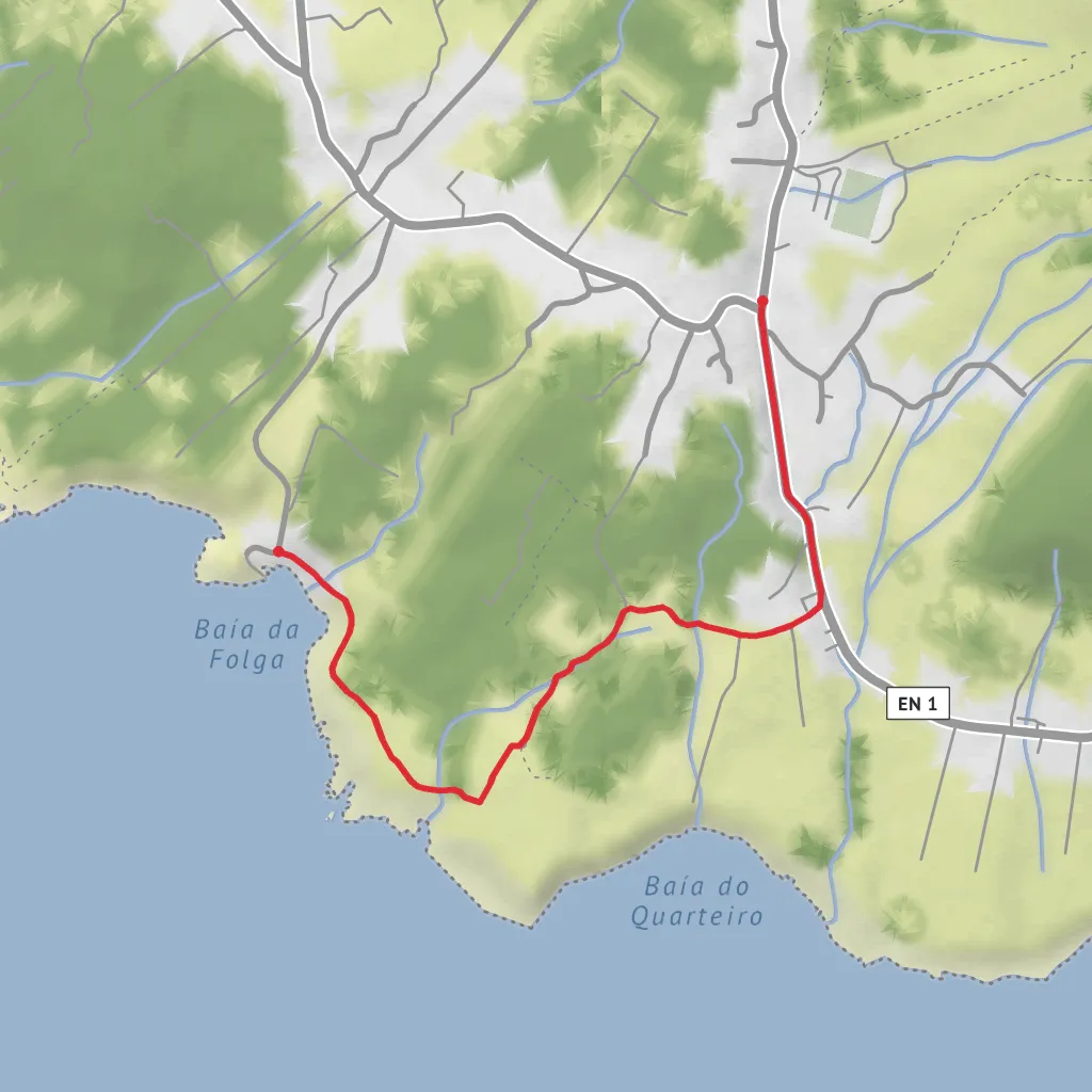
This short out-and-back coastal walk on Graciosa Island packs a surprising amount into roughly 2.1 km / 1.3 miles, with about 100 m / 328 ft of elevation change overall if you include the undulating return. Although often officially graded easy, it can feel more like a medium outing for hikers who are not used to uneven volcanic ground, exposed coastal sections, or warm, windy conditions. The route begins in the village of Luz, near the local Holy Spirit chapel in the village center, and heads down the regional road for about 600 m / 0.4 miles before turning onto a dirt track that leads through vineyard country toward the coast. (trails.visitazores.com)
The nearest clear starting landmark is the center of Luz, Santa Cruz da Graciosa, Graciosa Island, Azores, close to the Império do Divino Espírito Santo da Luz and the main village square. From there, the trail trends gently downhill at first, then becomes more irregular as it approaches the shoreline. Because this is a linear route, remember that the return walk retraces the same ground, so the climb back to Luz is the part that usually feels harder than expected. (trails.visitazores.com)
What the route feels like
The opening section is straightforward and gives you time to settle in, but once you leave the road and move onto the dirt path, the character changes quickly. You pass between old vineyard plots and agricultural land shaped by stone walls, a classic Graciosa landscape where farming had to adapt to wind, salt, and volcanic rock. The footing can vary between compact earth, loose stones, and rougher coastal tread, so lightweight trail shoes with decent grip are a better choice than smooth-soled sneakers. (trails.visitazores.com)
As you near the sea, the route becomes more scenic and more exposed. Expect open views, low coastal vegetation, and stretches where sun and wind are the main factors rather than steepness. There is little shelter, so even on a short hike it is worth carrying water, sun protection, and a light wind layer. In wet weather, the dirt sections can become slick, and in dry weather the reflected heat off stone and bare ground can make the walk feel warmer than the distance suggests. The route is waymarked, and if you want a navigation backup, HiiKER is the best tool to check the line of travel before setting out. (trails.visitazores.com)
Landmarks, nature, and wildlife
One of the main highlights is Portinho da Folga, the small harbor at the end of the trail. This is the visual payoff of the walk: a compact coastal inlet with a working-maritime feel and a traditional relationship to the sea that still defines this part of Graciosa. Official Azores trail information notes that the walk ends at Porto da Folga, a small bathing area, so in calm conditions some hikers combine the outing with a swim. (turismo.azores.gov.pt)
Along the coastal section, look for plant communities adapted to salt spray and exposure. Official trail descriptions specifically mention seaside goldenrod (Solidago sempervirens), African tamarisk (Tamarix africana), and the endemic Festuca petraea. Stone walls may also show colorful lichens, especially on sun-exposed faces. Birdlife can include common Azorean coastal species such as gulls and small passerines using the scrub and agricultural edges, and the shoreline itself is often lively with seabird movement depending on season and weather. (trails.visitazores.com)
A worthwhile side feature near the end of the route is the Chapel of Santo António, noted in Azores trail material as a point of interest reached near the bay. It adds a cultural layer to what might otherwise seem like a purely scenic coastal stroll. (trails.visitazores.com)
Historical character of the area
This landscape reflects several layers of Graciosa’s history. The vineyard plots
Surfaces
Unknown
Unpaved
Asphalt
Comments and Reviews
User comments, reviews and discussions about the Baía da Folga, Portugal.
average rating out of 5
0 rating(s)

