
Download
3D Flyover
Add to list
More
6.8 km
~1 hrs 41 min
201 m
Point to Point
“From misty crater lakes to a thunderous coastal waterfall, Flores unfolds in vivid, shifting layers.”
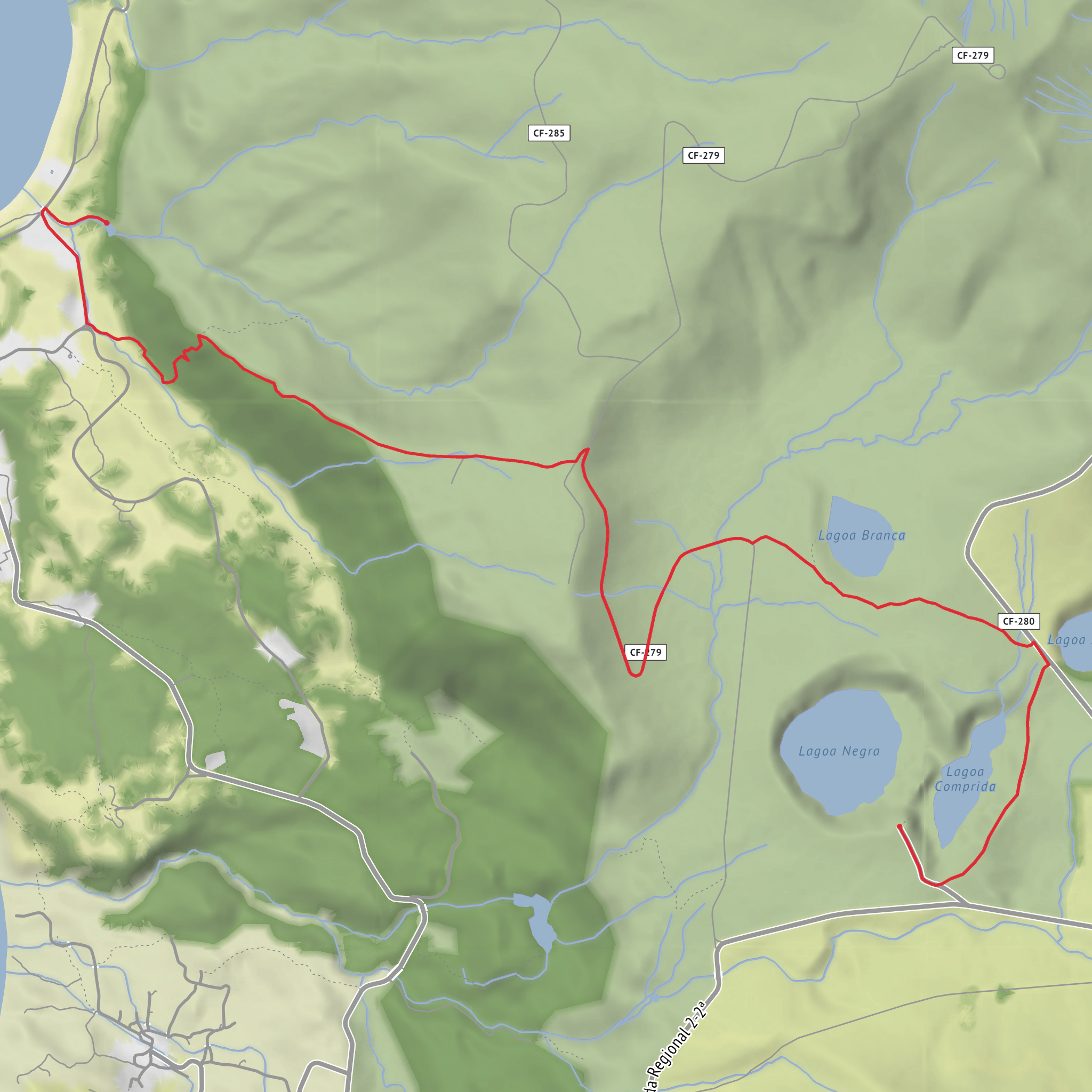
This point-to-point walk on Flores links the island’s high volcanic interior with its dramatic west coast, descending from the Miradouro das Lagoas Negra e Comprida near the central plateau to Poço do Bacalhau, just outside Fajã Grande, Lajes das Flores, Azores, Portugal. The route is about 7 km / 4.3 miles with roughly 200 m / 656 ft of ascent, but the defining feature is the long descent toward the coast, so knees and footing often feel the effort more than the elevation profile suggests. It is generally rated medium, and that feels accurate for hikers who are comfortable on uneven, sometimes muddy volcanic terrain. (parquesnaturais.azores.gov.pt)
The trail begins beside the viewpoint over Lagoa Negra and Lagoa Comprida, two crater lakes set in Flores’ central uplands. From the start, the landscape has a distinctly volcanic character: open plateau, lake basins, wet ground, and broad views that can change quickly with cloud and mist. Early on, expect a mix of track and narrower footpath as the route heads west toward Fajã Grande. The first section is less about steep climbing and more about settling into the exposed highland environment, where wind, drizzle, and low visibility can arrive suddenly even on days that seem clear lower down. Official Azores trail information places the start at the Lagoas viewpoint in the island interior and the finish at Poço do Bacalhau in Ponta da Fajã. (parquesnaturais.azores.gov.pt)
What the route feels like
As the walk progresses, the trail leaves the lake country behind and starts dropping from the plateau toward the western edge of Flores. Over roughly the middle miles, the scenery shifts from open upland to greener slopes, pasture edges, and increasingly expansive sea views. This transition is one of the route’s biggest strengths: in a relatively short distance, it shows off both the island’s inland caldeira landscape and its cliff-lined Atlantic coast. Older Azores walking material describes this route as one of the island’s most varied trails in terms of both natural and human landscape, which is a fair description of what hikers can expect. (visitazores.com)
The descent is where most people should pay attention. After wet weather, the ground can be slick, especially on compacted earth, stone, and grassy sections. Trekking poles can help with balance, but the more important preparation is footwear with reliable grip. Because this is a one-way route, it also helps to plan transport before setting out rather than improvising at the end. For navigation, it is worth loading the route in HiiKER in advance, especially if cloud sits over the plateau or if you want a clearer sense of where the steeper descending sections begin.
Landmarks, nature, and wildlife
The opening viewpoint over Lagoa Negra and Lagoa Comprida is one of the key landmarks of the hike, and it immediately places you in one of Flores’ most geologically important areas. Azores tourism sources note that Lagoa Negra, Lagoa Comprida, Lagoa Seca, Lagoa Branca, and Fajã Grande are considered geosites within the Azores Geopark because of their landscape and geological significance. That matters on the ground: you are walking through a landscape shaped by volcanic craters, water capture, erosion, and the island’s famously wet Atlantic climate. (turismo.azores.gov.pt)
As you descend, look for the contrast between endemic vegetation and more heavily modified rural land. Around the finish, Poço do Bacalhau lies within the Protected Landscape Area of the Central Zone and Cliffs of the West Coast and is associated with a geosite on the Ribeira das Casas. The waterfall is described by official sources as around 90 to 120 metres high depending on the source, plunging into a natural pool where swimming is possible in suitable conditions. (visitazores.com)
Birdlife can be rewarding, especially in the quieter upland sections and around wet ground, though sightings vary with season and weather. The island’s humid conditions also support lush mosses, ferns, and dense greenery, particularly where watercourses gather on the descent. The final approach toward Poço do Bacalhau is especially scenic, with the sound of falling water often arriving before the full view opens up. The waterfall itself is the natural finale: a tall white ribbon dropping beside Fajã Grande into a pool enclosed by steep green walls. (visitazores.com)
Historical and regional context
Flores has long been defined by isolation, water, and volcanic topography. The island’s name is tied to the abundance of yellow flowers once noted here, and its settlement patterns were shaped by the challenge of living between steep uplands and narrow coastal fajãs
Surfaces
Unknown
Dirt
Asphalt
Cobblestone
Comments and Reviews
User comments, reviews and discussions about the Miradouro das Lagoas to Poço do Bacalhau, Portugal.
average rating out of 5
0 rating(s)
