
Download
3D Flyover
Add to list
More
3.4 km
~1 hrs 1 min
213 m
Out and Back
“A steep, cliff-hung descent reveals a sunlit hidden fajã shaped by collapse, history, and Atlantic drama.”
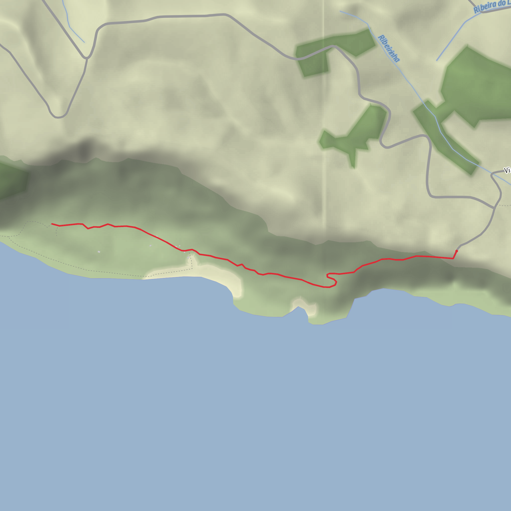
This short but demanding out-and-back route drops from the Miradouro da Fajã de Lopo Vaz on the south coast of Flores to a secluded coastal fajã formed beneath towering cliffs. Although the walk is only about 3 km / 1.9 miles round trip, the steep descent and re-ascent, uneven stone steps, and exposed cliffside character make it feel much more serious than the distance suggests. Expect roughly 200 metres / 656 feet of elevation change, most of it concentrated into a relatively short section. The official start is near the signed detour off Regional Road ER1-2A between kilometres 18 and 19 from Lajes das Flores, at the viewpoint and picnic area above the coast. (parquesnaturais.azores.gov.pt)
The setting is one of the most dramatic on Flores. The route descends from high ground to Fajã de Lopo Vaz, a debris-built coastal platform at the foot of immense sea cliffs. This fajã and nearby Ponta da Rocha Alta are recognized as geosites within the Azores Geopark, with the landform created by landslides and cliff collapses from the high escarpment above. That geology is central to the walk: the trail is effectively your only land access to a place shaped by collapse, erosion, and the Atlantic. (turismo.azores.gov.pt)
What the route feels like
From the viewpoint, the path begins descending immediately on a mix of dirt track, old stone paving, and basalt steps. The grade is the main challenge. On the way down, footing matters because loose gravel, damp rock, and worn steps can be slippery, especially after rain. On the return, the same terrain becomes a sustained climb that can feel strenuous in warm or humid weather despite the short mileage. (pt.wikipedia.org)
As the trail loses height, the views widen across the south coast, with the ocean constantly in sight and the cliffs rising sharply behind. The route has a historic feel because parts of the stonework reflect the old access used by settlers and local residents to reach the cultivated land below. Once on the fajã itself, the terrain eases and the atmosphere changes from steep mountain path to a quieter agricultural pocket isolated from the road network. (azoresislandstrails.com)
Landmarks, nature, and wildlife
One of the most distinctive features of Fajã de Lopo Vaz is its microclimate. Because the fajã faces south, sits low, and receives strong sun exposure, it has long supported crops that benefit from warmer conditions than much of the rest of Flores. Sources note cultivation of figs, bananas, and other fruit species, which helps explain why this small coastal shelf was historically valuable despite its isolation. (turismo.azores.gov.pt)
The fajã is also notable for its protected natural setting. The trail passes through part of the Protected Area for the Management of Habitats or Species of the South and Southeast Coast of Flores. Vegetation can be lush along the descent, and seabirds may be seen or heard around the cliffs and shoreline, especially where the rock faces and ocean edge create nesting and feeding habitat. As with many Azorean coastal trails, conditions can shift quickly between bright sun, mist, wind, and slick surfaces, so hikers should be prepared for rapid weather changes even on a short outing. (parquesnaturais.azores.gov.pt)
Geologically, this is one of the more interesting short walks on the island. The fajã is a classic detrital fajã, meaning it was built from material that fell from the cliffs above rather than from a lava delta. Historical accounts tied to the official trail guide describe the earth movement that formed it as so dramatic that it generated a wave that affected the port at Vila das Lajes. That gives the landscape an added sense of scale: the quiet farmland below is the product of a violent coastal event. (visitazores.com)
Historical significance
Fajã de Lopo Vaz is thought to be one of the earliest settled places on Flores, and its name is linked to Lopo Vaz, identified in Azorean trail material as one of the island’s first settlers, arriving from Terceira in the early 16th century. The old access route and cultivated plots below reflect that long relationship between settlement, subsistence farming, and difficult terrain. On Flores, fajãs like this were prized because they offered sheltered, workable land in an island otherwise dominated by steep slopes and exposed uplands.
Comments and Reviews
User comments, reviews and discussions about the Fajã de Lopo Vaz, Portugal.
average rating out of 5
0 rating(s)
