
Download
3D Flyover
Add to list
More
5.0 km
~1 hrs 24 min
245 m
Loop
“A dramatic cliffside loop weaving Atlantic vistas, laurel shade, old vineyards, and Faial’s volcanic memory.”
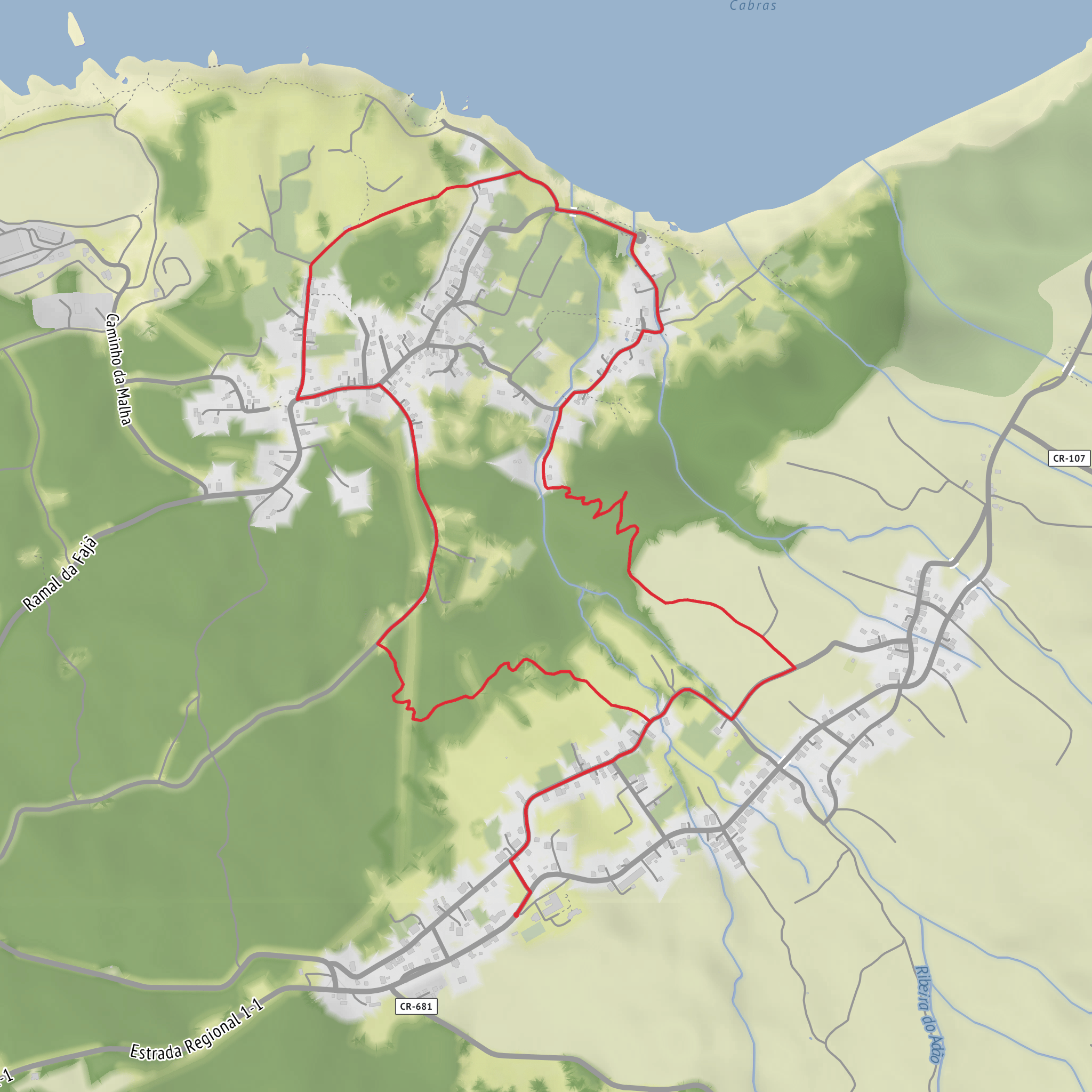
This compact loop on Faial’s north coast packs a surprising amount into roughly 5 km / 3.1 miles, with about 300 m / 985 ft of elevation change. The route starts near the Miradouro da Baía da Ribeira das Cabras, just outside Praia do Norte, Horta, Faial Island, Azores, and immediately gives a sense of what defines the walk: a steep volcanic escarpment, a sheltered fajã below, old agricultural traces, and broad Atlantic views. The official trail information places the start and finish on the regional road about 300 m / 0.2 mi from the viewpoint. (parquesnaturais.azores.gov.pt)
The terrain is varied for such a short outing. Expect a mix of rural lanes, dirt track, stone-and-earth footpath, and steeper sections on the descent and climb through the cliff zone. The high point is around 264 m / 866 ft and the low point near sea level, around 12 m / 39 ft, so the “medium” rating is mainly due to the sharp loss and regain of height rather than the distance itself. In dry weather, the route is manageable for regular walkers, but after rain the cliff path can become slick with mud, roots, and loose stone. (acores9.com)
What the route feels like
From the start near the viewpoint, the trail heads downhill through a more settled landscape of fields, water fountains, and rural access tracks before committing to the escarpment. This upper section is a good place to settle into the walk and take stock of the weather, because once the path drops into the cliffside, footing becomes more important. The descent is the most technical part of the loop, with a narrower tread and a more enclosed feel as vegetation thickens. (acores9.com)
As the route enters the old cliff line, the scenery shifts from open pasture to denser native vegetation associated with Azorean laurel forest remnants. Look for urze (Erica azorica) and pau-branco (Picconia azorica), both noted on official trail descriptions. This section is one of the most atmospheric parts of the hike, and it also explains why the trail feels more rugged than its mileage suggests. (parquesnaturais.azores.gov.pt)
A signed spur or opening in the vegetation provides a strong coastal outlook over the north shore. Below, the trail reaches the base of the escarpment, crosses the Ribeira do Adão, and joins Rua das Adegas on the way toward Praia do Norte. That transition from cliff path to the lower cultivated platform is one of the defining features of the loop. (acores9.com)
Landmarks, geology, and historical context
The escarpment itself is not just scenic; it is part of the Arriba Fóssil da Praia do Norte geosite, an ancient fossil cliff that once marked the western limit of Faial before later volcanic activity extended the island. The fajã below, Fajã da Praia do Norte, has a mixed origin of detrital deposits and lava flows, which helps explain both its shape and its long-standing human use. (parquesnaturais.azores.gov.pt)
That lower platform developed a useful microclimate, and this had real historical importance. It supported vine cultivation, the building of adegas (wine cellars), and seasonal or summer houses. Even on a short walk, you can read the landscape as a record of how people adapted to a sheltered pocket beneath a harsh Atlantic-facing cliff. (acores9.com)
Another notable landmark is the Ermida de Nossa Senhora da Penha de França, dating to 1787, which the trail passes as it moves through the fajã before climbing back toward the road. The chapel adds a cultural anchor to a route otherwise dominated by geology and coastal scenery. (acores9.com)
The wider region also carries the imprint of Faial’s volcanic history. Praia do Norte and the surrounding coast were shaped by eruptions from the Capelo volcanic complex, and historical accounts of the area note that lava and ash dramatically altered settlement and farmland. That background helps make sense of the black volcanic ground, abrupt relief, and the patchwork of cultivated and abandoned spaces you may notice along the loop. (en.wikipedia.org)
Nature and wildlife to look for
The route combines pasture edge, native woodland remnants, stream corridor,
Surfaces
Unpaved
Asphalt
Paved
Unknown
Comments and Reviews
User comments, reviews and discussions about the Rocha da Fajã and Baia da Ribeira das Cabras Loop, Portugal.
average rating out of 5
0 rating(s)
