
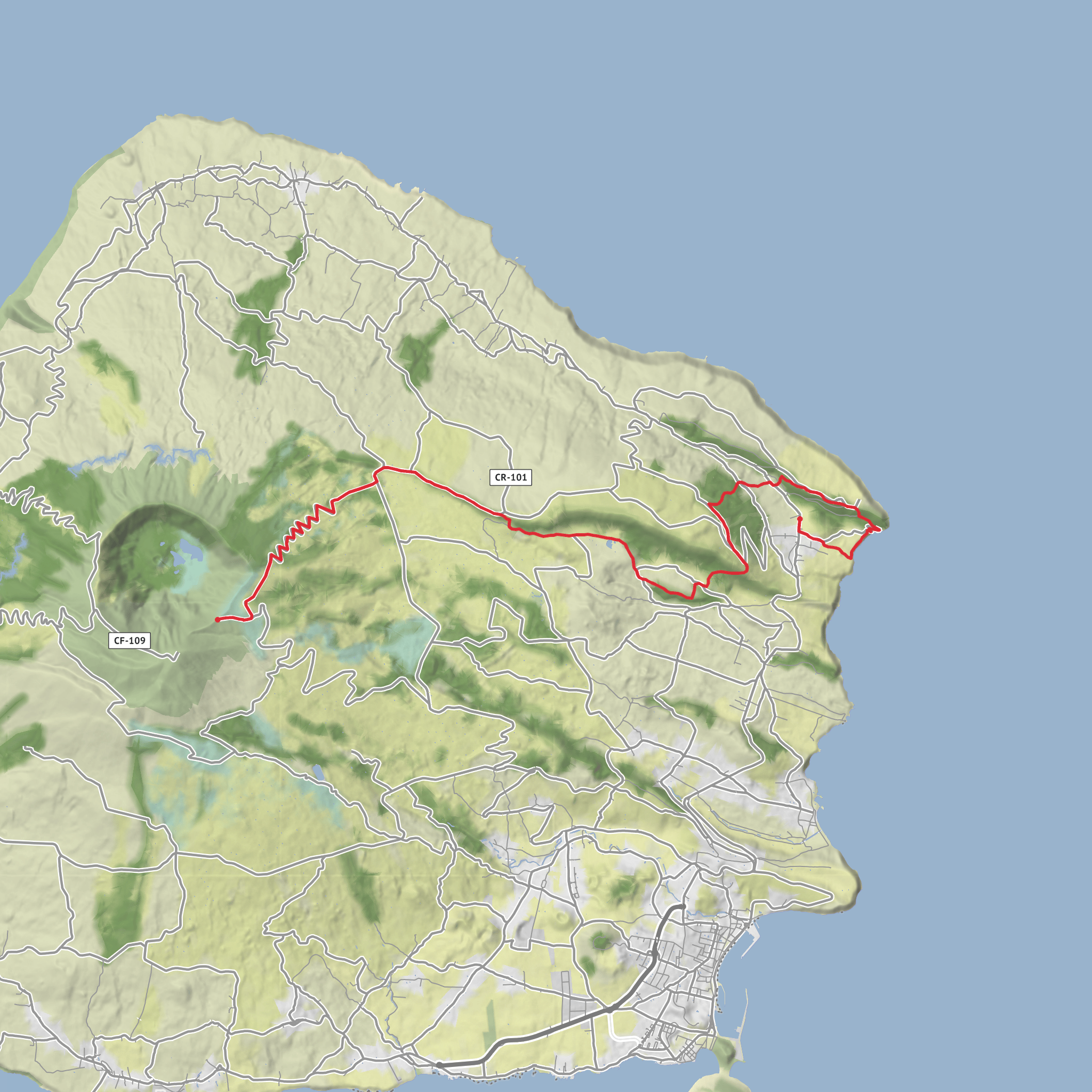
Ribeirinha to Caldeira via Ponta da Ribeirinha and Parque Florestal do Cabouco Velho
Download
3D Flyover
Add to list
More
17.5 km
~5 hrs 19 min
1093 m
Point to Point
“From earthquake-scarred coast to misty caldera, this demanding Faial crossing feels raw and unforgettable.”
This is a long, demanding cross-island-style climb on Faial that links the low coastal parish of Ribeirinha with the high volcanic interior near the Caldeira, following old rural access lanes, shoreline viewpoints, wetland habitat, forest roads, and a final sustained ascent to one of the island’s most dramatic volcanic landscapes. Expect roughly 17.5 km / 10.9 miles, about 1,100 m / 3,610 ft of ascent overall, and a full day on foot; the official trail listing gives a hard difficulty, around 7 hours, with elevations ranging from about 3 m to 892 m / 10 ft to 2,927 ft. (parquesnaturais.azores.gov.pt)
The route starts near the Ribeirinha Parish Council in the center of Ribeirinha, which the official trail information identifies as the trailhead approach point from Horta. A useful landmark for planning is the parish council area at Largo do Império, Ribeirinha, Faial, and the walk begins in the village core before dropping toward the coast. If you are driving from Horta, follow the regional road east toward Ribeirinha, then descend into the parish center. Parking is usually simplest in the village streets near the parish buildings, while keeping access clear for residents. Public transport on Faial is limited and should be checked locally in advance; Ribeirinha is on the island road network east of Horta, but service frequency can be sparse enough that many walkers arrange a taxi, shuttle, or car drop for a one-way hike. (parquesnaturais.azores.gov.pt)
Because this is a linear route ending high near the Caldeira rather than looping back to the start, transport logistics matter. If using a car, the easiest plan is usually to arrange a pickup near the Caldeira access area after finishing, or to leave a second vehicle near the upper end if your group has two cars. If relying on public transport, confirm same-day return options before setting out rather than assuming you can improvise at the finish. HiiKER is the best tool to use for checking the line of travel, junctions, and your exit point before you start. (parquesnaturais.azores.gov.pt)
What the route feels like early on
The opening section is shaped by both geology and human history. The trail begins in Ribeirinha, a parish badly affected by the 1998 Azores earthquake, and the official route description specifically notes visible earthquake damage in the ruins of São Mateus Church as well as at the Ribeirinha Lighthouse. That gives the first kilometers a strong sense of place: this is not just a scenic walk, but a route through a community marked by seismic forces that are still central to understanding Faial. (parquesnaturais.azores.gov.pt)
From the village, the trail heads down toward the coast, passing Boca da Ribeira harbor and continuing toward Ponta da Ribeirinha and the Ribeirinha Lighthouse. The lighthouse, inaugurated in 1919, stands in a landscape tied to the active Lomba Grande fault and was heavily affected by the 1998 earthquake, whose epicenter lay offshore about 5 km / 3.1 miles away. This coastal stretch is one of the most historically evocative parts of the day: sea cliffs, old access ways, and a ruined maritime landmark all underline how exposed and geologically active this side of Faial is. (parquesnaturais.azores.gov.pt)
After the coast, the route turns inland through woodland and viewpoints, then drops and rises again through a patchwork of dirt lanes, paved farm access, cultivated ground, and pasture. This is where the “old roads” identity of the trail becomes most obvious. The route follows ancient canadas, traditional rural lanes once used to move people and goods between parishes and Horta, and that historical layer is one of the defining features of the hike. Rather than a purpose-built mountain path from end to end, this is a journey along the connective tissue of older Faial life. (parquesnaturais.azores.gov.pt)
Middle section: fault lines, wetlands, and forest
A large part of the route runs along the Graben of Pedro Miguel, described by the Azores nature park as one of the archipelago’s main geosites. The
AI Planner
Days planned around your pace, with somewhere to stay each night.
Surfaces
Unknown
Asphalt
Unpaved
Dirt
Paved
Grass
Comments and Reviews
User comments, reviews and discussions about the Ribeirinha to Caldeira via Ponta da Ribeirinha and Parque Florestal do Cabouco Velho, Portugal.
average rating out of 5
0 rating(s)
