
Download
3D Flyover
Add to list
More
8.3 km
~2 hrs 26 min
466 m
Loop
“A richly varied coastal-and-highland loop, threaded with harbour history, woodland hush, and volcanic memory.”
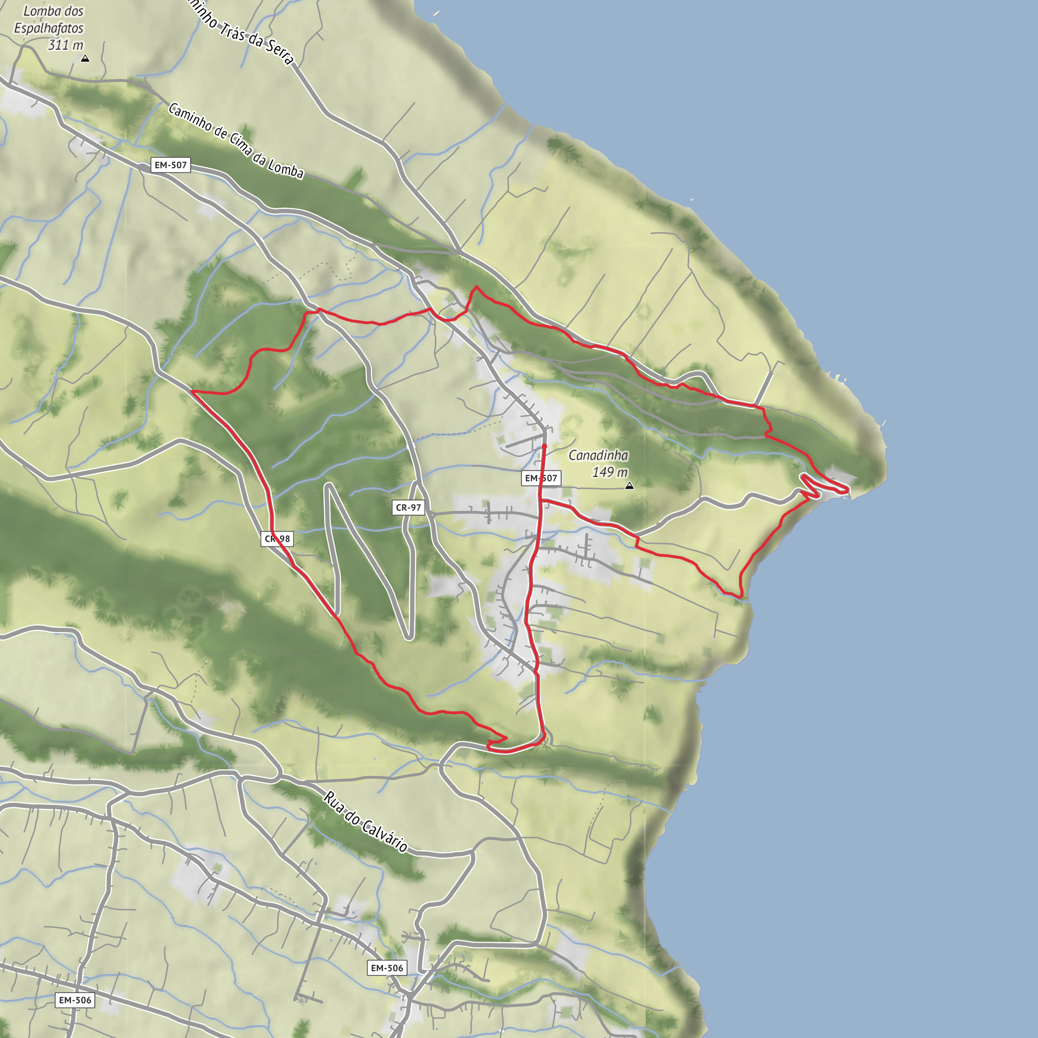
This roughly 8 km / 5 mile loop on Faial follows a varied circuit above and along the coast at Ribeirinha, linking village lanes, old harbour access, woodland, viewpoints, and pasture tracks. Expect around 500 m / 1,640 ft of cumulative ascent and descent over the full outing, even though the official trail profile rises from about 25 m to 377 m above sea level; the repeated ups and downs make it feel more substantial than the distance alone suggests. The route is generally considered moderate for most walkers using that total climbing figure, though official local listings describe the signed Ribeirinha circuit as easy, so difficulty will depend on fitness, weather, and how comfortable you are on damp, uneven ground. (trails.visitazores.com)
The walk begins in Ribeirinha on Faial Island, near the ruins of the Church of São Mateus, Ribeirinha, Horta, Faial, Azores, which is the clearest known landmark for the trailhead. From there, the route drops toward Porto da Boca da Ribeira, the old harbour below the village, then continues through woodland to the Farol da Ribeirinha / Ponta da Ribeirinha lighthouse area before looping inland through Espalhafatos, pasture country, and the protected slopes of Lomba Grande. (trails.visitazores.com)
The opening section is usually the easiest to read on the ground: village streets and descending paths lead you downhill toward the sea. Within the first 1.5 to 2 km / 0.9 to 1.2 miles, you reach Porto da Boca da Ribeira, an old fishing quay now associated with leisure facilities and a picnic area. This coastal section is one of the route’s defining landmarks, with open Atlantic views and a strong sense of the parish’s maritime past. Some local tourism material also notes the harbour’s importance as a former whaling port on southern Faial before the Capelinhos eruption reshaped regional activity. (trails.visitazores.com)
What the terrain feels like
After the harbour, the trail turns more natural and enclosed. The next stretch moves through woodland containing Japanese cedar as well as endemic Azorean species such as Azorean juniper and heather. Underfoot, this can mean dirt path, roots, leaf litter, and muddy patches after rain. Good grip matters here, especially on the shaded sections where moisture lingers. If you are planning navigation backup, use HiiKER and still pay close attention at junctions, because local sources note that trail markings change where this route overlaps with other signed trails. (trails.visitazores.com)
Around the middle part of the loop, the route reaches the Ribeirinha lighthouse area. The lighthouse was inaugurated in 1919 and, like the church ruins, was badly affected by the 1998 earthquake. This gives the walk an unusual character: it is not just scenic, but also a route through a landscape marked by geological instability and community memory. From here, the trail continues toward the Ribeirinha viewpoint and then inland across roads, farm access tracks, and grazing land. (trails.visitazores.com)
The climbing tends to feel most noticeable after the coastal section. Over the next 2 to 3 km / 1.2 to 1.9 miles, the route gains height through dirt roads and open agricultural ground. This is where the loop becomes more exposed to sun, wind, and passing showers. Even on a mild day, conditions can shift quickly on Faial, so a light waterproof layer and an extra warm layer are sensible. The higher ground also gives broader views over the coast and across the Faial Channel toward Pico and, in clear weather, sometimes São Jorge. (acores9.com)
Landmarks, nature, and what to watch for
One worthwhile feature is the optional detour to Pedras Negras viewpoint, which adds a little distance but gives a stronger sense of the island’s volcanic structure. The wider route passes through the Pedro Miguel Graben and the Ribeirinha Volcanic Complex, described by official trail information as one of the main geosites of the archipelago and the oldest part of Faial, with geology dating back roughly 800,000 years. That geological backdrop
Surfaces
Unknown
Asphalt
Unpaved
Concrete
Dirt
Grass
Comments and Reviews
User comments, reviews and discussions about the Porto da Boca da Ribeira Loop, Portugal.
average rating out of 5
0 rating(s)
