
Download
3D Flyover
Add to list
More
3.8 km
~58 min
133 m
Loop
“A breezy coastal loop where pale volcanic cliffs, seabirds, and Atlantic light reward steady walkers.”
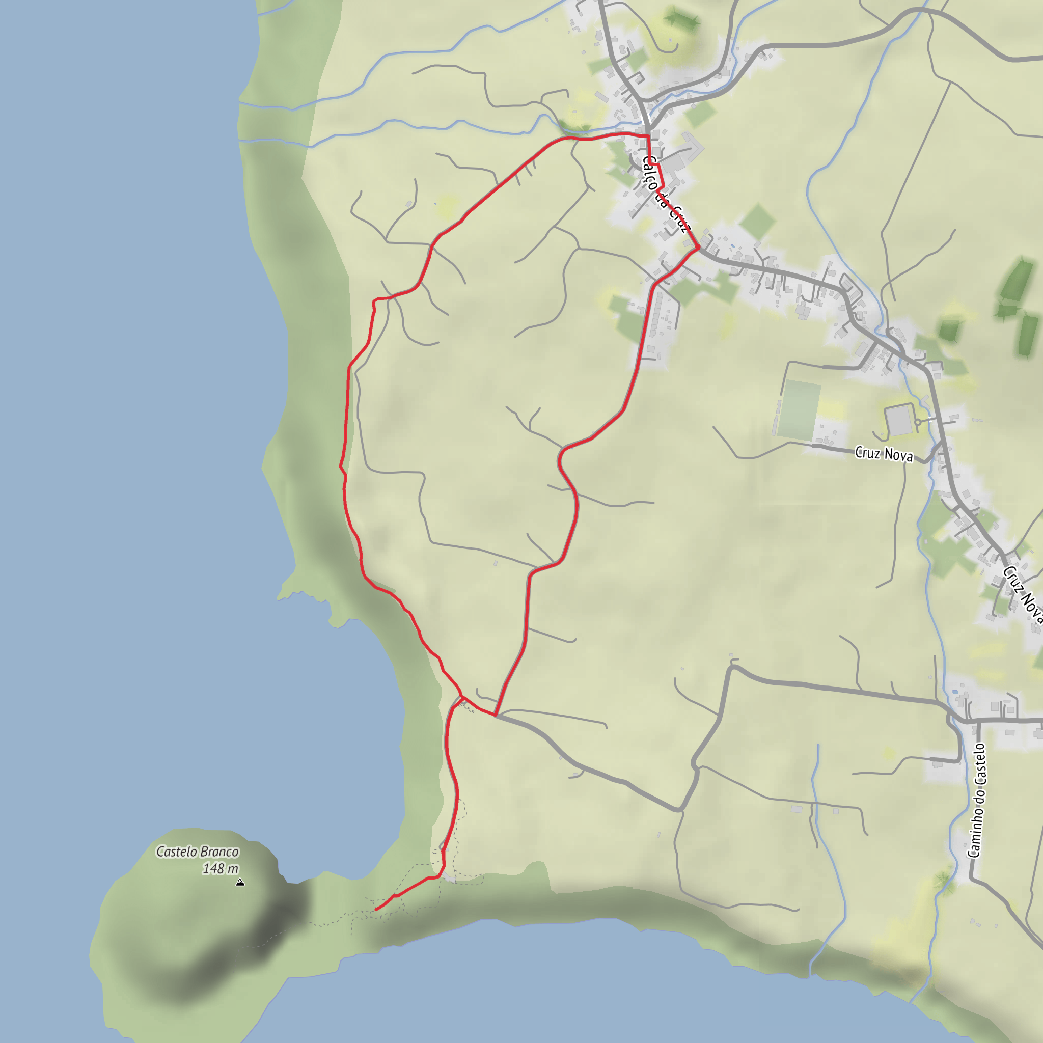
This short coastal loop on Faial gives a lot back for its modest size: roughly 3.7 to 4 km (2.3 to 2.5 miles) with about 100 to 120 m (330 to 395 ft) of elevation gain, usually taking around 1.5 hours at an unhurried pace. The route begins near Lombega, Castelo Branco parish, Horta municipality, Faial Island, Azores, on the western side of the island, where the signed trail heads toward the protected slopes above Varadouro and the striking volcanic mass of Morro de Castelo Branco. Official Azores trail information places the start and finish at Lombega in Castelo Branco parish, reached by following the regional road west from Horta and watching for the trail sign on the left. (parquesnaturais.azores.gov.pt)
The walking is generally straightforward, but “medium” is a fair planning grade for many hikers because the route includes uneven ground, short climbs, exposed coastal sections, and potentially slippery surfaces if conditions are wet. The altitude range is roughly 81 m to 202 m (266 to 663 ft), so the climbing is never extreme, but it is enough to notice, especially if wind is strong off the Atlantic. Waterproof layers, sun protection, and sturdy footwear are sensible even on a short outing. The official trail guidance also advises staying on the marked path and avoiding shortcuts, which matters here because the route passes through sensitive protected habitat. (parquesnaturais.azores.gov.pt)
Getting to the start is simplest by car. From Horta, drive west on the regional road toward Castelo Branco; the trailhead is near Lombega, a small locality in the parish, with signage marking the route. If you are navigating digitally, the most useful landmark to enter is Lombega, Castelo Branco, Faial, Azores, rather than relying on a remote coordinate pin. Public transport on Faial can be limited and seasonal compared with larger destinations, so hikers planning to use buses should check current island services in advance and build in extra time; in practice, many visitors reach this trail by rental car or taxi from Horta. (parquesnaturais.azores.gov.pt)
What the route is like
From the start, the trail follows old rural paths and open ground with broad views over the southwest coast of Faial. One of the defining features is the gradual reveal of Morro de Castelo Branco, a pale trachytic lava dome whose shape and color make it stand out from the darker volcanic landscape around it. This formation creates a peninsula-like mass on the coast and is one of the area’s major geological landmarks. The route is partly inside the Varadouro–Castelo Branco Protected Area for the Management of Habitats or Species and also passes through the Morro de Castelo Branco Nature Reserve, so the scenery combines pasture-edge walking, native vegetation, sea cliffs, and exposed viewpoints. (parquesnaturais.azores.gov.pt)
Expect the first part of the loop to feel open and airy rather than forested. The path rises gently, and with only around 100 m (330 ft) of ascent overall, the climbing comes in manageable sections rather than one long haul. As you gain height, the views widen toward the coast near Varadouro, where cliffs and ocean dominate the horizon. On clear days, this is the kind of route where the landscape does much of the storytelling: volcanic slopes, marine exposure, and the contrast between cultivated land and protected natural ground. (parquesnaturais.azores.gov.pt)
The middle of the walk is where the trail becomes most distinctive. Here, the route approaches the reserve around Morro de Castelo Branco itself, and the terrain feels more dramatic despite the short mileage. The dome is considered a geosite of the Azores UNESCO Global Geopark, and official descriptions highlight it as one of the key natural features of the walk. The loop is not long, but it rewards slow pacing, especially if you want time for birdwatching, photography, or simply reading the coastline. (parquesnaturais.azores.gov.pt)
Nature, wildlife, and seasonal conditions
This is an especially good walk for hikers interested in coastal ecology. Official park information notes that the area supports some of the most important seabirds of the Azores, and the reserve is recognized as a nesting and habitat zone. Depending on season and conditions, hikers may notice seabird activity around the cliffs and offshore rock faces, so binoculars can be worthwhile even on such a short route. (parquesnaturais.azores.gov.pt)
The flora is also a highlight. Protected and locally significant species recorded in the area include Erica azorica and Myosotis maritima, along with other native plants associated with the Azorean coastal environment. Because these habitats are fragile and often wind-shaped, it is important not to step off the marked trail
Surfaces
Unknown
Asphalt
Unpaved
Paved
Comments and Reviews
User comments, reviews and discussions about the Morro de Castelo Branco and Varadouro Loop, Portugal.
average rating out of 5
0 rating(s)
